
Allemagne
Description

If ever any country takes pride in its romantic legacy, it must be Germany. Put on your hiking boots and headphones and enter the realm of Wagner, Brahms and Schumann, walking through the land of Rhine and Danube, of traditional half-timbered houses, mighty castles and ancient taverns serving excellent food and wine. Most popular hiking destinations are the Black Forest in the southwest, Alsace-Lorraine on the border with France, Bavaria in the south, and forested Thüringen and Harz in central Germany. But there is more to explore. Try an autumn clad Swabian Alb for instance, or spring on the northern island of Rügen.
Not surprisingly, Germany counts over 200 long distance hiking trails, all waymarked and well documented. Walk any European long distance trail, except E2 and E7, and you will pass through Germany! Even if not spectacular in terms of altitude, the varying landscapes can be truly wild and offer wonderful panorama's.
On the negative side, bear in mind that Germany is a modern country. Forests and farmland are exploited efficiently and can be pretty boring.
There are no real difficulties and you can go any time of the year, but higher up snow can make walking difficult in wintertime (and create good opportunities for cross country skiing). Finding food and lodging is never an issue, as mountain huts, hotels, inns and private rooms (Zimmer frei) abound, as do campsites.
Interesting is the current tendency in the country to "certify" trails if they comply to a list of standards. The effect is that some trails get much more attention than other trails. They get the predicate "Premiumweg" or get elected the most beautiful trail of the country. Of course, this does NOT mean that other trails are less interesting. The effect, however, is that while new trails are created, old trails gradually disappear.
Carte

Sentiers
- 66 Seen RegionalparkrouteGPX
- Aar HöhenwegGPX
- AhornwegGPX
- Ahr-Venn-WegGPX
- AhrtalwegGPX
- AlemannenwegGPX
- Alpen Weitwanderweg
- Alsenztal Wanderweg
- Alsterwanderweg GPX
- Altmühltal PanoramawegGPX
- ArminiuswegGPX
- AusoniuswegGPX
- Badener Weg
- BaierwegGPX
- Barbarossaweg GPX
- BöhmwegGPX
- Bückebergweg
- Bodensee RundwegGPX
- BonifatiuswegGPX
- BorgmannwegGPX
- Breisgauer WeinwegGPX
- Burgen WanderwegGPX
- BurgensteigGPX
- BurgenwegGPX
- Burgenweg Bergstrasse
- Burgenweg Kulturhistorische Wanderweg
- Burgundenweg
- BurgwaldpfadGPX
- ButjadingerwegGPX
- Christine Kochweg GPX
- Deutsche WeinstrasseGPX
- Dichter Musiker MalerwegGPX
- Diemelsteig
- Donau-ZollernalbwegGPX
- DonauberglandwegGPX
- DonausteigGPX
- DreiländerwegGPX
- E1GPX
- E10GPX
- E11GPX
- E3GPX
- E4GPX
- E5GPX
- E6GPX
- E8GPX
- E9GPX
- Eder HöhenwegGPX
- EggewegGPX
- EhmsenwegGPX
- EifelsteigGPX
- Elb Höhenweg
- Elbe-Weser-WanderwegGPX
- ElisabethpfadGPX
- EmmerwegGPX
- Ems-Hase-Hunte-ElsewegGPX
- Ems-HuntewegGPX
- Ems-JadewegGPX
- EmswegGPX
- Erft-Lieser-Mosel-Weg GPX
- ErzwegGPX
- EselswegGPX
- Europäische Wasserscheideweg
- FörsterwegGPX
- Feengrotten-KyffhäuserwegGPX
- FrankenwegGPX
- Frankenweg (Schwäbischer Albverein)GPX
- Frankenweg Odenwald
- Frankfurter GrünGürtel Rundwanderweg
- Frau HollepfadGPX
- Fränkischer GebirgswegGPX
- Fränkischer Rotwein WanderwegGPX
- FreudenthalwegGPX
- FuldahöhenwegGPX
- GäurandwegGPX
- Görlitz-Greiz
- GeestwegGPX
- Gernsbacher RundeGPX
- GlasschleifererwegGPX
- GoethewegGPX
- GoldsteigGPX
- GR128 - VlaanderenrouteGPX
- GR15 - AE - Ardennes-EifelGPX
- GR5GPX
- GR56 - Hautes Fagnes - EifelGPX
- Graf EngelbertwegGPX
- GunthersteigGPX
- Hainleite-WanderwegGPX
- Handelsweg
- HansawegGPX
- HanseatenwegGPX
- Hansjakobweg I (Kleiner Hansjakobweg)GPX
- Hansjakobweg II (Großer Hansjakobweg)GPX
- Harzer BaudensteigGPX
- Harzer HexenstiegGPX
- Hærvejen - OchsenwegGPX
- Höhenweg Fichtelgebirge
- Höhenweg Steinwaldweg
- HünenwegGPX
- Heilbronner HöhenwegGPX
- HerkuluswegGPX
- HermannshöhenGPX
- HermannswegGPX
- Hessenweg 1GPX
- Hessenweg 10GPX
- Hessenweg 11GPX
- Hessenweg 2GPX
- Hessenweg 3GPX
- Hessenweg 4GPX
- Hessenweg 5GPX
- Hessenweg 6GPX
- Hessenweg 7GPX
- Hessenweg 8GPX
- Hessenweg 9GPX
- Heuberg-AllgäuwegGPX
- HochrhönerGPX
- Hochrhein HöhenwegGPX
- HohenzollernwegGPX
- Hotzenwald QuerwegGPX
- Hunsrück Höhenweg
- Jacobspad LimburgGPX
- JadewegGPX
- Jagtsteig
- JakobswegGPX
- Jakobsweg Breisach - Cluny
- Jakobsweg im Elsass
- Jakobsweg Waldshut-Vézelay
- Josef-Schramm-Weg GPX
- Jubiläumsweg BodenseekreisGPX
- JurasteigGPX
- Kaiser OttowegGPX
- KaiserwegGPX
- Kammweg Erzgebirge-VogtlandGPX
- Kandel HöhenwegGPX
- Karl-Kaufmann-WegGPX
- KarolingerwegGPX
- KarstwanderwegGPX
- KölnpfadGPX
- König LudwigwegGPX
- KellerwaldsteigGPX
- Kelten ErlebniswegGPX
- KlötziestiegGPX
- Kocher Jagst Trail
- KrönungswegGPX
- KunigundenwegGPX
- KyffhäuserwegGPX
- Lahn Dill BerglandpfadGPX
- Lahn WanderwegGPX
- LahnhöhenwegGPX
- Lausitzer SchlangeGPX
- LönspfadGPX
- LöwenwegGPX
- Lech Höhenweg
- LechwegGPX
- LieserpfadGPX
- Limes WanderwegGPX
- LulluspfadGPX
- LutherwegGPX
- Maas-NiederrheinpadGPX
- Main-Donau-BodenseewegGPX
- Main-Neckar-RheinwegGPX
- Main-WerrawegGPX
- Maintal Höhenringweg
- MalerwegGPX
- Markgräfler Wiwegli
- MarskramerpadGPX
- MatthiaswegGPX
- MaximilianswegGPX
- MärchenlandwegGPX
- Mühlen WanderwegGPX
- MühlensteigGPX
- MühlenwegGPX
- Mühlenweg am WiehengebirgeGPX
- Müritz NationalparkwegGPX
- Medebacher BergwegGPX
- MittelwegGPX
- Mosel-OurwegGPX
- MoselhöhenwegGPX
- MoselsteigGPX
- Muldental WanderwegGPX
- MurgleiterGPX
- Nahe HöhenwegGPX
- NaturparkwegGPX
- Natursteig SiegGPX
- NibelungensteigGPX
- NibelungenwegGPX
- NiederrheinwegGPX
- NoaberpadGPX
- Nord-Ostsee-WanderwegGPX
- NordwaldkammwegGPX
- North Sea TrailGPX
- NurtschwegGPX
- Oberallgäuer RundwanderwegGPX
- Oberlausitzer BergwegGPX
- Ortenauer WeinpfadGPX
- Ostfriesland WanderwegGPX
- Ostsee-SaaletalsperrenGPX
- OstwegGPX
- Oude IJssel-Rijnpad
- PandurensteigGPX
- PankewegGPX
- Panoramaweg Baden-BadenGPX
- Panoramaweg SchwarzatalGPX
- Panoramaweg TaubertalGPX
- Pfälzer WeinsteigGPX
- Pickerweg
- PlackwegGPX
- PrälatenwegGPX
- Querweg Freiburg-BodenseeGPX
- Querweg Gengenbach-Alpirsbach
- Querweg Lahr-RottweilGPX
- Querweg Schwarzwald-Kaiserstuhl-RheinGPX
- Römerkanal WanderwegGPX
- Rügen Rundwanderweg
- Rügener Küsten Streckentour
- Remstal HöhenwegGPX
- RenchtalsteigGPX
- RennsteigGPX
- RennwegGPX
- Rhön HöhenwegGPX
- Rhein-Kyll-WegGPX
- Rhein-Rureifel-Weg GPX
- RheinauenwegGPX
- RheinburgenwegGPX
- Rheingauer Riesling Routen
- RheinhöhenwegGPX
- RheinsteigGPX
- Rhine-Meuse Trail
- Romantische StrasseGPX
- RothaarsteigGPX
- RothaarwegGPX
- Rotwein WanderwegGPX
- Ruhr HöhenwegGPX
- Rund um MagdeburgGPX
- RunenwegGPX
- Ruppiner Land-Rundwanderweg
- Saale-Orla-WegGPX
- Saar-HunsrücksteigGPX
- Saarland RundwanderwegGPX
- Santiago de Compostela Pilgrims WayGPX
- Sauerland WaldrouteGPX
- Sächsischer Wein WanderwegGPX
- SchinderhannespfadGPX
- Schlei-Eider-ElbeGPX
- SchluchtensteigGPX
- SchusterachtGPX
- Schwarzwald Nordrand WegGPX
- Schwarzwald-Jura-Bodensee-WegGPX
- Schwarzwald-Schwäbische Alb-Allgäu-WegGPX
- Schwäbisch Allgäuer WanderwegGPX
- Schwäbische Alb Hauptwanderweg 5
- Schwäbische Alb-Südrand-WegGPX
- Schwäbische-Alb-Nordrand-WegGPX
- Schwäbische-Alb-Oberschwaben-WegGPX
- Schweriner See Rundtour
- SeensteigGPX
- Selketalstieg
- Siegerland HöhenringGPX
- SigwardswegGPX
- Sintfeld HöhenwegGPX
- SironawegGPX
- SoonwaldsteigGPX
- SpessartwegGPX
- SponheimerwegGPX
- StörtebekerwegGPX
- Steigerwald PanoramawegGPX
- StormarnwegGPX
- Strandvogt-Törn
- Stromberg-Schwäbischer Waldweg
- StudentenpfadGPX
- TalsperrenwegGPX
- Talsperrenweg Zeulenroda
- Taunus HöhenwegGPX
- Taunus-Rhön-WegGPX
- TöddenwegGPX
- Templar Trail
- ThüringenwegGPX
- Traumpfad München-VenedigGPX
- UplandsteigGPX
- Urwaldsteig EderseeGPX
- Via AlpinaGPX
- Via BalticaGPX
- Via Claudia AugustaGPX
- Via Colonensis
- Vogelsberger Vulkansteig
- Vogtland PanoramawegGPX
- Vulkanring VogelsbergGPX
- VulkanwegGPX
- Wanderweg der Deutschen EinheitGPX
- Weg der FreundschaftGPX
- Weinwanderweg Rhein-NaheGPX
- Wendland RundwegGPX
- WeserberglandwegGPX
- WesergebirgswegGPX
- WesterwaldsteigGPX
- Westfalen WanderwegGPX
- Westpfalz WanderwegGPX
- WestwegGPX
- Westweg FichtelgebirgeGPX
- WildbahnGPX
- Wildnis TrailGPX
- WillibrorduswegGPX
- Winterberger HochtourGPX
- WittekindswegGPX
- WupperwegGPX
- ZeugenbergrundeGPX
- Zittau-WernigerodeGPX
- Zschopautal WanderwegGPX
- ZweitälersteigGPX
Régions
- Alfelder Bergland
- Allgäuer Alpen
- Alps
- Ammergauer Alpen
- Arnsberger Wald
- Bayerische Voralpen
- Bayerischer Wald
- Berchtesgadener Alpen
- Bergisches land
- Bodensee
- Bregenzerwald
- Burgwald
- Chiemgauer Alpen
- Eifel
- Elbsandsteingebirge
- Elstergebirge
- Erzgebirge
- Estergebirge
- Fichtelgebirge
- Frankenwald
- Fränkische Alb
- Fränkische Schweiz
- Gladenbacher Bergland
- Haardt
- Habichtswald
- Harz
- Hautes Fagnes
- Hohenloher Ebene
- Hoher Meissner
- Hunsrück
- Kaiserstuhl
- Karwendel
- Kaufunger Wald
- Kellerwald
- Knüll
- Kyffhäuser
- Lausitzer Bergland
- Lüneburger Heide
- Leinebergland
- Lennegebirge
- Lipper Bergland
- Mangfallgebirge
- München
- Mecklenburgische Seenplatte
- Mosel
- Munsterland
- Naturpark Rheinland
- Nordpfälzer Bergland
- Oberpfälzer Wald
- Odenwald
- Ostfriesland
- Pfälzerwald
- Rügen
- Rhön
- Rheingau
- Rothaargebirge
- Ruhrgebiet
- Saalhauser Berge
- Sauerland
- Sächsische Schweiz
- Schwarzwald
- Schwäbische Alb
- Siebengebirge
- Solling
- Soonwald
- Spessart
- Spreewald
- Steigerwald
- Steinernes Meer
- Sylt
- Tannheimer Bergen
- Taunus
- Teutoburgerwald
- Thüringer Schiefergebirge
- Thüringer Wald
- Vogelsberg
- Vogtland
- Welzheimer Wald
- Wesergebirge
- Westerwald
- Wetterstein
- Wiehengebirge
- Zittauer Gebirge
Etats
Montagnes


Liens
Données
Rapports
Guides et cartes
Hébergement
Organisations
Voyagistes
GPS
Autre
Livres

United Kingdom
- Pfälzerwald (Palatinate Forest) 50K Kümmerly + Frey Map No. 24
- Pfälzerwald, the Palatinate Forest south of Kaiserslautern, at 1:35,000 from Kümmerly+Frey in a series GPS compatible, double-sided maps printed on durable, waterproof and tear-resistant plastic paper; contoured, with hiking and cycle routes, other recreational activities, etc. Maps in this series are at a scale of either 1:50,000 or 1:35,000.... Lire la suite

United Kingdom
- Württemberg Winelands Cycle Route (360km) Bikeline Map/Guide
- Württemberg Winelands Cycle Route, a 360-km long cycle trail from Rottenburg on the Neckar across the Tauber Valley to Niederstetten, presented by the Verlag Esterbauer in guide with maps at 1:50,000 showing the route and its variants. Extensive information is conveyed by symbols, indicating road surface, campsites and other accommodation,... Lire la suite

United Kingdom
- Erzegebirge - Klingenthal - Altenberg - Fichtelberg - Oberwiesenthal - Seiffen 50K Kümmerly + Frey Map No. 48
- Erzegebirge - Klingenthal - Altenberg - Fichtelberg – Oberwiesenthal - Seiffen region of Germany at 1:50,000 from Kümmerly+Frey in a series GPS compatible, double-sided maps printed on durable, waterproof and tear-resistant plastic paper; contoured, with hiking and cycle routes, other recreational activities, etc.Maps in this series are at a... Lire la suite

United Kingdom
- Ausseerland - Ennstal - Tauplitz Kompass 68
- Map No. 68, Ausseerland, from Kompass, printed on waterproof and tear-resistant synthetic paper in a series of walking maps of selected areas of Germany at 1:50,000, with hiking routes on a topographic base, various types of accommodation, recreational facilities, places of interest, etc. Kompass are Europe’s largest publishers of walking maps,... Lire la suite

United Kingdom
- Fischland - Darß - Kühlungsborn 50K Kümmerly + Frey Map No. 13
- Fischland - Darß - Kühlungsborn area along the Baltic coast of Germany at 1:50,000 from Kümmerly+Frey in a series GPS compatible, double-sided maps printed on durable, waterproof and tear-resistant plastic paper; contoured, with hiking and cycle routes, other recreational activities, etc.Maps in this series are at a scale of either 1:50,000 or... Lire la suite

United Kingdom
- Müritz National Park - Waren - Plauer See - Neusterlitz K+F Outdoor Map 16
- Müritz Lake - Neusterlitz area of eastern Germany’s lake district at 1:50,000 from Kümmerly+Frey in a series GPS compatible, double-sided maps printed on durable, waterproof and tear-resistant plastic paper; contoured, with hiking and cycle routes, other recreational activities, etc. An inset extends coverage to the Wolin Island in Poland.Maps... Lire la suite

United Kingdom
- Germany Munich Travel Guide 2023
- Your 7-Day Guide to the City's Best Attractions Lire la suite

United Kingdom
- Turning to Nature in Germany
- Hiking, Nudism, and Conservation, 1900-1940 Lire la suite

United Kingdom
- Germany Birds
- A Folding Pocket Guide to Familiar Species Lire la suite
Netherlands
2012
- Wandelgids Moselhöhenweg | Rother Bergverlag
- Duitstalige wandelgids met zeer goed beschreven wandelingen in de wandelgebieden. Redelijk kaartmateriaal, vooral de beschrijving van de route en de praktische info die er bij hoort is goed. 152 Seiten mit 86 Farbabbildungen 24 Höhenprofile, 25 Wanderkärtchen im Maßstab 1:75.000, eine Übersichtskarte im Maßstab 1:600.000 Wer einmal mit dem Zug... Lire la suite
Netherlands
- Deutschland-Rad
- Deutschland-Rad. Mit einer Jugendgruppe beginnen 1947 die Fahrradtouren. Später folgen die Touren "Rund um Deutschland", und nach dem Fall der Mauer die Touren "Quer durch Deuschland". Viele Radreisen finden statt in den Flusslandschaften von Rhein, Neckar, Donau, Weser, Saale, Elbe, Neisse, Isar, entlang der Ostseeküste auf die Inseln Rügen... Lire la suite
- Also available from:
- Bol.com, Belgium
Belgium
- Deutschland-Rad
- Deutschland-Rad. Mit einer Jugendgruppe beginnen 1947 die Fahrradtouren. Später folgen die Touren "Rund um Deutschland", und nach dem Fall der Mauer die Touren "Quer durch Deuschland". Viele Radreisen finden statt in den Flusslandschaften von Rhein, Neckar, Donau, Weser, Saale, Elbe, Neisse, Isar, entlang der Ostseeküste auf die Inseln Rügen... Lire la suite
Netherlands
2021
- Wandelgids Altmühltal-Panoramaweg | Rother Bergverlag
- Von Gunzenhausen nach Kelheim. 15 Etappen. Mit GPS-Daten Rother Wanderbuch Lire la suite

United Kingdom
- Danube Cycle Route Part 5: Belgrade - Black Sea (1400km) Bikeline Map/Guide ENGLISH Ed.
- The Danube Cycle Route Part 5 – the fifth, 1400-km long section from Belgrade to the Black Sea – in an English language edition of Verlag Esterbauers’ Bikeline series. Coverage includes alternative routes along the Bulgarian or the Romanian side of the river, plus a variant within Romania via Constanta to the Danube Delta. The guide provides... Lire la suite
- Also available from:
- Bol.com, Netherlands
- Bol.com, Belgium
Netherlands
- Danube Bike Trail 5 Belgrad - Black Sea
- Bikeline Radtourenbücher. 1. Auflage. Lire la suite
Belgium
- Danube Bike Trail 5 Belgrad - Black Sea
- Bikeline Radtourenbücher. 1. Auflage. Lire la suite

Netherlands
- Kut Vonnegut American Exile
- Underlying all of the moral, social, and political issues in Kurt Vonnegut's narratives is the one human condition that exposes the lack of morality in human beings the most, war. For Vonnegut, everything is influenced by war and WWII is the defining moment for his generation, America, and the world. His portrait of post-WWII America is a... Lire la suite
- Also available from:
- Bol.com, Belgium
Belgium
- Kut Vonnegut American Exile
- Underlying all of the moral, social, and political issues in Kurt Vonnegut's narratives is the one human condition that exposes the lack of morality in human beings the most, war. For Vonnegut, everything is influenced by war and WWII is the defining moment for his generation, America, and the world. His portrait of post-WWII America is a... Lire la suite
Netherlands
2016
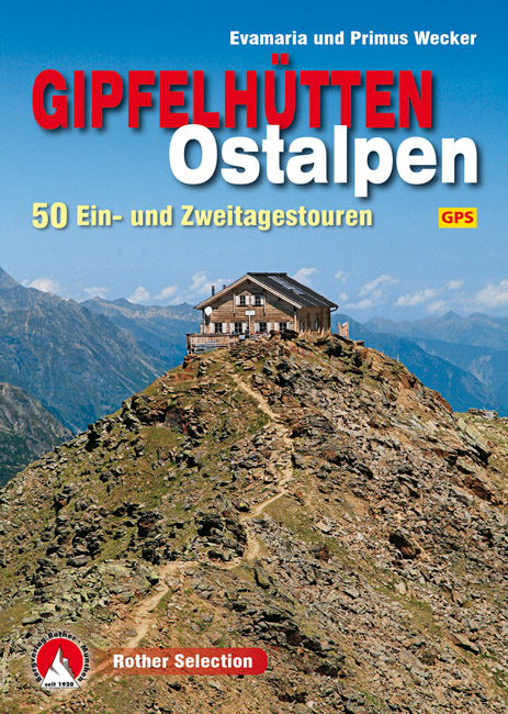
- Wandelgids Gipfelhütten Ostalpen | Rother Bergverlag
- Gipfelhütten sind ganz besondere Logenplätze! Herrlich ist die Aussicht, die sich mit einem erfrischenden Getränk von der Hüttenterrasse aus genießen lässt. Und wer eine Nacht so weit oben verbringt, erlebt das Schauspiel eines farbenprächtigen Sonnenunter- oder -aufgangs. Der Rother-Selection-Band »Gipfelhütten Ostalpen« führt zu 50 exponiert... Lire la suite
Cartes

United Kingdom
- Cologne Freytag & Berndt Map
- Indexed street map of Cologne at 1:20,000 from Freytag & Berndt with an enlargement of central Cologne at 1:10,000. Mapping is bright, colourful and clear, with one-way streets shown, as well as the U-bahn, bus and tram networks with stops clearly indicated.Points of interest such as Cologne cathedral, the Romano-Germanic museum, theatres and... Lire la suite

United Kingdom
- North Sea Coast Cycle Route 1 - Rotterdam to Leer Bikeline Map-Guide
- The North Sea Cycle Route Part 1 – a 455-km long section from Rotterdam to Lear presented by Verlag Esterbauer in a guide with maps at 1:75,000 showing the route and its variants. Extensive information is conveyed by symbols, indicating road surface, campsites and other accommodation, repair workshops, recreational facilities, places of... Lire la suite

United Kingdom
- Nuremberg - Ansbach - Bamberg - Bayreuth - Erlangen - Fürth ADAC Street Atlas
- Nürnberg Region Street Atlas in a series of detailed atlases covering the whole of Germany at 1:20,000 with UTM coordinates for GPS navigation, postal codes and public transport, published by ADAC, the country’s largest motoring organization. The plans name all the individual streets and indicate all the main landmarks and public buildings. All... Lire la suite

United Kingdom
- Canal du Midi Cycle Route: Toulouse to the Mediterranean - Canal de la Robine (265km) Bikeline Map/Guide
- Canal du Midi Cycle Route, a 160km long cycle trail from Toulouse, through Carcassonne and Béziers, to Sète presented by the Verlag Esterbauer in a guide with maps at 1:50,000 showing the route and its variants. Also covered in a route along the Canal de la Robine to include Narbonne and the spur southwards to Port-la-Nouvelle. Extensive... Lire la suite

United Kingdom
- Spreewald - NP Dahme-Heideseen 50K Kümmerly + Frey Map No. 29
- Spreewald - NP Dahme-Heideseen area of eastern Germany at 1:50,000 from Kümmerly+Frey in a series GPS compatible, double-sided maps printed on durable, waterproof and tear-resistant plastic paper; contoured, with hiking and cycle routes, other recreational activities, etc. Coverage includes Goslar and Wernigerode.Maps in this series are at a... Lire la suite

United Kingdom
- Emsland Cycle Tour (297km) Bikeline Map/Guide
- Emsland Cycle Tour, a 297km cycle route between Papenburg and Rheine presented by the Verlag Esterbauer in guide with maps at 1:50,000 showing the route and its variants. Extensive information is conveyed by symbols, indicating road surface, campsites and other accommodation, repair workshops, recreational facilities, places of interest, etc. A... Lire la suite

United Kingdom
- Stromberg-Murrtal Cycle Route - Idyllic Route
- Stromberg-Murrtal Cycle Route, presented by the Verlag Esterbauer in a guide with maps at 1:50,000 showing the route and its variants. Extensive information is conveyed by symbols, indicating road surface, campsites and other accommodation, repair workshops, recreational facilities, places of interest, etc. A list of various types of... Lire la suite

United Kingdom
- Rhine Cycle Route 3 - Mainz to Duisburg Bikeline Map-Guide
- The Rhine Cycle Route Part 3 – a 302-km long section from Mainz to Duisburg presented by Verlag Esterbauer in a guide with maps at 1:75,000 showing the route and its variants. Extensive information is conveyed by symbols, indicating road surface, campsites and other accommodation, repair workshops, recreational facilities, places of interest,... Lire la suite

United Kingdom
- Dresden Freytag & Berndt Map
- Indexed street map of Dresden at 1:20,000 from Freytag & Berndt with an enlargement of the Old Town at 1:8,000, as well as map of the environs of Dresden. Mapping is bright, colourful and clear, with one-way streets shown, as well as the S-bahn, bus, tram, cable-car and Elbe ferry networks with stops clearly indicated.Points of interest such as... Lire la suite

United Kingdom
- Lahn Valley Cycle Route - from Source to Rhine Bikeline Map-Guide
- Lahn Valley Cycle Route, a 247km long cycle route from the source to the Rhine presented by the Verlag Esterbauer in a guide with maps at 1:50,000 showing the route and its variants. Extensive information is conveyed by symbols, indicating road surface, campsites and other accommodation, repair workshops, recreational facilities, places of... Lire la suite

United Kingdom
- Nahe Cycle Route: From the Source to the Rhine at Bingen (123km) Bikeline Map/Guide
- Nahe Cycle Route, a 123-km long cycling trailfrom the river’s source to the Rhine at Bingen plus several 15 tours off the main trail combining in all to around 670kms, presented by the Verlag Esterbauer in a guide with maps at 1:50,000 showing the route and its variants. Extensive information is conveyed by symbols, indicating road surface,... Lire la suite

United Kingdom
- Roman Border (Limes) Cycle Route: the Rhine to the Danube (816km) Bikeline Map/Guide
- The Roman Border Cycle Route, an 816-km trail along the Limes - the Upper Germanic-Rhaetian boundary, one of the most outstanding archaeological monuments in Central Europe and a UNESCO World Heritage site. The route, which runs from the Rhine at Bad Hönningen near Koblenz to the Danube at Regensburg, is presented by the Verlag Esterbauer in a... Lire la suite

United Kingdom
- Cologne - Bonn - Aachen - Koblenz - Leverkusen ADAC Street Atlas
- Cologne - Bonn Region Street Atlas in a series of detailed atlases covering the whole of Germany at 1:20,000 with UTM coordinates for GPS navigation, postal codes and public transport, published by ADAC, the country’s largest motoring organization. The plans name all the individual streets and indicate all the main landmarks and public... Lire la suite

United Kingdom
- Rhine - Neckar Cycling Atlas
- Cycling atlas of the Rhine - Neckar region of Germany at 1:75,000 in a series of handy size spiral bound atlases from Verlag Esterbauer, Europe’s leading publishers of cycling maps. The guide includes over 1000km of cycling trails in the region between Worms and Karlsruhe, including around Heidelberg and in the Odenwald Natural Park.Cycling... Lire la suite

United Kingdom
- Oberstdorf - Kleinwalsertal - Sonthofen - Oberstaufen K+F Outdoor Map 1
- Oberstdorf – Kleinwalsertal area of the German Alps at 1:35,000 from Kümmerly+Frey in a series GPS compatible, double-sided maps printed on durable, waterproof and tear-resistant plastic paper; contoured, with hiking and cycle routes, other recreational activities, etc.Maps in this series are at a scale of either 1:50,000 or 1:35,000. Contour... Lire la suite