
Canterbury
Description
Sentiers de cette région
- Avalanche Peak – Crow River route
- Ball Pass CrossingGPX
- Carrington Hut – Waimakariri Col – Otira Route
- Carrington Hut routeGPX
- Casey Saddle – Binser Saddle route
- Cass – Lagoon Saddle tramping track
- Devilskin Saddle route
- Edwards – Hawdon Route
- Edwards – Otehake route
- Harman Pass Route
- Harper Pass route
- Lake Man tramping track and route
- Lake Sumner and Lewis Pass routes
- Lewis Pass – Waiau Pass – Blue Lake route
- Minchin Pass route
- Mingha – Deception route
- St James WalkwayGPX
- Three Passes route
Liens
Données
Rapports
Guides et cartes
Hébergement
Organisations
Voyagistes
GPS
Autre
Livres

Stanfords
United Kingdom
United Kingdom
- Canterbury - Margate - Ramsgate A-Z Street Atlas
- This A-Z map of Canterbury, Margate and Ramsgate is a full colour street atlas which also includes a places of interest guide. The publication features 41 pages of street mapping which extends to include:Faversham, Whitstable, Herne Bay, Birchington, Westgate on Sea, Broadstairs, SandwichThere are also large scale city/town centre maps of... Lire la suite

The Book Depository
United Kingdom
United Kingdom
- Lost Railway Walks
- Explore More Than 100 of Britain's Lost Railways Lire la suite

Stanfords
United Kingdom
United Kingdom
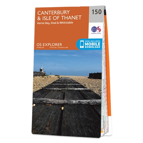
- Canterbury & the Isle of Thanet - Herne Bay, Deal & Whitstable OS Explorer Active Map 150 (waterproof)
- Canterbury, the Isle of Thanet, Herne Bay, Deal and Whitstable area on a detailed topographic and GPS compatible map No. 150, waterproof version, from the Ordnance Survey’s 1:25,000 Explorer series.MOBILE DOWNLOADS: this title and all the other OS Explorer maps include a code for downloading after purchase the digital version onto your... Lire la suite
- Also available from:
- The Book Depository, United Kingdom


The Book Depository
United Kingdom
United Kingdom
- Day Walks of New Zealand: Canterbury and Kaikoura
- Canterbury & Kaikoura Lire la suite

Stanfords
United Kingdom
2015
United Kingdom
2015
- Canterbury & the Isle of Thanet - Herne Bay, Deal & Whitstable OS Explorer Map 150 (paper)
- Canterbury, the Isle of Thanet, Herne Bay, Deal and Whitstable area on a detailed topographic and GPS compatible map No. 150, paper version, from the Ordnance Survey’s 1:25,000 Explorer series. MOBILE DOWNLOADS: this title and all the other OS Explorer maps include a code for downloading after purchase the digital version onto your smartphone... Lire la suite
- Also available from:
- The Book Depository, United Kingdom
- De Zwerver, Netherlands

De Zwerver
Netherlands
2015
Netherlands
2015

Stanfords
United Kingdom
2018
United Kingdom
2018
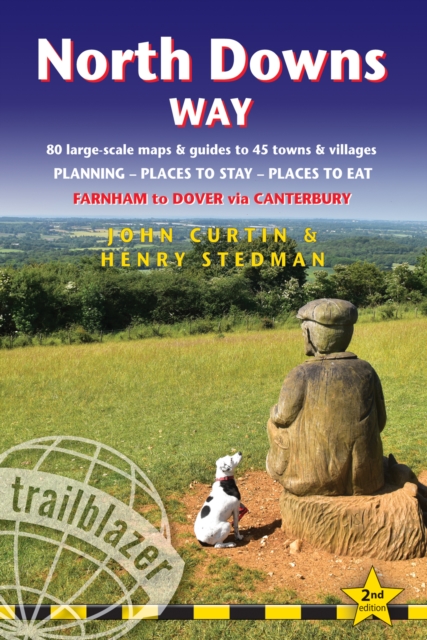
- North Downs Way: Farnham to Dover via Canterbury
- Practical guide to walking the North Downs Way National Trail that runs from Farnham in Surrey to Dover in Kent, partly following the old Pilgrims` Way to the shrine of St Thomas a Becket at Canterbury. It winds its way through the protected landscape of the Surrey Hills and the Kent Downs, passing medieval churches, castles, Neolithic burial... Lire la suite
- Also available from:
- The Book Depository, United Kingdom
- De Zwerver, Netherlands

The Book Depository
United Kingdom
2018
United Kingdom
2018
- North Downs Way (Trailblazer British Walking Guides)
- Practical walking guide to North Downs Way with 80 Large-Scale Walking Maps & Guides to 45 Towns & Villages - Planning, Places to Stay, Places to Eat - Farnham to Dover via Canterbury (Trailblazer British Walking Guides) Lire la suite
De Zwerver
Netherlands
2018
Netherlands
2018
- Wandelgids North Downs Way | Trailblazer Guides
- Practical guide to walking the North Downs Way National Trail that runs from Farnham in Surrey to Dover in Kent, partly following the old Pilgrims` Way to the shrine of St Thomas a Becket at Canterbury. It winds its way through the protected landscape of the Surrey Hills and the Kent Downs, passing medieval churches, castles, Neolithic burial... Lire la suite

Stanfords
United Kingdom
2016
United Kingdom
2016
- Canterbury, East Kent, Dover & Margate OS Landranger Map 179 (paper)
- Eastern Kent with Canterbury, Dover and Margate, including sections of the North Downs Way and the E2 and E9 European Long-Distance Paths, on a paper version of map No. 179 from the Ordnance Survey’s Landranger series at 1:50,000, with contoured and GPS compatible topographic mapping plus tourist information.MOBILE DOWNLOADS: As well as the... Lire la suite
- Also available from:
- The Book Depository, United Kingdom
- De Zwerver, Netherlands


De Zwerver
Netherlands
2016
Netherlands
2016


Stanfords
United Kingdom
United Kingdom
- Canterbury, East Kent, Dover & Margate OS Landranger Active Map 179 (waterproof)
- Eastern Kent with Canterbury, Dover and Margate, including sections of the North Downs Way and the E2 and E9 European Long-Distance Paths, on a waterproof and tear-resistant OS Active version of map No. 179 from the Ordnance Survey’s Landranger series at 1:50,000, with contoured and GPS compatible topographic mapping plus tourist... Lire la suite
- Also available from:
- The Book Depository, United Kingdom


The Book Depository
United Kingdom
United Kingdom
- The Way of Saint Martin
- A Slow Pilgrimage from Dover to Canterbury Lire la suite

The Book Depository
United Kingdom
United Kingdom
- Out of London Walks
- Great escapes by Britain's best walking tour company Lire la suite

The Book Depository
United Kingdom
2023
United Kingdom
2023
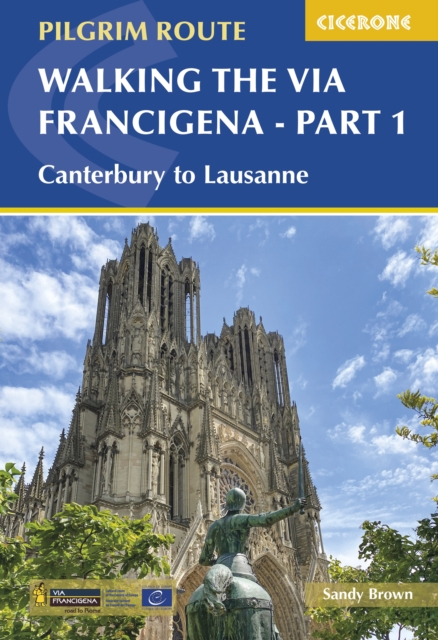
- Walking the Via Francigena Pilgrim Route - Part 1
- Canterbury to Lausanne Lire la suite
- Also available from:
- De Zwerver, Netherlands
De Zwerver
Netherlands
2023
Netherlands
2023
- Wandelgids Via Francigena Pilgrim Route Part 1 | Cicerone
- Canterbury to Lausanne Lire la suite

De Zwerver
Netherlands
2022
Netherlands
2022

The Book Depository
United Kingdom
2017
United Kingdom
2017
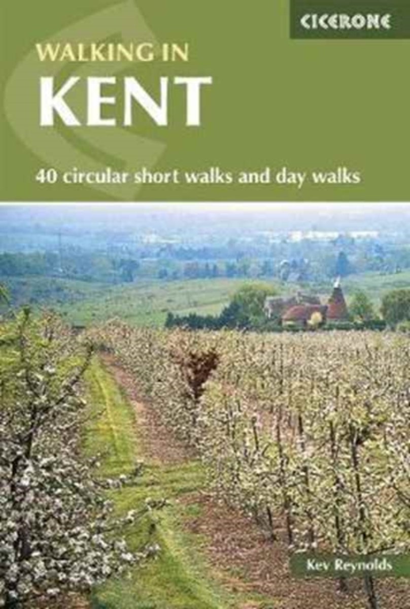
- Walking in Kent
- 40 circular short walks and day walks Lire la suite
- Also available from:
- Bol.com, Netherlands
- Bol.com, Belgium
- De Zwerver, Netherlands
Bol.com
Netherlands
2017
Netherlands
2017
- Walking in Kent
- Walking in Kent describes 40 circular day walks in the Garden of England. This guidebook includes routes ranging from 5 to 9 miles in west Kent and The Weald and north and east Kent. Encompassing woodland walks, clifftop paths and riverside rambles, there is something for everyone, from family strollers and determined ramblers. No specialised... Lire la suite
Bol.com
Belgium
2017
Belgium
2017
- Walking in Kent
- Walking in Kent describes 40 circular day walks in the Garden of England. This guidebook includes routes ranging from 5 to 9 miles in west Kent and The Weald and north and east Kent. Encompassing woodland walks, clifftop paths and riverside rambles, there is something for everyone, from family strollers and determined ramblers. No specialised... Lire la suite

De Zwerver
Netherlands
2017
Netherlands
2017
- Wandelgids Walking in Kent | Cicerone
- A guidebook describing 40 walks in the county of Kent. Covering west Kent and The Weald and north and east Kent, including the Kent Downs and the Greensand Hills. Walks of 5 to 9 miles explore rivers and coastline, beautiful countryside and historic villages. With outlines of 11 longer walks ranging from 15 to 163 miles. Lire la suite
De Zwerver
Netherlands
2020
Netherlands
2020
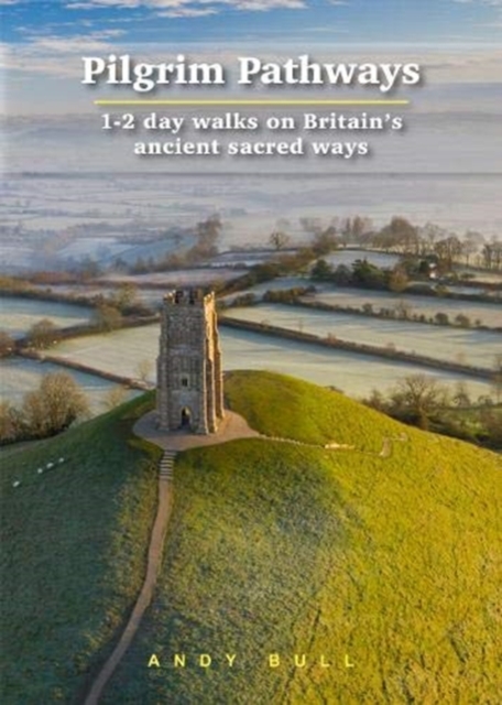
- Wandelgids Pilgrim Pathways | Trailblazer Guides
- Many people are inspired by the idea of going on a pilgrimage. TV series such as The Road to Rome and The Road to Santiago have shown that even the averagely unfit celeb can hobble through one. However, few of us have time for such long routes. So what to do?Pilgrim Pathways has the answer: 20 answers in fact. The pilgrimages in this guidebook... Lire la suite
Cartes
Stanfords
United Kingdom
United Kingdom
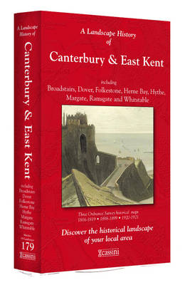
- Canterbury and East Kent 1816-1921 (3-map set)
- Map No. 179, Canterbury and East Kent 1816-1921 (3-map set), in the Cassini Historical Series of old Ordnance Survey mapping of England and Wales at 1:50,000 in a format designed to offer a convenient comparison with the present day coverage from the OS, and most locations in three different editions. Old historical maps have been combined so... Lire la suite
Stanfords
United Kingdom
United Kingdom
- Canterbury, Herne Bay and Whitstable Past and Present
- Canterbury, Herne Bay and Whitstable in the Cassini Past and Present map series which covers town and cities of England and Wales and offers a unique way of tracing their history and expansion by showing four different periods of their development using Ordnance Survey mapping from the mid-19th century, the late 19th century, the 1920s and the... Lire la suite

Stanfords
United Kingdom
United Kingdom
- North Downs Way A-Z Adventure Atlas
- North Downs Way Adventure Atlas at 1:25,000 in a series of handy A5 size Adventure Atlases from Geographers` A-Z Map Company with cartography from the Ordnance Survey’s Explorer series. The route from Farnham to Dover is presented with the alternative final sections, either via Canterbury or via Folkestone. To see other titles in this series... Lire la suite

Stanfords
United Kingdom
United Kingdom
- Canterbury and East Kent 1816-1819
- Map No. 179, Canterbury and East Kent 1816-1819, in the Cassini Historical Series of old Ordnance Survey mapping of England and Wales at 1:50,000 in a format designed to offer a convenient comparison with the present day coverage from the OS, and most locations in three different editions. Old historical maps have been combined so that the... Lire la suite
Stanfords
United Kingdom
United Kingdom
- Canterbury and East Kent 1920-1921
- Map No. 179, Canterbury and East Kent 1920-1921, in the Cassini Historical Series of old Ordnance Survey mapping of England and Wales at 1:50,000 in a format designed to offer a convenient comparison with the present day coverage from the OS, and most locations in three different editions. Old historical maps have been combined so that the... Lire la suite
Stanfords
United Kingdom
United Kingdom
- Canterbury and East Kent 1898-1899
- Map No. 179, Canterbury and East Kent 1898-1899, in the Cassini Historical Series of old Ordnance Survey mapping of England and Wales at 1:50,000 in a format designed to offer a convenient comparison with the present day coverage from the OS, and most locations in three different editions. Old historical maps have been combined so that the... Lire la suite

De Zwerver
Netherlands
Netherlands
- Wegenkaart - landkaart 504 Southeast England - Zuid oost Engeland - Kent | Michelin
- MICHELIN REGION MIDLANDS EST-ANGLIELondres, Birmingham, Ile de Wight, Canterbury, Manchester , 3 régions sur une seule carte Lire la suite