E8
Description
- Name E8 (E8)
- Distance de sentier 4,390 km, 2,728 milles
- Durée en jours 220 jours
- Début de sentier Dorsey Head (Irl)
- Fin de sentier Rhodopen (Bg)
- Classement Traildino MW, Marche modérée, sentier de randonnée
- Classement Traversée de montagne T1, Randonnée

 E8: Dorsey Head (Irl) - Rhodopen(Bg), 4390 km
Irish Sea – Rhein – Main – Donau – Karpaten – Rhodopen
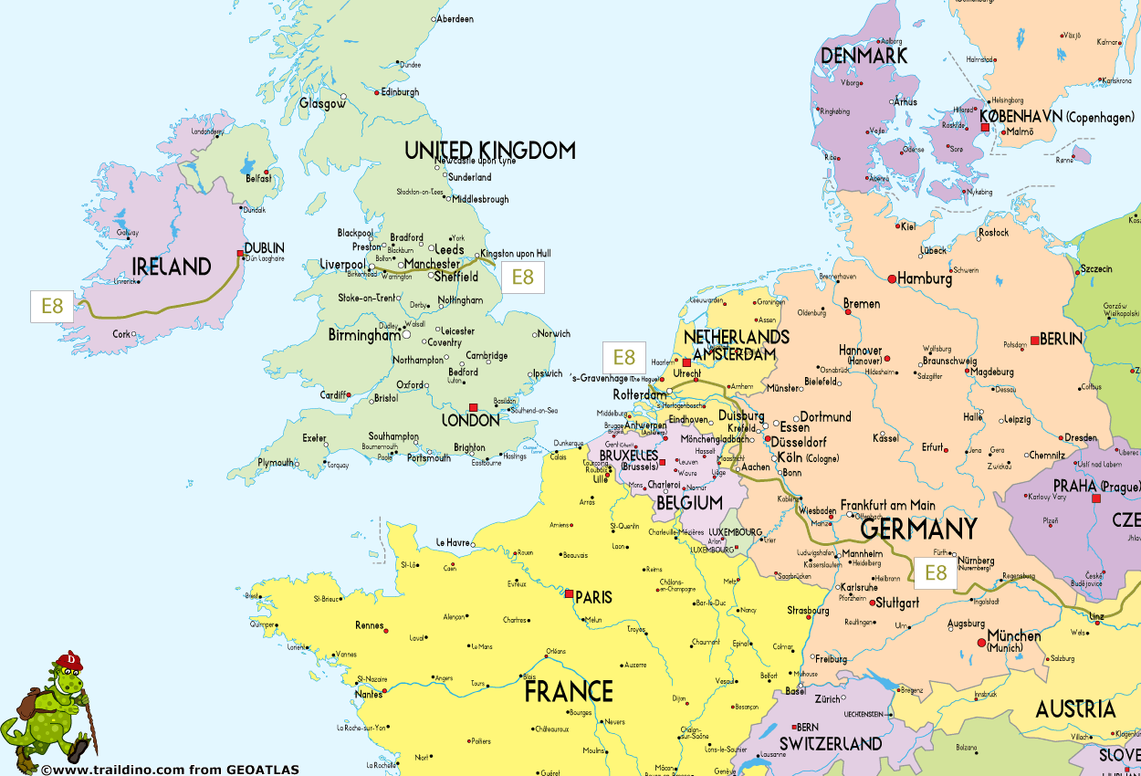
For 4390km this trail will lead you from the Atlantic coast of Ireland eastward, across the UK, the Netherlands, Germany, Austria, Slovakia and Poland, where you will come to an abrupt halt on the Beskid Pass which is the Ukrainian border. Follows a gap in the trail: the portion through Ukraine and Romania and the first stretch in Bulgaria is non-existent. You can then continue again on the last 400km stretch through Bulgaria's Rhodope range to Mezek near the Turkish border.
As with all European long distance paths, the waymarking reveals the different national policies. This is Europe! And this is the best reason to love the continent!! Anyway, in Ireland, England and Holland the trail is made up of existing, well documented, and very good waymarked trails. Germany offers a mixed deal: the E8 partly uses some existing long distance trails, but mostly local paths. Austria again has a wide network of trails, also accommodating the E8. In Eastern Europe, local paths and roads are used, and generally the waymarking is very good, but often you have to knit the color schemes together yourself. Unfortunately, in Ukraine and Romania hiking facilities are largely extinct. In Bulgaria however, some good waymarking has been done.
Well, let's put things together now. This is the complete string of trails making up your complete E8-hike:
Ireland (620 km)
- Dursey Head, start
- Beara Way, Dursey Head - Kenmare, 100 km, 5 days
- Kerry Way, Kenmare - Killarny, 40 km, 2 days
- Local trail, Killarny - Shrone, few km
- Blackwater Way, Shrone - Clogheen, 168 km, 10 days
- East Munster Way, Clogheen - carrick-on-Suir, 75 km, 3 days
- South Leinster Way, Carrick-on-Suir - Kildavin, 104 km, 5 days
- Local trail, Kildavin - Clonegal, few km
- Wicklow Way, Clonegal - Dublin, 129 km, 6 days
- Ferry Dublin – Liverpool (United Kingdom)
United Kingdom (300 km)
- Trans Pennine Way
- Ferry Kingston upon Hull – Hoek van Holland (Netherlands)
Netherlands (276 km)
- First village in the Netherlands is Hoek van Holland
- Grote Rivierenpad (LAW 6)
Note: this trail is a recent combination of Oeverloperpad (LAW 6-1) and Lingepad (LAW 6-2) - Pieterpad, bits (LAW 9)
Germany (1.500 km)
- Rheinhöhenweg
- Goldsteig
- Altmühltal Panoramaweg
- Partly the HW3 in the Schwäbische Alb, or Main-Neckar-Rhein-Weg
- And many other, local trails, waymarked
Austria (500 km)
- Connecting trail from Germany
- Ostösterreichischer_Grenzlandweg, Weitwanderweg 07 (WWW 07)
Slovakia (740 km)
- Border Austria / Slovakia – Bratislava - Baba Pass (527 m), hut (33 km)
- Baba Pass – Chata Brezinky, hut (30 km)
- Chata Brezinky - Dobrá Voda, village (23 km)
- Dobrá Voda – Myjava, town (22 km)
- Myjava - Holubyho chata (950 m), hut (18 km)
- Holubyho - Nové Mesto nad Váhom, town (29 km)
- Nové Mesto nad Váhom - chata pod Inovcom (840 m), hut (24 km)
- chata pod Inovcom – Trenčín, town (19 km)
- Trenčín - Trenčianske Teplice, spa (13 km)
- Trenčianske Teplice - Vápeč (955 m), (27 km), path to Homôlka hut (5 km)
- Vápeč – Čičmany, village (23 km)
- Čičmany - Vyšehradské sedlo (579 m), pass (30 km), bus to Nitrianske Pravno (8 km)
- Vyšehradské sedlo - Kremnické Bane, village (33 km), bus to Kremnice (5 km)
- Kremnické Bane - Kráľova studňa (1280 m), hotel (30 km)
- Kráľova studňa – Donovaly, tourist centre (19 km)
- Donovaly - Zámostská hoľa (1612 m), hut (22 km), path to Magurka (5 km)
- Zámostská hoľa - Chata gen. M.R. štefánika (1727 m), hut (19 km)
- M.R. štefánika - Honzovské (1171 m) (17 km), path to Dobšinskej hotel (4 km)
- Honzovské – Skalisko (1293 m), hut (31 km)
- Skalisko - Štós-kúpele, spa (28 km)
- Štós-kúpele - Jahodná chata, hut (31 km)
- Jahodná – Košice, town (10 km)
- Košice - Kysak, village (19 km)
- Kysak – Cemjata, village (22 km), path to Prešova (6 km)
- Cemjata - sedlo Čergov (917 m), hut (29 km)
- sedlo Čergov – Bardejov, town (22 km)
- Bardejov – Zborov, village (17 km)
- Zborov – Svidník. town (31 km)
- Svidník - Dukliansky priesmyk (502 m), pass, border Slovakia / Poland (26 km)
- Last village in Slovakia is Vyšný Komárnik - Dukliansky Priesmyk
VKÚ maps
127 Malé Karpaty-Bratislava
128 Malé Karpaty-Záruby
129 Malé Karpaty-Bradlo
130 Považský Inovec-Piešťany
107 Biele Karpaty-Trenčín
119 Strážovské vrchy-Trenčianske Teplice
131 Vtáčnik-Horná Nitra
120 Malá Fatra-Martinské hole
132 Kremnické vrchy
121 Veľká Fatra
122 Nízke Tatry-Chopok
123 Nízke Tatry-Kráľova hoľa
124 Slovenský raj
125 Volovské vrchy-Krompachy
136 Volovské vrchy-Košice
115 Šarišská vrchovina-Branisko
104 Čergov
105 Ondavská vrchovina-Bardejov
106 Laborecká vrchovina-Dukla
Poland (195 km)
- First village in Poland is Barwinek near Dukla, border Slovakia
- Barwinek – Dukla, connecting trail (yellow), 20 km, 1 day
- Beskids Trail / Główny Szlak Beskidzki, from Chyrowa to Wołosate, 171 km, 10 days
- Wołosate to border Ukraine, 3 km. Here, the trail and markings end
- Last village in Poland is Wołosate
Ukraine
- First village in Ukraina is Lubnya
- Trail is non-existent
Romania
- Non-existent
Bulgaria (400 km)
- First part non-existent
- Start of current trail in Borovec, small town 80 km from Sofia in Rila Mountains, waymarked
- Svilengrad near Greece / Turkey, finish
Turkey?
- Currently no trail
- Istanbul, future finish?
Carte
Liens
Données
Rapports
Guides et cartes
Hébergement
Organisations
Voyagistes
GPS
Autre
Cartes

United Kingdom
- Stara Planina Central: Zlatitsa to Kalofer Domino Map
- Stara Planina Central: Zlatitsa to Kalofer map at 1:50,000 from Bulgarian publishers Domino, contoured and GPS compatible, with hiking trails, accommodation options including a list of local mountain refuges, etc. The map is double-sided and covers the mountains from just west of Ribaritsa and Zlatitsa eastwards beyond Kalofer to the peak of... Lire la suite
- Also available from:
- De Zwerver, Netherlands

Netherlands
- Wandelkaart 1 Stara Planina gebergte | Domino
- Stara Planina Central: Zlatitsa to Kalofer map at 1:50,000 from Bulgarian publishers Domino, contoured and GPS compatible, with hiking trails, accommodation options including a list of local mountain refuges, etc. The map is double-sided and covers the mountains from just west of Ribaritsa and Zlatitsa eastwards beyond Kalofer to the peak of... Lire la suite

United Kingdom
- Stara Planina Central: Uzana to Vratnik Domino Map
- Stara Planina Central: Uzana to Vratnik map at 1:50,000 from Bulgarian publishers Domino, contoured and GPS compatible, with hiking trails, accommodation options including a list of local mountain refuges, etc. The map is double-sided and covers the mountains from just west of the Uzana massif, the geographical centre of Bulgaria, eastwards to... Lire la suite
- Also available from:
- De Zwerver, Netherlands

Netherlands
- Wandelkaart 2 Stara Planina gebergte | Domino
- Stara Planina Central: Uzana to Vratnik map at 1:50,000 from Bulgarian publishers Domino, contoured and GPS compatible, with hiking trails, accommodation options including a list of local mountain refuges, etc. The map is double-sided and covers the mountains from just west of the Uzana massif, the geographical centre of Bulgaria, eastwards to... Lire la suite

United Kingdom
- Transrhodopi - Long distance hiking and biking trail From Trigrad to Ivaylovgrad
- Western Rhodope Mountains at 1:100,000 on a contoured GPS compatible map from Domino extending from just west of the Pirin National Park to Asenovgrad in the north-east. The map is double-sided with a good overlap between the sides. Topography is shown by contours at 50m intervals with relief shading and spot heights, plus colouring for... Lire la suite

United Kingdom
- Stara Planina Western: Belogradchik to Berkovita Domino Map
- Stara Planina Western: Belogradchik to Berkovita map at 1:50,000 from Bulgarian publishers Domino, contoured and GPS compatible, with hiking trails, accommodation options including a list of local mountain refuges, etc. The map is double-sided and covers the mountains from the peak of Byala Voda near Belogradchik eastwards to just beyond... Lire la suite
- Also available from:
- De Zwerver, Netherlands

Netherlands
- Wandelkaart 3 Stara Planina gebergte | Domino
- Stara Planina Western: Belogradchik to Berkovita map at 1:50,000 from Bulgarian publishers Domino, contoured and GPS compatible, with hiking trails, accommodation options including a list of local mountain refuges, etc. The map is double-sided and covers the mountains from the peak of Byala Voda near Belogradchik eastwards to just beyond... Lire la suite

United Kingdom
- Stara Planina Western: Berkovita to Zlatitsa Domino Map
- Stara Planina Western: Berkovita to Zlatitsa map at 1:50,000 from Bulgarian publishers Domino, contoured and GPS compatible, with hiking trails, accommodation options including a list of local mountain refuges, etc. The map is double-sided and covers the mountains from Varshets (directly north of Sofia) to just beyond Etrepole.Maps in the... Lire la suite
- Also available from:
- De Zwerver, Netherlands

Netherlands
- Wandelkaart 4 Stara Planina gebergte | Domino
- Stara Planina Western: Berkovita to Zlatitsa map at 1:50,000 from Bulgarian publishers Domino, contoured and GPS compatible, with hiking trails, accommodation options including a list of local mountain refuges, etc. The map is double-sided and covers the mountains from Varshets (directly north of Sofia) to just beyond Etrepole.Maps in the... Lire la suite

United Kingdom
- Rila Mountains Domino
- Rila Mountains at 1:50,000 on a large, double-sided, contoured map with GPS waypoints for shelters and chalets, peaks, etc. and highlighting hiking routes. Topography is shown by contours at 50m intervals with additional relief shading and graphics and colouring for scree, single rocks over 5m high, marshlands and pine scrub and forests. An... Lire la suite
- Also available from:
- De Zwerver, Netherlands

Netherlands
- Wandelkaart 5 Rila gebergte | Domino
- Rila Mountains at 1:50,000 on a large, double-sided, contoured map with GPS waypoints for shelters and chalets, peaks, etc. and highlighting hiking routes. Topography is shown by contours at 50m intervals with additional relief shading and graphics and colouring for scree, single rocks over 5m high, marshlands and pine scrub and forests. An... Lire la suite

United Kingdom
- Pirin Mountains Domino
- Pirin Mountains at 1:50,000 on a large, double-sided, contoured map with GPS waypoints for shelters and chalets, peaks, etc. and highlighting hiking routes. Topography is shown by contours at 40m intervals with additional relief shading and graphics and colouring for sandstone stacks, single rocks over 5m high, marshlands and different types of... Lire la suite
- Also available from:
- De Zwerver, Netherlands

Netherlands
- Wandelkaart 6 Pirin gebergte | Domino
- Pirin Mountains at 1:50,000 on a large, double-sided, contoured map with GPS waypoints for shelters and chalets, peaks, etc. and highlighting hiking routes. Topography is shown by contours at 40m intervals with additional relief shading and graphics and colouring for sandstone stacks, single rocks over 5m high, marshlands and different types of... Lire la suite

United Kingdom
- Western Rhodope Mountains Domino Map
- Western Rhodope Mountains at 1:100,000 on a contoured GPS compatible map from Domino extending from just west of the Pirin National Park to Asenovgrad in the north-east. The map is double-sided with a good overlap between the sides. Topography is shown by contours at 50m intervals with relief shading and spot heights, plus colouring for... Lire la suite
- Also available from:
- De Zwerver, Netherlands

Netherlands
- Wandelkaart - Wegenkaart - landkaart 7 Westelijke Rhodopen - Western Rhodopes | Domino
- Western Rhodope Mountains at 1:100,000 on a contoured GPS compatible map from Domino extending from just west of the Pirin National Park to Asenovgrad in the north-east. The map is double-sided with a good overlap between the sides. Topography is shown by contours at 50m intervals with relief shading and spot heights, plus colouring for... Lire la suite

United Kingdom
- Strandzha Mountains: Burgas to the Turkish Border Domino Map
- Strandzha Mountains in the south-eastern corner of Bulgaria between Burgas to the Turkish border on a contoured and GPS compatible map from Domino showing local hiking trails and highlighting various interesting sites, with three more detailed enlargements at 1:25,000. Most place names are in both Latin and Cyrillic alphabet; map legend... Lire la suite
- Also available from:
- De Zwerver, Netherlands

Netherlands
- Wandelkaart Strandzha - Bulgarije | Domino
- Strandzha Mountains in the south-eastern corner of Bulgaria between Burgas to the Turkish border on a contoured and GPS compatible map from Domino showing local hiking trails and highlighting various interesting sites, with three more detailed enlargements at 1:25,000. Most place names are in both Latin and Cyrillic alphabet; map legend... Lire la suite

Netherlands
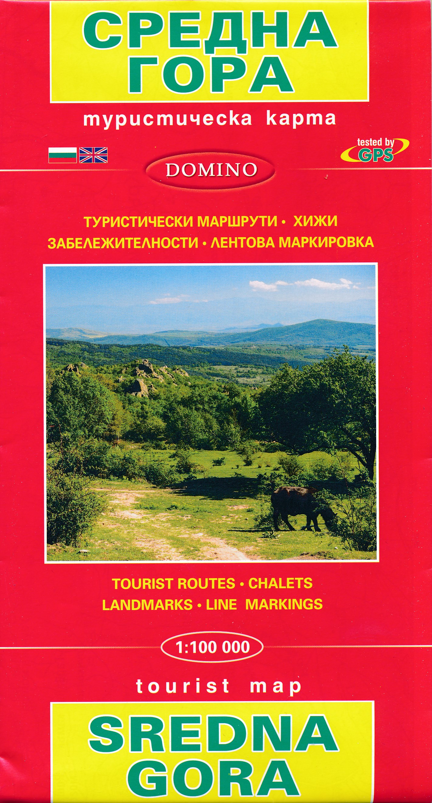
- Wandelkaart Sredna Gora - Bulgarije | Domino
- Pirin Mountains at 1:50,000 on a large, double-sided, contoured map with GPS waypoints for shelters and chalets, peaks, etc. and highlighting hiking routes. Topography is shown by contours at 40m intervals with additional relief shading and graphics and colouring for sandstone stacks, single rocks over 5m high, marshlands and different types of... Lire la suite


