
GR53 - Crête des Vosges
Description
- Name GR53 - Crête des Vosges (GR53)
- Distance de sentier 167 km, 104 milles
- Durée en jours 8 jours
- Début de sentier Wissembourg
- Fin de sentier Schirmeck
- Classement Traildino MW, Marche modérée, sentier de randonnée
- Classement Traversée de montagne T1, Randonnée


 Wissembourg - Basel
The Vosges (Vogesen) is an old range of low mountains, west of the Rhine Valley. Historically it belonged alternately to Germany or France. The German influence is very clear, especially in the northern parts. Here the hills are relatively low, pushed together, with extensive forests. Actually, it is a continuation of the German Pfälzerwald north of it. Going south the hills broaden, get higher, and in the higher parts open flats top the hills, like the Ballon d'Alsace, with 1247 m the highest summit of these mountains.
The GR53 is interwoven with the GR531 and GR532. Then there is also the popular GR5 intertwining. So alltogether you can feel free to explore the Vosges from north to south, from the dark forests to the vineyards of the Rhine valley, finding ruined bourgs or mediaeval villages on your way.
Carte

Liens
Données
Rapports
Guides et cartes
Hébergement
Organisations
Voyagistes
GPS
Autre
Livres


Netherlands
2021
- Wandelgids 265 Vogesen - Durchquerung: GR53 GR5 | Rother Bergverlag
- In 37 etappes over de Lange Astands Wandelingen GR 53, GR 5 en GR 531 van Wissembourg naar Giromagny en Masevaux door de prachtige Vogezen. Goed alternatief voor de langverwachte maar nog steeds niet uitgekomen Crete des Vosges wandelgids van FFRP. Duitse samenvatting: Die Vogesen sind nicht nur eines der urwüchsigsten Mittelgebirge in unseren... Lire la suite

United Kingdom
2017
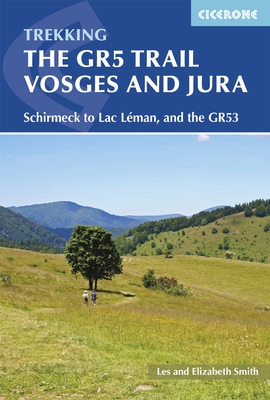
- The GR5 Trail - Vosges and Jura
- Schirmeck to Lac LA (c)man, and the GR53 Lire la suite
- Also available from:
- Bol.com, Netherlands
- Bol.com, Belgium
- De Zwerver, Netherlands

Netherlands
2017
- The GR5 trail - Vosges and Jura
- The tranquil Vosges and Jura enjoy rolling hills with far-reaching views, ruined castles, enchanting wine-making villages, forests and spectacular gorges. The GR5/GR53 provides an interesting waymarked route, starting on the GR53 from the quiet hills of the Northern Vosges, and continuing through Alsace, then the Doubs Gorge, up onto the Jura... Lire la suite
Belgium
2017
- The GR5 trail - Vosges and Jura
- The tranquil Vosges and Jura enjoy rolling hills with far-reaching views, ruined castles, enchanting wine-making villages, forests and spectacular gorges. The GR5/GR53 provides an interesting waymarked route, starting on the GR53 from the quiet hills of the Northern Vosges, and continuing through Alsace, then the Doubs Gorge, up onto the Jura... Lire la suite
Netherlands
2017
- Wandelgids The GR5 Trail Vosges and Jura | Cicerone
- Guidebook to a 687km (427 mile) trek through eastern France, traversing the Vosges and the Haut-Jura plateau. The route follows the GR53 from Wissembourg to Schirmeck, before picking up the central section of the GR5 from Schirmeck to Nyon on Lake Geneva, taking in wooded and grassy hills, river gorges and fascinating castle ruins. Lire la suite

Netherlands
2024
