
Wien
Description
Wien is the smallest Bundesland of Austria, but the one with the largest population.
Sentiers de cette état
Liens
Données
Rapports
Guides et cartes
Hébergement
Organisations
Voyagistes
GPS
Autre
Livres
The Book Depository
United Kingdom
2019
United Kingdom
2019
- Also available from:
- De Zwerver, Netherlands

Bol.com
Netherlands
Netherlands
- WF5421 Allgäu, Allgäuer Alpen Kompass
- De Kompass wandelgids + kaart geeft een overzicht van alle wandelroutes in het gebied met nauwkeurige routeaanwijzingen en hoogteaanduidingen, De extra grote kaart, schaal 1:35 000, is ideaal om van te voren uw route uit te stippelen en om onderweg te gebruiken • naast de bekende bestemmingen, worden ook de minder bekende vermeld • openbaar... Lire la suite
- Also available from:
- Bol.com, Belgium
Bol.com
Belgium
Belgium
- WF5421 Allgäu, Allgäuer Alpen Kompass
- De Kompass wandelgids + kaart geeft een overzicht van alle wandelroutes in het gebied met nauwkeurige routeaanwijzingen en hoogteaanduidingen, De extra grote kaart, schaal 1:35 000, is ideaal om van te voren uw route uit te stippelen en om onderweg te gebruiken • naast de bekende bestemmingen, worden ook de minder bekende vermeld • openbaar... Lire la suite
De Zwerver
Netherlands
2017
Netherlands
2017
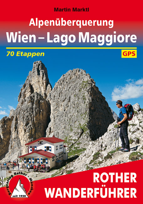
- Wandelgids Alpenüberquerung Wien - Lago Maggiore | Rother Bergverlag
- Goede wandelgids met kaartmateriaal, hoogteprofielen en praktische informatie. Duitstalig. Einmal einen ganzen Sommer lang Auszeit in den Bergen nehmen, ohne jede Eile die Natur und die Freiheit genießen ... Davon träumt wohl jeder ambitionierte Wanderer, und auf die besonders Ambitionierten wartet jetzt eine ganz besondere Herausforderung: zu... Lire la suite
De Zwerver
Netherlands
2021
Netherlands
2021
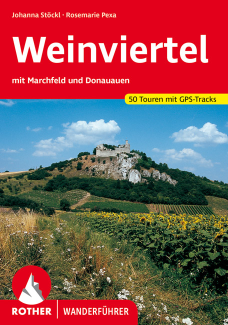
- Wandelgids Weinviertel | Rother Bergverlag
- Uitstekende wandelgids met een groot aantal dagtochten in dal en hooggebergte. Met praktische informatie en beperkt kaartmateriaal! Wandelingen in verschillende zwaarte weergegeven in rood/blauw/zwart Das Weinviertel, zwischen Manhartsberg, Donau und March gelegen, überrascht den Wanderer immer wieder durch eine landschaftliche Vielfalt, wie... Lire la suite

De Zwerver
Netherlands
2018
Netherlands
2018
- Wandelgids Tourist route E4 in Bulgaria | Oilaripi
- Verrassend goede wandelgids van een deel van de E4 in Bulgarije. Goede kaarten, hoogteprofielen, prima beschrijvingen en praktische informatie maken het een volwaardige wandelgids die je in eerste instantie van dit gebied niet zou verwachten. Guidebook along the main ridge of the great alpine route E4 in Bulgaria, also known as �the fiv... Lire la suite
Bol.com
Netherlands
Netherlands
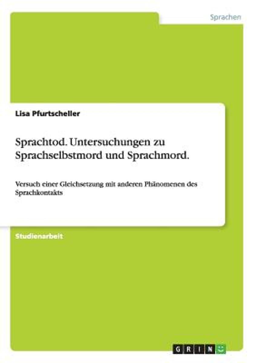
- Sprachtod. Untersuchungen Zu Sprachselbstmord Und Sprachmord.
- Studienarbeit aus dem Jahr 2011 im Fachbereich Sprachwissenschaft / Sprachforschung (fachubergreifend), Note: 1,0, Universitat Wien (Romanistik), Sprache: Deutsch, Abstract: Robert Aitchison stellt in seinem Buch Language change: progress or decay" die interessante Frage: Human beings never stop talking. How then can a language die out?"... Lire la suite
- Also available from:
- Bol.com, Belgium
Bol.com
Belgium
Belgium
- Sprachtod. Untersuchungen Zu Sprachselbstmord Und Sprachmord.
- Studienarbeit aus dem Jahr 2011 im Fachbereich Sprachwissenschaft / Sprachforschung (fachubergreifend), Note: 1,0, Universitat Wien (Romanistik), Sprache: Deutsch, Abstract: Robert Aitchison stellt in seinem Buch Language change: progress or decay" die interessante Frage: Human beings never stop talking. How then can a language die out?"... Lire la suite

De Zwerver
Netherlands
2023
Netherlands
2023

De Zwerver
Netherlands
2024
Netherlands
2024
- Klimgids - Klettersteiggids Alpine Klettersteige Ostalpen | Rother Bergverlag
- 70 spannende Touren zwischen Wien, Bodensee und Gardasee Rother Selection. 1. Auflage. Lire la suite

Bol.com
Netherlands
Netherlands
- Der Jesus vom Sexshop
- Mit siebzehn trampte Helge Timmerberg nach Indien, bereiste den legendären Hippie-Trail; in Kurdistan fiel er unter die Wölfe, im Iran wurde er verhaftet, und in Belutschistan traf ihn die Liebe - sie hieß Leila. Seither, seit vier Jahrzehnten, ist Timmerberg auf Reisen, Sesshaftigkeit hat ihm das Schicksal verboten - entstanden sind daraus... Lire la suite
- Also available from:
- Bol.com, Belgium
Bol.com
Belgium
Belgium
- Der Jesus vom Sexshop
- Mit siebzehn trampte Helge Timmerberg nach Indien, bereiste den legendären Hippie-Trail; in Kurdistan fiel er unter die Wölfe, im Iran wurde er verhaftet, und in Belutschistan traf ihn die Liebe - sie hieß Leila. Seither, seit vier Jahrzehnten, ist Timmerberg auf Reisen, Sesshaftigkeit hat ihm das Schicksal verboten - entstanden sind daraus... Lire la suite
De Zwerver
Netherlands
2013
Netherlands
2013
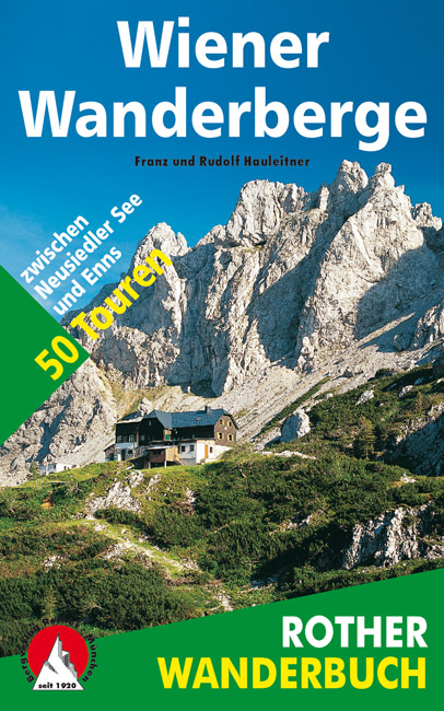
- Wandelgids Wiener Wanderberge | Rother Bergverlag
- De ‘Rother Wanderbücher’ behandelen telkens de 50 mooiste wandelingen, die variëren van eenvoudige kindvriendelijke wandelingen tot routes die aanzienlijk meer ervaring vereisen. Uitvoerige routebeschrijvingen, een aantrekkelijke lay-out met vele kleurenfoto’s, niets aan duidelijkheid te wensen gelaten hoogteprofielen, kaartjes met de... Lire la suite

The Book Depository
United Kingdom
2015
United Kingdom
2015
- The High Mountains of Crete
- The White Mountains, Psiloritis and Lassithi Mountains Lire la suite
- Also available from:
- Bol.com, Netherlands
- Bol.com, Belgium
- De Zwerver, Netherlands

Bol.com
Netherlands
2015
Netherlands
2015
- The high mountains of Crete
- Guidebook to walking and trekking the high mountains of Crete. The largest of the Greek Islands, Crete's mountains provide breathtaking walking and wilderness on this popular island. The routes in this guidebook are graded for difficulty and range from short, easy strolls to challenging, multi-day treks, providing options for all walkers. In... Lire la suite
Bol.com
Belgium
2015
Belgium
2015
- The high mountains of Crete
- Guidebook to walking and trekking the high mountains of Crete. The largest of the Greek Islands, Crete's mountains provide breathtaking walking and wilderness on this popular island. The routes in this guidebook are graded for difficulty and range from short, easy strolls to challenging, multi-day treks, providing options for all walkers. In... Lire la suite

De Zwerver
Netherlands
2015
Netherlands
2015
- Wandelgids The high mountains of Crete - Kreta | Cicerone
- Guidebook of walking routes in Crete's mountains, covering the Lefka Ori (White Mountains), Mount Ida (the Psiloritis range), the Lassithi mountains and E4 trail. Each of the 87 walks is graded, in a range between 2 and 28km with various longer options, covering a multitude of terrains from rugged mountain ridges to forested crags and beaches. Lire la suite

De Zwerver
Netherlands
2024
Netherlands
2024
Bol.com
Netherlands
Netherlands
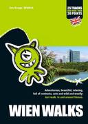
- WIEN WALKS
- Adventurous, beautiful, relaxing, full of contrasts, cute and wild and woolly: Just walk. In and around Vienna. . 1., Auflage. Lire la suite
- Also available from:
- Bol.com, Belgium
Bol.com
Belgium
Belgium
- WIEN WALKS
- Adventurous, beautiful, relaxing, full of contrasts, cute and wild and woolly: Just walk. In and around Vienna. . 1., Auflage. Lire la suite
Cartes

Stanfords
United Kingdom
United Kingdom
- Danube-Auen NP - Lobau - Hainburg - Marchegg - Gänserdorf - Bruck a.d. Leitha F&B WK013
- Danube-Auen NP - Lobau - Hainburg - Marchegg - Gänserdorf - Bruck a.d. Leitha area extending eastwards from Vienna to Bratislava presented at 1:50,000 in a series of contoured and GPS compatible outdoor leisure map from Freytag & Berndt with hiking and cycling routes, mountain huts, campsites and youth hostels, local bus stops, plus other... Lire la suite

Stanfords
United Kingdom
United Kingdom
- E4 Arquipelago de Cabo Verde
- Plans included:Porto Novo (Ilha de Santo Antão) (1:10 000)Mindelo (Porto Grande) (Ilha de São Vicente) (1:20 000)Ilha de Santa Luzia (1:not known)Porto de Tarrafal (Ilha de São Nicolau) (1:8500)Porto da Preguiça (Ilha de São Nicolau) (1:8500)Baía da Palmeira (Ilha do Sal) (1:15 000)Porto de Sal-Rei (Ilha da Boavista) (1:30 000)Porto da Praia... Lire la suite

Stanfords
United Kingdom
United Kingdom
- Vienna Borch
- Tourist plan for visitors to Vienna: clear, indexed, laminated and waterproof, highlighting top 30 sights and providing plans of the Hofburg and Schönbrunn palaces, a map of the city’s environs, and a diagram of the rail/metro network. The main plan at 1:11,000 covers the city from the Westbanhof to WienNeu Exhibition Centre and the Prater... Lire la suite

Stanfords
United Kingdom
United Kingdom
- Hungarian National Long-distance Blue Trail (E4): Visegrad to Irott-ko
- Hiking guide to the north-western section of Hungary’s National Blue Trail which forms part of the E4 European long-distance footpath. The guide covers the route from the historic town of Visegrád on the Danube, across the Buda Hills on the outskirts of Budapest and the Bakony Hills along the north-eastern shore of Lake Balaton, to Írott-ko in... Lire la suite

Stanfords
United Kingdom
United Kingdom
- World Global Mapping Antique Political Wall Map LARGE PAPER
- Award winning political wall map of the world at 1:30,000,000 from Global Mapping, size 134 x 76.5 cm (53” x 30” approx) – paper version, in an antique style of presentation with the countries in pleasant subdued colours and the oceans with graphics to show the ridges, etc. A useful enlargement presents Europe in greater clarity.Countries are... Lire la suite

Stanfords
United Kingdom
United Kingdom
- Vienna F&B Tourist Street Plan
- Tourist street map at 1:25,000 of the central region of the city, from Donaufeld in the north-east to Oberlaa district in the south and Penzing in the west. Detail includes public buildings and locations of interest, tram & bus routes, railways & metro lines, pedestrian zones, information centres, post offices, hospitals, parks. Map legend... Lire la suite

Stanfords
United Kingdom
United Kingdom
- World IGN Physical 14M Wall Map PLASTIC 3-Sheet Set
- IGN’s very attractive large wall map of the world published in three separate sheets (size when combined 289 x 143 cm / 114” x 56” approx) and printed on light, waterproof and tear-resistant synthetic paper. The sheets can be assembled either Atlantic- or Pacific-centred.Physical geography of the land masses is vividly presented in pleasant... Lire la suite

Stanfords
United Kingdom
United Kingdom
- Adelboden - Lenk
- Adelboden - Lenk area of the western Bernese Oberland, from Gstaad to Frutigen and Leukerbad at 1:50,000 in a series from Hallwag covering Switzerland’s popular hiking regions on light, waterproof and tear-resistant maps highlighting long-distance paths: the nine national routes plus special regional routes, as well as other local hiking... Lire la suite

Stanfords
United Kingdom
United Kingdom
- Peloponnese Anavasi Road Atlas
- Road Atlas of the Peloponnese from Anavasi, in an A4 paperback format, with contoured, GPS compatible mapping at 1:50,000, very detailed road classification, hiking paths, and place names in both Greek and Latin alphabets.The main section of the atlas has 178 pages of detailed maps with contours at 100m intervals, altitude colouring and relief... Lire la suite

Stanfords
United Kingdom
United Kingdom
- Taygetos - North Taygetos Anavasi 8.1
- The Taygetos range between Sparta and Kalamata at 1:50,000 on a contoured, GPS compatible map from Anavasi with on the reverse a special map highlighting the region’s numerous hiking trails, including the course of the E4 European long-distance path.On one side is the main map of the area with excellent presentation of its topography by... Lire la suite

Stanfords
United Kingdom
United Kingdom
- Greece: Attika and Central Greece Road Atlas
- Road Atlas of Attika, the region around Athens, and Central Greece from Anavasi, in an A4 paperback format, with contoured mapping at 1:50,000, a 2km UTM grid for GPS users, very detailed road classification, hiking paths, and place names in both Greek and Latin alphabets.The main section of the atlas has 219 pages of detailed maps with... Lire la suite

Stanfords
United Kingdom
United Kingdom
- Hohe Wand - Schneeberg - Biedermeiertal - Gutenstein F&B WK5012
- Hohe Wand - Schneeberg - Biedermeiertal - Gutenstein area of eastern Austria presented at 1:35,000 in a series of contoured and GPS compatible outdoor leisure map from Freytag & Berndt with hiking and cycling routes, mountain huts, campsites and youth hostels, local bus stops, plus other tourist information. Cartography is an enlargement of the... Lire la suite

Stanfords
United Kingdom
United Kingdom
- Transrhodopi - Long distance hiking and biking trail From Trigrad to Ivaylovgrad
- Western Rhodope Mountains at 1:100,000 on a contoured GPS compatible map from Domino extending from just west of the Pirin National Park to Asenovgrad in the north-east. The map is double-sided with a good overlap between the sides. Topography is shown by contours at 50m intervals with relief shading and spot heights, plus colouring for... Lire la suite

Stanfords
United Kingdom
United Kingdom
- Thermal Region Baden - Forchtenstein - Rosaliengebirge - Bucklige Welt - Wiener Neustadt F&B WK023
- Rosaliengebirge - Hohe Wand - Forchtenstein - Thermenregion - Wiener Neustadt area of eastern Austria presented at 1:50,000 in a series of contoured and GPS compatible outdoor leisure map from Freytag & Berndt with hiking and cycling routes, mountain huts, campsites and youth hostels, local bus stops, plus other tourist information.To see the... Lire la suite

Stanfords
United Kingdom
United Kingdom
- Vienna Woods F&B WK011
- The Vienna Woods at 1:50,000 in a series of contoured and GPS compatible outdoor leisure map from Freytag & Berndt with hiking and cycling routes, mountain huts, campsites and youth hostels, local bus stops, plus other tourist information.To see the list of currently available titles in this series please click on the series link.Freytag &... Lire la suite