
London
Description
Capital of the United Kingdom. All sorts of walks. The Thames Path runs right through the city center and you can hop on the London Eye after being fooled at the ticket counter and view forward and backward on your trail.
Sentiers de cette région
Liens
Données
Rapports
Guides et cartes
Hébergement
Organisations
Voyagistes
GPS
Autre
Livres

Stanfords
United Kingdom
United Kingdom
- London`s Hidden Walks: Volumes 1-3
- People love walking the streets of London, but there are always more questions than answers after a stroll through the capital. These books are packed with interesting details about London`s history with fascinating stories and more general historical facts. This box set combines volumes 1, 2 and 3 in an attractive slip case. Each volume... Lire la suite

Stanfords
United Kingdom
United Kingdom
- The Stubborn Light of Things: A Nature Diary
- A Sunday Times Nature Book of the YearA nature diary by award-winning novelist, nature writer and hit podcaster Melissa Harrison, following her journey from urban south London to the rural Suffolk countryside.”A writer of great gifts.” Robert Macfarlane”The journal of a writer to compare to Thomas Hardy. Melissa Harrison is among our most... Lire la suite

Stanfords
United Kingdom
United Kingdom
- London Marco Polo Spiral Guide
- London in the Marco Polo Spiral Guides series is a practical guide presenting the most important things to see and do in the city in a nutshell, and aimed at travellers who don’t have a lot of time to prepare and research for a trip. The guide highlights the top 10 sights, suggests tours and great ideas for exciting days out, and features... Lire la suite

Stanfords
United Kingdom
United Kingdom
- Middlesex & West London - Pub Strolls
- Pub Strolls in Middlesex & West London is a collection of 30 short circular walks based on good local pubs, and includes routes near Staines, Hounslow, Hammersmith, Ealing, Hillingdon, Brent, Camden, Finchley and Barnet. Each walk begins and ends with a pub chosen for its welcome and its food, and varies in length from 1 to 5 miles. Each pub... Lire la suite

Stanfords
United Kingdom
United Kingdom
- Beastly Journeys: Unusual Tales of Travel with Animals
- David Attenborough, Dion Leonard, Dervla Murphy and Brian Jackman are just four of the authors whose work features in this new anthology from Bradt focusing on true stories about travelling with animals. In Beastly Journeys, there are 46 tales of extraordinary animal travel experiences, from hilarious holidays with pets to journeys on which... Lire la suite

Stanfords
United Kingdom
United Kingdom
- A Historical Riverside London Pub Walk
- Discover London’s ancient Riverside pubs, set in an area that was for centuries home to pirates, smugglers, shipbuilders, pilgrims and the infamous Execution Dock. The pubs and the sites are in the Wapping and, across the Thames, the Rotherhithe area of east London, and where appropriate the guide provides information on opening hours and phone... Lire la suite

Stanfords
United Kingdom
United Kingdom
- DK Eyewitness London
- Planning a trip to London? Look no further.Whether you want to tread the footsteps of kings and queens in the royal palaces, take a break from sightseeing in one of the city`s many parks, or sample the tantalizing array of street food from around the world, your DK Eyewitness travel guide makes sure you experience all that London has to... Lire la suite

Stanfords
United Kingdom
United Kingdom
- Walking the Grand Union Canal from London to Birmingham
- One of England`s finest canal walks - 153 miles - from the River Thames to Gas Street Basin, Birmingham. Details of shorter route via the Paddington Arm. Can be done over 9 stages with good interlinking transport at the end of each stage. Badge and certificate available for the successful. Includes full description and maps, photos, history... Lire la suite

Stanfords
United Kingdom
United Kingdom
- Walking Haunted London
- Updated for the most intrepid London visitors and residents, “Walking Haunted London” is a spine-chilling guide that wends it way through eerie and, in many cases, long-forgotten parts of one of the world`s greatest cities.From ”Deadman`s Walk” and the ”Screaming Wood” to ”Dick Turpin” and ”Jack the Ripper”, professional tour guide and... Lire la suite

Stanfords
United Kingdom
United Kingdom
- Londoners: The Days and Nights of London Now
- Londoners by Craig Taylor is a collection of approximately 80 short stories told by people who live in the capital. The result is a kaleidoscopic view of London through the experiences of people from all walks of life: from the taxi driver and the artist to the protester, the cruiser, the squatter, the police officer and the civil engineer.... Lire la suite

Stanfords
United Kingdom
United Kingdom
- Rebel Footprints - Second Edition: A Guide to Uncovering London`s Radical History
- The radical response to conservative heritage tours and banal day-tripper guides, `Rebel Footprints` brings to life the history of social movements in the capital. Transporting readers from well-known landmarks to history-making hidden corners, David Rosenberg tells the story of protest and struggle in London from the early nineteenth to the... Lire la suite

Stanfords
United Kingdom
United Kingdom
- An Historical Walk Through William Shakespeare`s London
- Handy pocket size guide to locations in London associated with Shakespeare and his times. Starting at the Blackfriars tube station and crossing over the Thames to the Bankside area and the Globe theatre, the guide takes in diverse range of sites including the George Inn, Clink Prison, the Golden Hinde ship of Sir Francis Drake, etc. Where... Lire la suite

Stanfords
United Kingdom
United Kingdom
- South Downs - 20 Country Walks For All The Family
- Batsford`s Walking Guides is an exciting new gift series of walking books, aimed at the weekend, family walker. These small-format, portable, hardback books have an attractive retro feel, with nostalgic line drawings and hand-drawn maps. Each of the 20 walks have been carefully selected to appeal to family walkers, most are circular and none... Lire la suite

Stanfords
United Kingdom
United Kingdom
- Railway Walks: LMS
- Jeff Vinter, consultant to the BBC`s popular ”Railway Walks” series, here provides a detailed guide to ten of the best railway walks in the territory of the former London Midland and Scottish Railway. These range from the Midland Railway`s express line through the Peak District to the incredible Cromford and High Peak Railway, built before... Lire la suite
Cartes

Stanfords
United Kingdom
United Kingdom
- Ontario Southwestern: Brantford - London - Kitchener/Waterloo - Bruce Peninsula
- The south-western part of Ontario on a detailed, double-sided road map at 1:250,000 extending from Lake Erie to Lake Huron and the Bruce Peninsula, with five street plans at 1:25,000 covering central London, Windsor, Sarnia, Owen Sound and Stratford.Coverage of the region is divided between the two sides of the map, with a good overlap between... Lire la suite

Stanfords
United Kingdom
United Kingdom
- Runners London in a Box: Beautiful running routes around London on individual handy, pocket-size cards
- 32 incredible running routes intelligently located all over Greater London. In this unique, boxed collection of folding, pocket-size cards you`ll find a variety of running routes around Greater London. Each card has a different route fully described and illustrated on a large scale, 1:25 000 map and include our carefully planned pitstops along... Lire la suite

Stanfords
United Kingdom
United Kingdom
- London East 1920-1921
- Map No. 177, London East 1920-1921, in the Cassini Historical Series of old Ordnance Survey mapping of England and Wales at 1:50,000 in a format designed to offer a convenient comparison with the present day coverage from the OS, and most locations in three different editions. Old historical maps have been combined so that the sheet lines... Lire la suite

Stanfords
United Kingdom
United Kingdom
- London
- London at 1:50,00 with mapping from the Ordnance Survey’s Landranger series published by Cassini to add to their extensive coverage of the city on historical maps reflecting different periods in its development. Unlike the Landranger series which splits the city east/west, the Cassini version is centred on Charing Cross and covers most of the... Lire la suite

Stanfords
United Kingdom
United Kingdom
- Luxembourg North
- One of two topographic survey maps of Luxembourg at 1:50,000, with contours at 10-metres intervals and additional relief shading. An overprint highlights long-distance footpaths, including the GR5 (E-2), cycle routes, and various places of interest, including campsites. The map covers an area of approximately 53 x 43 km / 33 x 27 miles. Map... Lire la suite
Stanfords
United Kingdom
United Kingdom
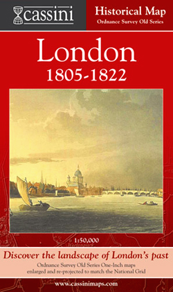
- London 1805-1822
- London in 1805-1822 in the Cassini Historical Series reproducing old Ordnance Survey mapping of England and Wales at 1:50,000. The four London maps cover roughly the area of the present day Greater London rather than following the format of rest of the series which is designed to correspond to the current Landranger maps. Mapping is identical... Lire la suite
Stanfords
United Kingdom
United Kingdom
- London West 1805-1920 (3-map set)
- Map No. 176, London West 1805-1920 (3-map set), in the Cassini Historical Series of old Ordnance Survey mapping of England and Wales at 1:50,000 in a format designed to offer a convenient comparison with the present day coverage from the OS, and most locations in three different editions. Old historical maps have been combined so that the sheet... Lire la suite
Stanfords
United Kingdom
United Kingdom
- London East 1805-1922 (3-map set)
- Map No. 177, London East 1805-1922 (3-map set), in the Cassini Historical Series of old Ordnance Survey mapping of England and Wales at 1:50,000 in a format designed to offer a convenient comparison with the present day coverage from the OS, and most locations in three different editions. Old historical maps have been combined so that the sheet... Lire la suite

Stanfords
United Kingdom
United Kingdom
- Luxembourg South
- One of two topographic survey maps of Luxembourg at 1:50,000, with contours at 10-metres intervals and additional relief shading. An overprint highlights long-distance footpaths, including the GR5 (E-2), cycle routes, and various places of interest, including campsites. The map covers an area of approximately 53 x 43 km / 33 x 27 miles. Map... Lire la suite
Stanfords
United Kingdom
United Kingdom
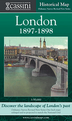
- London 1897-1898
- London in 1897-1898 in the Cassini Historical Series reproducing old Ordnance Survey mapping of England and Wales at 1:50,000. The four London maps cover roughly the area of the present day Greater London rather than following the format of rest of the series which is designed to correspond to the current Landranger maps. Mapping is identical... Lire la suite

Stanfords
United Kingdom
United Kingdom
- Sonoma Valley Biking and Hiking Trails
- Sonoma Valley on a contoured hiking and biking map from Map Adventures showing local conservations areas, detailed classification of recreational trails, wineries, etc. On one side a map at 1:30,000 covers the northern part of the valley along the Sonoma Highway from Glen Ellen to Santa Rosa, including the Taylor Mountain Regional Park, Annadel... Lire la suite

Stanfords
United Kingdom
United Kingdom
- England Coast Path Adventure Map - Minehead to Brean Down
- The A-Z Adventure Series of maps combines the best of OS and A-Z, creating the perfect companion for walkers, off-road cyclists, horse riders and anyone wishing to explore the great outdoors.This official Minehead to Brean Down Adventure Map covers a 58 mile (93km) section of the England Coast Path, a new National Trail around England`s coast.... Lire la suite

Stanfords
United Kingdom
United Kingdom
- Ontario MapArt Pocket Road Atlas
- Pocket road atlas of Ontario presenting the southern part of the province at 1:700,000 with the northern part at 1:1,500,000, plus enlargements showing in greater detail 25 municipal areas and downtown street plans for 21 locations, a map showing Highway Service Centres, etc..The atlas presents the southern part of the province at 1:700,000,... Lire la suite
Stanfords
United Kingdom
United Kingdom
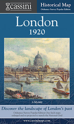
- London 1920
- London in 1920 in the Cassini Historical Series reproducing old Ordnance Survey mapping of England and Wales at 1:50,000. The four London maps cover roughly the area of the present day Greater London rather than following the format of rest of the series which is designed to correspond to the current Landranger maps. Mapping is identical to the... Lire la suite

Stanfords
United Kingdom
United Kingdom
- Cycle Tours Chilterns, Hertfordshire & Essex
- This spiral-bound guide describes 20 wonderful bike rides in the countryside to the north and west of London. The area offers some excellent and varied cycling: from the challenges of the steep wooded escarpment of the Chilterns in the west to the gentle gradients on networks of quiet lanes in Hertfordshire and north Essex. The book contains 15... Lire la suite