Stanfords
United Kingdom
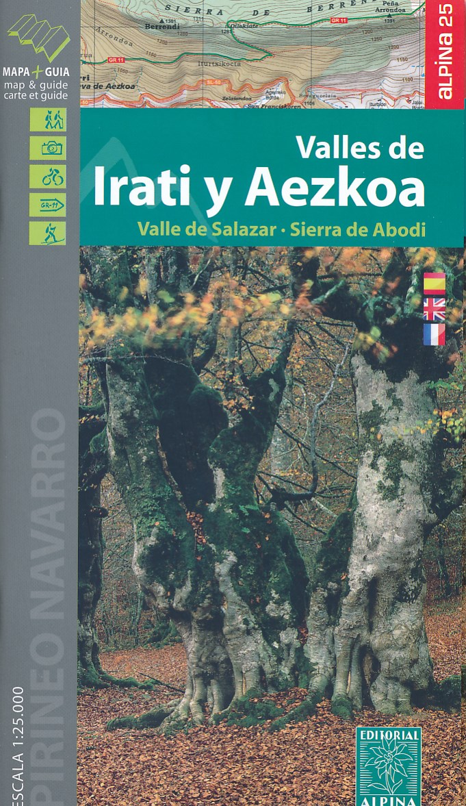
- Valles de Irati y Aezkoa Editorial Alpina
- Valles de Irati & Aezkoa in an extensive and very popular series of walking maps from Editorial Alpina covering the Pyrenees, Catalonia and other selected hiking areas in Spain, including Picos de Europa, Sierra Nevada and parts of Andalucía, Majorca, etc. Scales vary from 1:50,000 to 1:10,000, with the majority of the titles at 1:25,000. The... Lire la suite

Stanfords
United Kingdom

De Zwerver
Netherlands
- Wandelkaart 55 Montseny Parc Natural | Editorial Alpina
- Montseny in an extensive and very popular series of walking maps from Editorial Alpina covering the Pyrenees, Catalonia and other selected hiking areas in Spain, including Picos de Europa, Sierra Nevada and parts of Andalucía, Majorca, etc. Scales vary from 1:50,000 to 1:10,000, with the majority of the titles at 1:25,000. The maps have... Lire la suite

Stanfords
United Kingdom
- Muntanya d’Alinyà Editorial Alpina
- Muntanya d’Alinyà, including Serra d’Aubenç and Serra de Turp, in an extensive and very popular series of walking maps from Editorial Alpina covering the Pyrenees, Catalonia and other selected hiking areas in Spain, including Picos de Europa, Sierra Nevada and parts of Andalucía, Majorca, etc. Scales vary from 1:50,000 to 1:10,000, with the... Lire la suite

Stanfords
United Kingdom
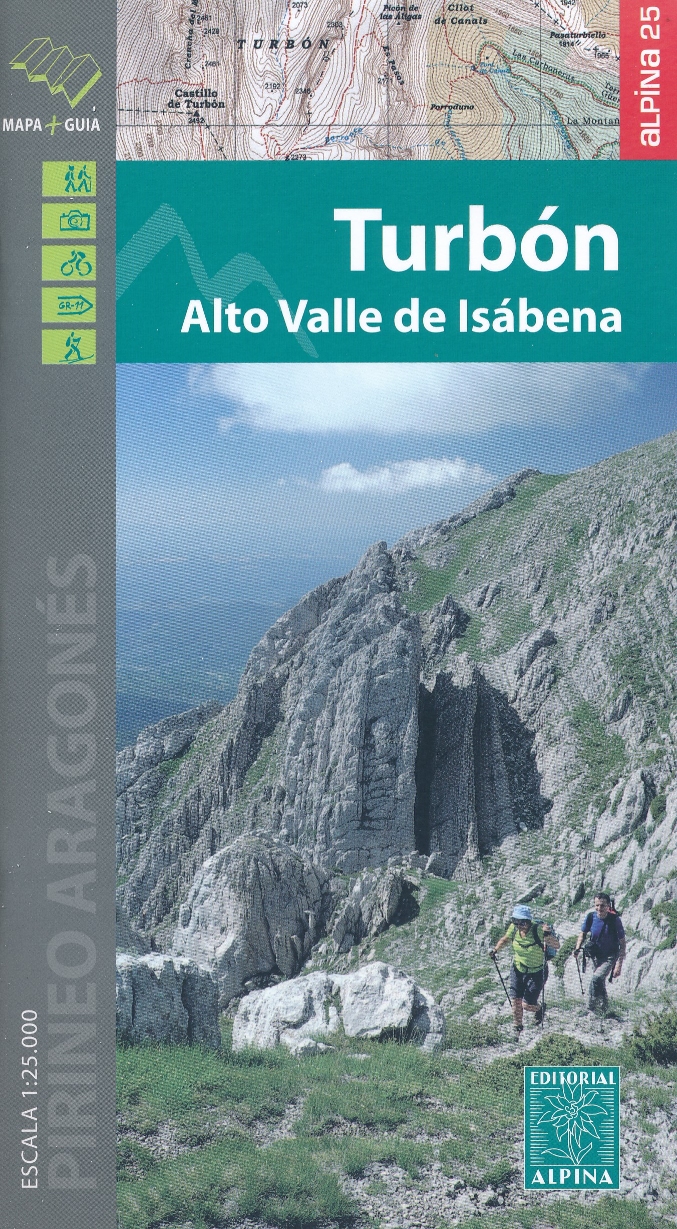
- El Turbón – Alto Valle de Isábena Editorial Alpina
- El Turbón - Alto Valle de Isábena in an extensive and very popular series of walking maps from Editorial Alpina covering the Pyrenees, Catalonia and other selected hiking areas in Spain, including Picos de Europa, Sierra Nevada and parts of Andalucía, Majorca, etc. Scales vary from 1:50,000 to 1:10,000, with the majority of the titles at... Lire la suite
Stanfords
United Kingdom
- Bachimala - Valles de Chistau y Bielsa Editorial Alpina
- Bachimala area of the High Pyrenees in Spain on a contoured and GPS compatible map at 1:25,000 from Editorial Alpina, with a booklet including English language descriptions of recommended walks, extensive accommodation list, etc. With the peak of Gran Bachimala towards the north-eastern corner of the map, coverage extends west to Bielsa and... Lire la suite

Stanfords
United Kingdom
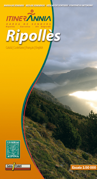
- Ripollès Editorial Alpina
- Ripollès in an extensive and very popular series of walking maps from Editorial Alpina covering the Pyrenees, Catalonia and other selected hiking areas in Spain, including Picos de Europa, Sierra Nevada and parts of Andalucía, Majorca, etc. Scales vary from 1:50,000 to 1:10,000, with the majority of the titles at 1:25,000. The maps have... Lire la suite
De Zwerver
Netherlands
- Wandelkaart Ripolles | Editorial Alpina
- Zeer gedetailleerde wandelkaart van een klein deel van de Spaanse Pyreneeen. Met ingetekende wandelroutes en andere informatie. Uitstekende kaart. Met symbolen voor campings, hutten. Op de topografische wandelkaart worden o.a. berghutten, campings aangeduid en hoogtelijnen, ingetekende wandelroutes en de GR paden (doorgaande... Lire la suite

Stanfords
United Kingdom
- Montaña Palentina y Sur de la Liébana CNIG
- Montaña Palentina, just south-east of the Picos de Europa, on a contoured and GPS compatible map at 1:50,000 from IGN/CNIG with cartography from their topographic survey of Spain. The map has contours at 20m intervals enhanced by bold relief shading, plus colouring and graphics to show different types of vegetation. Mountain refuges are... Lire la suite

Stanfords
United Kingdom

Stanfords
United Kingdom
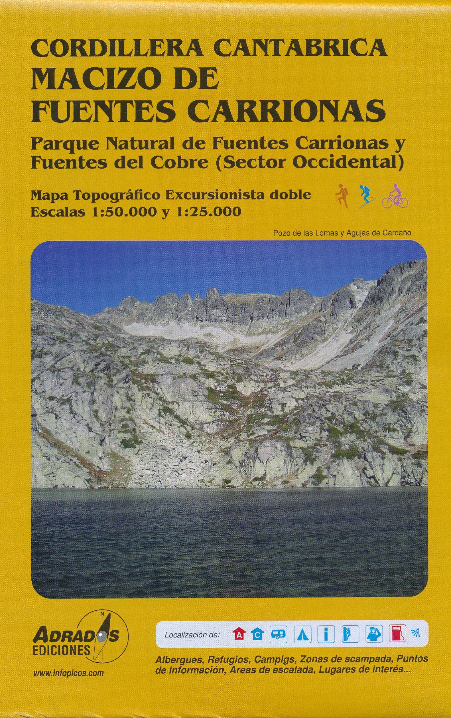
- Fuentes Carrionas Massif Adrados Map PAPER
- Fuentes Carrionas Massif, just south of the Picos de Europa, on a detailed hiking map from Adrados Ediciones combining coverage at 1:50,000 of the western part of Fuentes Carrionas and Fuentes del Cobre Natural Park with more detailed mapping at 1:25,000 of Peña Prieta Massif.The main map at 1:50,000 has contours at 20m intervals with bold... Lire la suite

Stanfords
United Kingdom
- Landscapes along the River Ter Ed. Alpina 40K Map
- Landscapes along the River Ter map in an extensive and very popular series of walking maps from Editorial Alpina covering the Pyrenees, Catalonia and other selected hiking areas in Spain, including Picos de Europa, Sierra Nevada and parts of Andalucía, Majorca, etc. Scales vary from 1:50,000 to 1:10,000, with the majority of the titles at... Lire la suite

Stanfords
United Kingdom
- Valles de Belagua y Roncal Editorial Alpina
- Valles de Belagua & Roncal in an extensive and very popular series of walking maps from Editorial Alpina covering the Pyrenees, Catalonia and other selected hiking areas in Spain, including Picos de Europa, Sierra Nevada and parts of Andalucía, Majorca, etc. Scales vary from 1:50,000 to 1:10,000, with the majority of the titles at 1:25,000. The... Lire la suite

Stanfords
United Kingdom
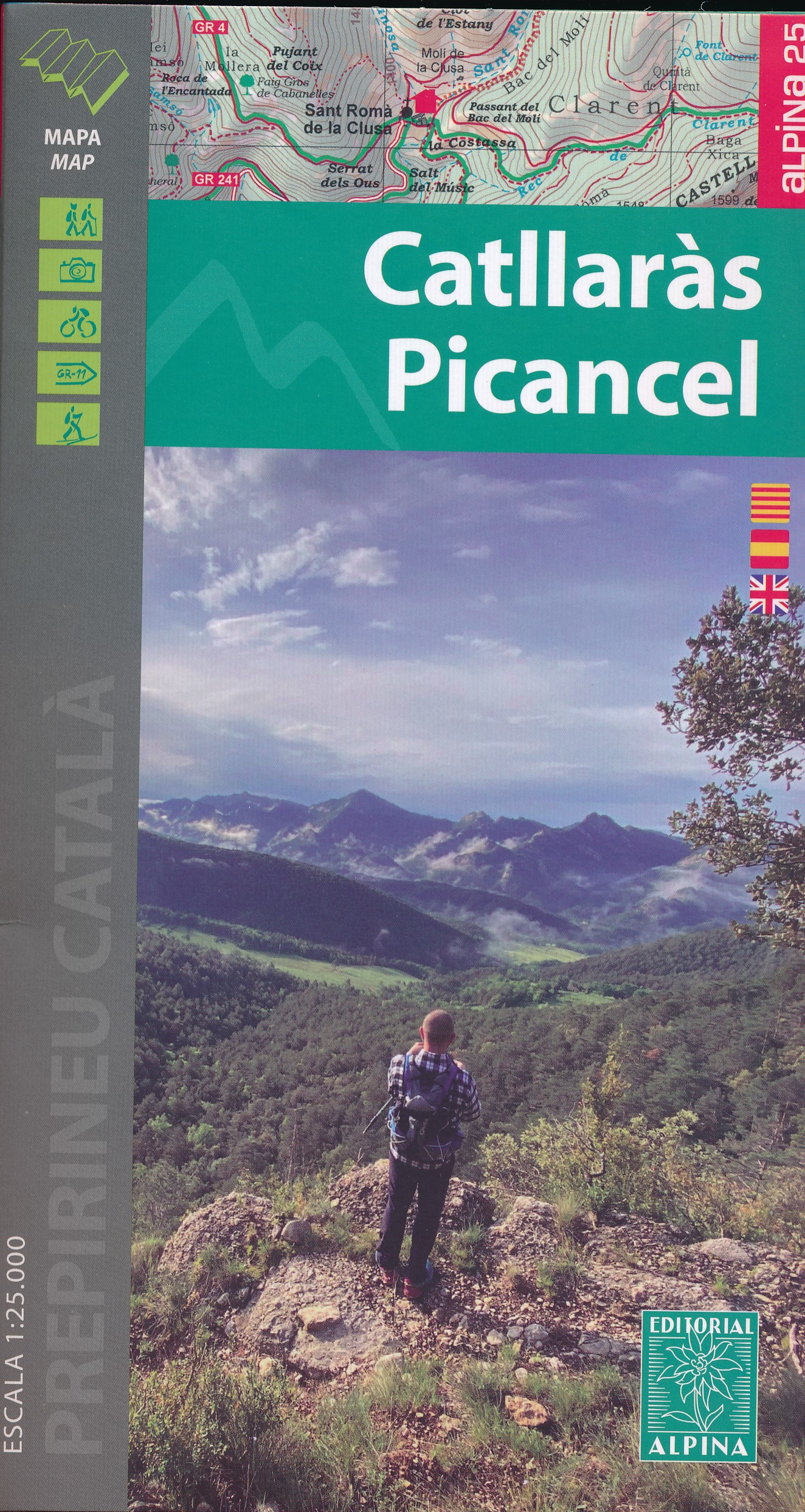
- Catllaràs - Picancel Editorial Alpina
- Catllaràs Picancel in an extensive and very popular series of walking maps from Editorial Alpina covering the Pyrenees, Catalonia and other selected hiking areas in Spain, including Picos de Europa, Sierra Nevada and parts of Andalucía, Majorca, etc. Scales vary from 1:50,000 to 1:10,000, with the majority of the titles at 1:25,000. The maps... Lire la suite
De Zwerver
Netherlands
- Wandelkaart 39 Catllaràs Picancel | Editorial Alpina
- Catllaràs Picancel in an extensive and very popular series of walking maps from Editorial Alpina covering the Pyrenees, Catalonia and other selected hiking areas in Spain, including Picos de Europa, Sierra Nevada and parts of Andalucía, Majorca, etc. Scales vary from 1:50,000 to 1:10,000, with the majority of the titles at 1:25,000. The maps... Lire la suite

Stanfords
United Kingdom
- Picos de Europa National Park - Anillo de Picos Adrados Map
- Picos de Europa National Park at 1:50,000 on an excellent, contoured and GPS compatible map from Adrados Ediciones highlighting three hiking routes which can be combined into a Tour of the Picos, plus English language descriptions of the routes and lists of mountain huts and refuges.The map covers the whole of the National Park area and extends... Lire la suite

Stanfords
United Kingdom
- Vall de Barravés - Ribagorça Editorial Alpina
- Val de Barravés - Ribagorça at 1:25,000 in an extensive and very popular series of walking maps from Editorial Alpina covering the Pyrenees, Catalonia and other selected hiking areas in Spain, including Picos de Europa, Sierra Nevada and parts of Andalucía, Majorca, etc.Scales of maps in this series vary from 1:50,000 to 1:10,000, with the... Lire la suite

Stanfords
United Kingdom
- Picos de Europa National Park CNIG 3-Map/Guide Set SPANISH
- Picos de Europa - English edition, on a set of three double-sided, contoured and GPS-compatible maps at 1:25,000 from the Spanish civilian survey organization, prominently highlighting numerous hiking and sightseeing routes, plus a 240-page English language guide with route descriptions, etc.The maps have cartography of Spain’s civilian... Lire la suite