
Stanfords
United Kingdom

Stanfords
United Kingdom
- Zell am See - Kaprun - Saalbach F&B WK382
- Zell-am-See - Kaprun - Saalbach area of the Austrian Alps presented at 1:50,000 in a series of contoured and GPS compatible outdoor leisure map from Freytag & Berndt with hiking and cycling routes, mountain huts, campsites and youth hostels, local bus stops, plus other tourist information. To see the list of currently available titles in this... Lire la suite

Stanfords
United Kingdom
- Achensee - Rofan - Unterinntal F&B WK321
- Achensee - Rofan - Unterinntal area of the Austrian Alps north-east of Innsbruck presented at 1:50,000 in a series of contoured and GPS compatible outdoor leisure map from Freytag & Berndt with hiking and cycling routes, mountain huts, campsites and youth hostels, local bus stops, plus other tourist information. To see the list of currently... Lire la suite

Stanfords
United Kingdom
- Goms - Aletsch
- Goms - Aletsch area of the Bernese Oberland at 1:50,000 in a series from Hallwag covering Switzerland’s popular hiking regions on light, waterproof and tear-resistant maps highlighting long-distance paths: the nine national routes plus special regional routes, as well as other local hiking trails.Cartography is similar to that used both in... Lire la suite

Stanfords
United Kingdom
- Styrian Winelands - Southwest Styria F&B WK411
- Styrian Winelands area south-eastern Austria presented at 1:50,000 in a series of contoured and GPS compatible outdoor leisure map from Freytag & Berndt with hiking and cycling routes, mountain huts, campsites and youth hostels, local bus stops, plus other tourist information. To see the list of currently available titles in this series please... Lire la suite
Stanfords
United Kingdom
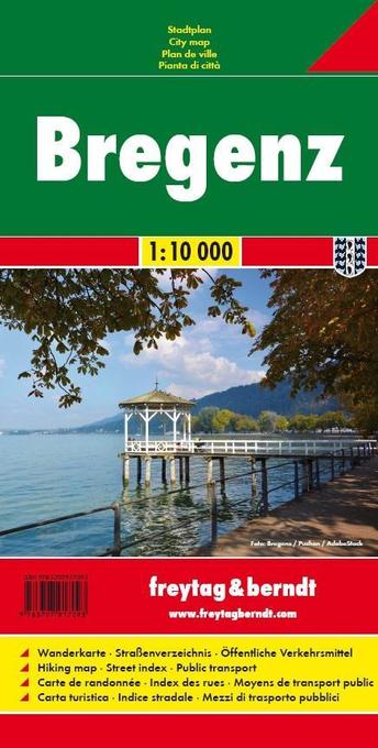
- Bregenz F&B
- Indexed street plan of Bregenz extending north along the Bodensee coast to Lochau and Unter Hochsteg. Detail includes pedestrianised areas, railways, bus routes and cycle paths. Notable buildings are highlighted in red, and symbols indicate post offices, hostels, campsites and car parks.On the reverse is a 1:50,000 contoured map of the... Lire la suite

Stanfords
United Kingdom
- Defereggental - Villgratental Kompass 45
- Defereggental - Lasörlinggruppe (No. 45), a detailed, GPS compatible map at 1:50,000 from Kompass with local and long-distance footpaths, cycling routes, accommodation, etc, printed on durable, waterproof and tear-resistant synthetic paper. This title has on the reverse an additional panorama map of the region.KOMPASS HIKING & RECREATIONAL... Lire la suite

Stanfords
United Kingdom
- Hungarian National Long-distance Blue Trail (E4): Visegrad to Irott-ko
- Hiking guide to the north-western section of Hungary’s National Blue Trail which forms part of the E4 European long-distance footpath. The guide covers the route from the historic town of Visegrád on the Danube, across the Buda Hills on the outskirts of Budapest and the Bakony Hills along the north-eastern shore of Lake Balaton, to Írott-ko in... Lire la suite
Stanfords
United Kingdom
- Adelboden - Lenk
- Adelboden - Lenk area of the western Bernese Oberland, from Gstaad to Frutigen and Leukerbad at 1:50,000 in a series from Hallwag covering Switzerland’s popular hiking regions on light, waterproof and tear-resistant maps highlighting long-distance paths: the nine national routes plus special regional routes, as well as other local hiking... Lire la suite

Stanfords
United Kingdom
- Vorderes Zillertal - Achensee - Alpbachtal - Wildschonau Kompass 28
- Vorderes Zillertal - Alpbach - Rofan - Wildschönau (No. 28), a detailed, GPS compatible map at 1:50,000 from Kompass with local and long-distance footpaths, cycling routes, accommodation, etc, printed on durable, waterproof and tear-resistant synthetic paper. This title has on the reverse an additional panorama map of the region. KOMPASS HIKING... Lire la suite
Stanfords
United Kingdom
- Zillertal Alps - Tux Alps Kompass 37
- Zillertal Alps - Mayrhofen - Zell am Ziller - Tuxer Voralpen (No. 37), a detailed, GPS compatible map at 1:50,000 from Kompass with local and long-distance footpaths, cycling routes, accommodation, etc, printed on durable, waterproof and tear-resistant synthetic paper. KOMPASS HIKING & RECREATIONAL MAPS:This title is part of an extensive series... Lire la suite

Stanfords
United Kingdom
- Val Brembana - Valsassina - Le Grigne: Lecco - Bergamo 50K IGC Map No. 22
- Val Brembana - Valsassina - Le Grigne area including Lecco and Bergamo in a series contoured hiking maps at 1:50,000 with local trails, long-distance footpaths, mountain accommodation, etc. from the Turin based Istituto Geografico Centrale.Maps in this series have contours at 50m intervals, enhanced by shading and graphic relief. An overprint... Lire la suite

Stanfords
United Kingdom
- Val Venosta / Vinschgau K+F Outdoor Map 1
- Val Venosta / Vinschgau area in the Dolomites at 1:50,000 in a series of waterproof and tear-resistant, GPS compatible and contoured recreational maps from Kümmerly + Frey with both local and long-distance hiking and cycling trails, ski routes, sites for other outdoor pursuits, accommodation, bus stops, etc. Coverage includes the Ortles/Ortler... Lire la suite
Stanfords
United Kingdom
- Haslital: Grindelwald - Engelberg 50K Hallwag Outdoor Map No. 5
- Haslital area, from Grindelwald to Engelberg, at 1:50,000 in a series from Hallwag covering Switzerland’s popular hiking regions on light, waterproof and tear-resistant maps highlighting long-distance paths: the nine national routes plus special regional routes, as well as other local hiking trails.Cartography is similar to that used both in... Lire la suite

Stanfords
United Kingdom
- Olympus Geopsis 139
- Mt Olympus in a series of waterproof and tear-resistant hiking maps at scales varying from 1:50,000 to 1:10,000, with a UTM grid for GPS users. Contour interval varies depending on the scale, on most maps it is 20m. Relief shading, spot heights, springs, seasonal streams and, in most titles, landscape/land-use variations, e.g. forests,... Lire la suite