
New Jersey
Description
New Jersey borders on the Atlantic. This state is very populated. Hiking is best in the mountainous northern part, with several state parks and forests. Here are 72 miles of the Appalachian Trail.
The Highlands Trail is supposed to connect New Jersey to New York, Pennsylvania and Connecticut, 150 miles.
Another important trail is the Long Path, 326 miles, also in the state of New York.
The Great Eastern Trail, East Coast Greenway and Eastern Continental Trail run through New Jersey.
Carte

Sentiers de cette état
Liens
Données
Rapports
Guides et cartes
Hébergement
Organisations
Voyagistes
GPS
Autre
Livres

Stanfords
United Kingdom
2015
United Kingdom
2015
- Paxos: Car Tours and Walks
- Paxos is the Sunflower Landscapes guide to exploring the best walking and touring possibilities on the island. The guide covers a range of routes including walks in Gaios, Bogdanatika, Loggos, Lakka and Antixpaxos. A double-sided, fold-out touring map at the back of the book gives an overview of the island and the location of each walk.... Lire la suite

Stanfords
United Kingdom
United Kingdom
- Rick Steves Mediterranean Cruise Ports (Fifth Edition)
- Set sail and dive into Europe`s magnificent port cities with Rick Steves Mediterranean Cruise Ports! Inside you`ll find:*Rick`s expert advice on making the most of your time on a cruise and experiencing each city, with thorough coverage of 23 ports of call*Practical travel strategies including how to choose and book your cruise, adjusting to... Lire la suite

Stanfords
United Kingdom
2019
United Kingdom
2019
- DK Eyewitness Travel Guide Poland
- Discover Poland with this essential travel guide, designed to help you create your own unique trip and to transport you to this beautiful country before you`ve even packed your case - step back in time in Torun, Lublin, Krakow and Gdansk, explore the tranquil Mazurian Lakes, tuck into barszcz beetroot soup, or take in some folk music. The DK... Lire la suite

Stanfords
United Kingdom
United Kingdom
- Tenerife 8/2012 – REMOVED FROM WEBSITE BECAUSE OF DISTRIBUTION PROBLEMS
- About this series:Landmark Visitors Guides present the reader with a detailed, wide-ranging, and easy-to-read overview of an area, making them not only useful guides while on a trip, but also an ideal way to get acquainted with an area before you go.Each guide offers a wide array of information on history & culture, local colour & character,... Lire la suite

Stanfords
United Kingdom
United Kingdom
- DK Eyewitness Travel Guide New York City
- Whether you want to visit the iconic Empire State Building, take a leisurely stroll through Central Park, or sample the sublime cocktails in East Village, your DK Eyewitness travel guide makes sure you experience all that New York City has to offer.Dynamic and diverse, New York City is bursting at the seams with unmissable sights,... Lire la suite

Stanfords
United Kingdom
United Kingdom
- Fodor`s Inside Lisbon
- Hip, innovative, and affordable, Lisbon is a hub for cosmopolitan, design-minded makers and shakers, who are breathing new life into the Portugal`s food, nightlife, and arts scenes. Fodor`s brand-new guidebook, Inside Lisbon, touches on top tourist sights, including Tram 28, St. George`s Castle, and Jeronimos Monastery, but also delves deep... Lire la suite
Stanfords
United Kingdom
United Kingdom
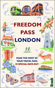
- Freedom Pass London
- Since its creation over 40 years ago, London`s Freedom Pass concessionary travel scheme has continued to grow in popularity and there are now over 1 million registered holders. Whether a fruit picker or forager, a rambler or angler, or simply someone who enjoys the quirky charm of a local pub, Bradt`s new Freedom Pass is the perfect read to... Lire la suite
Stanfords
United Kingdom
United Kingdom
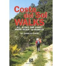
- Costa Del Sol Walks
- Full-color guide to thirty-four walks all within a short distance from the coast, from Nerja to Manilva. With easy-to-follow route notes, full-color maps and clear instructions on how to get to the start of each walk. Lire la suite

Stanfords
United Kingdom
United Kingdom
- DK Eyewitness California
- Dreamin` of California?Whether you want to hike to the waterfalls in Yosemite National Park, tour a winery in Napa or ride a classic cable car in San Francisco, your DK Eyewitness travel guide makes sure you experience all that California has to offer.California`s dramatic landscape has inspired generations of artists and explorers - from... Lire la suite

Stanfords
United Kingdom
United Kingdom
- DK Eyewitness Budapest
- Your journey starts here. Featuring DK`s much-loved maps and illustrations, walks and information, plus all new, full-colour photography, this 100% updated guide to Budapest brings you the best of this vibrant and historic city in a brand-new, lightweight format.What`s inside?- full-colour photography, hand-drawn illustrations, and maps... Lire la suite

Stanfords
United Kingdom
United Kingdom
- DK Eyewitness Switzerland
- Discover Switzerland - a country small in size, but big on experience.Whether you want to hit the slopes, join the Swiss in their national pastime of hut-to-hut hiking, or take a scenic railway journey to remember, your DK Eyewitness travel guide makes sure you experience all that Switzerland has to offer.Full of magical sights and exhilarating... Lire la suite

Stanfords
United Kingdom
2015
United Kingdom
2015
- Azores: Car Tours and Walks
- The Azores in the Sunflower Landscapes guide series; exploring the best walking and touring possibilities in the region or area. Detailed information about touring by hired car or public transport, as well as on foot, is provided, helping walkers to navigate and plan day-trips. Shorter strolls are also included as an alternative for each main... Lire la suite

Stanfords
United Kingdom
United Kingdom
- DK Eyewitness Barcelona and Catalonia
- Discover unique architecture, diverse landscapes and a centuries-old culture.Whether you want to enjoy Costa Brava`s laidback lifestyle, marvel at the iconic Sagrada Familia or hike the undulating landscape of long-extinct volcanoes, your DK Eyewitness travel guide makes sure you experience all that Barecelona and Catalonia have to offer.From... Lire la suite

Stanfords
United Kingdom
United Kingdom
- Insight Guides Explore New York
- From making sure you don`t miss out on must-see attractions like Times Square, Brooklyn Bridge, Empire State Building, Central Park and Statue of Liberty, to discovering hidden gems, including Greenwich Village, the easy-to-follow, ready-made walking routes will save you time, help you plan and enhance your visit to New York.Practical,... Lire la suite

Stanfords
United Kingdom
United Kingdom
- Walking The Invisible: Following in the Brontës` Footsteps
- Michael Stewart has been captivated by the Brontës since he was a child, and has travelled all over the north of England in search of their lives and landscapes. Now, he`d like to invite you into the world as they would have seen it. Following in the footsteps of the Brontës across meadow and moor, through village and town,... Lire la suite
Cartes

Stanfords
United Kingdom
United Kingdom
- Cycling the Canal de la Garonne: From Bordeaux to Toulouse
- This guidebook presents a cycle ride along the Canal de la Garonne in the south of France. The 290km route is covered in 7 stages from bustling Bordeaux to the splendid rose city of Toulouse, with a 135km excursion from to Lacanau on the Atlantic coast. Optional side trips explore the countryside and historical towns and villages, including... Lire la suite

Stanfords
United Kingdom
United Kingdom
- Khiratadi (114) (2980 08)
- Khiratadi, sheet no. 2980-08, in the topographic survey of Nepal at 1:50,000 published by the Nepali Government in the late 1990s and early 2000s and produced from remote sensing data by Finnish cartographers as part of that country’s international aid program. The maps cover 15’ x 15’ quadrangles.IMPORTANT – PLEASE NOTE BEFORE ORDERING:... Lire la suite

Stanfords
United Kingdom
United Kingdom
- Barcelona High 5 Edition Street Plan
- The first water-resistant “Comfort Map“ with direct access to useful additional information from the InternetBarcelona in a scale of 1:20,000 including detailed presentation of the old town in a scale of 1:11,000 presented on a practical map; inclusive of the High 5 Edition app technology for calling up additional travel information and many... Lire la suite
Stanfords
United Kingdom
United Kingdom
- Martadi
- Martadi, sheet no. 2981-10, in the topographic survey of Nepal at 1:50,000 published by the Nepali Government in the late 1990s and early 2000s and produced from remote sensing data by Finnish cartographers as part of that country’s international aid program. The maps cover 15’ x 15’ quadrangles.IMPORTANT – PLEASE NOTE BEFORE ORDERING:... Lire la suite
Stanfords
United Kingdom
United Kingdom
- Lapchegau
- Lapchgau, sheet no. 2886-13, in the topographic survey of Nepal at 1:50,000 published by the Nepali Government in the late 1990s and early 2000s and produced from remote sensing data by Finnish cartographers as part of that country’s international aid program. The maps cover 15’ x 15’ quadrangles.IMPORTANT – PLEASE NOTE BEFORE ORDERING:... Lire la suite
Stanfords
United Kingdom
United Kingdom
- Bahundada
- Bahundada, sheet no. 2884-10, in the topographic survey of Nepal at 1:50,000 published by the Nepali Government in the late 1990s and early 2000s and produced from remote sensing data by Finnish cartographers as part of that country’s international aid program. The maps cover 15’ x 15’ quadrangles.IMPORTANT – PLEASE NOTE BEFORE ORDERING:... Lire la suite
Stanfords
United Kingdom
United Kingdom
- Nepal Survey 1:25,000 Sheet 2883 11D (Patichaur)
- Koban, sheet no. 2883-07, in the topographic survey of Nepal at 1:50,000 published by the Nepali Government in the late 1990s and early 2000s and produced from remote sensing data by Finnish cartographers as part of that country’s international aid program. The maps cover 15’ x 15’ quadrangles.IMPORTANT – PLEASE NOTE BEFORE ORDERING:... Lire la suite
Stanfords
United Kingdom
United Kingdom
- Jomson
- Jomson, sheet no. 2883-03, in the topographic survey of Nepal at 1:50,000 published by the Nepali Government in the late 1990s and early 2000s and produced from remote sensing data by Finnish cartographers as part of that country’s international aid program. The maps cover 15’ x 15’ quadrangles.IMPORTANT – PLEASE NOTE BEFORE ORDERING:... Lire la suite
Stanfords
United Kingdom
United Kingdom
- Salpa Bhanjyang - Baksila
- Salpa Bhanjyang - Baksila, sheet no. 2786-12, in the topographic survey of Nepal at 1:50,000 published by the Nepali Government in the late 1990s and early 2000s and produced from remote sensing data by Finnish cartographers as part of that country’s international aid program. The maps cover 15’ x 15’ quadrangles.IMPORTANT – PLEASE NOTE BEFORE... Lire la suite
Stanfords
United Kingdom
United Kingdom
- Gurjakhani
- Gurjakhani, sheet no. 2883-05, in the topographic survey of Nepal at 1:50,000 published by the Nepali Government in the late 1990s and early 2000s and produced from remote sensing data by Finnish cartographers as part of that country’s international aid program. The maps cover 15’ x 15’ quadrangles.IMPORTANT – PLEASE NOTE BEFORE ORDERING:... Lire la suite
Stanfords
United Kingdom
United Kingdom
- Lantan (2885 15)
- Upper Langtang Valley, sheet no. 2885-15, in the topographic survey of Nepal at 1:50,000 published by the Nepali Government in the late 1990s and early 2000s and produced from remote sensing data by Finnish cartographers as part of that country’s international aid program. The maps cover 15’ x 15’ quadrangles.IMPORTANT – PLEASE NOTE BEFORE... Lire la suite
Stanfords
United Kingdom
United Kingdom
- Dhime
- Dhime, sheet no. 2882-01, in the topographic survey of Nepal at 1:50,000 published by the Nepali Government in the late 1990s and early 2000s and produced from remote sensing data by Finnish cartographers as part of that country’s international aid program. The maps cover 15’ x 15’ quadrangles.IMPORTANT – PLEASE NOTE BEFORE ORDERING:... Lire la suite
Stanfords
United Kingdom
United Kingdom
- Arughat
- Arughat, sheet no. 2884-16, in the topographic survey of Nepal at 1:50,000 published by the Nepali Government in the late 1990s and early 2000s and produced from remote sensing data by Finnish cartographers as part of that country’s international aid program. The maps cover 15’ x 15’ quadrangles.IMPORTANT – PLEASE NOTE BEFORE ORDERING:... Lire la suite

Stanfords
United Kingdom
United Kingdom
- World Maps International Political Wall Map MEDIUM MAGNETIC-BOARD FRAMED with flags
- Framed, 103 x 72cm (3ft 4’’ x 2ft 4’’ approx.) version of the medium size political map of the world from Maps International mounted on *magnetic board* to which magnetic makers can be attached. Countries are shown in bright vivid colours against light blue oceans. Country names are in large, clearly legible print. English versions of all city... Lire la suite
Stanfords
United Kingdom
United Kingdom
- Khalanga Baja (Darchula)
- Khalanga Baja (Darchula), sheet no. 2980-03 / 3080-15, in the topographic survey of Nepal at 1:50,000 published by the Nepali Government in the late 1990s and early 2000s and produced from remote sensing data by Finnish cartographers as part of that country’s international aid program. The maps cover 15’ x 15’ quadrangles.IMPORTANT – PLEASE... Lire la suite