
Georgia
Description
The north of Georgia is mountainous. The Appalachian Trail starts here. Also, the Benton Mackaye Trail has 75 miles in the Chattahooche National Forest in the north, before it enters the state of Tennessee.
Georgia shares the 250 mile Pinhote Trail with Alabama.
Three long distance trails (will) run through Georgia. The Eastern Continental Trail, The East Coast Greenway and the Great Eastern Trail.
Carte

Sentiers de cette état
Liens
Données
Rapports
Guides et cartes
Hébergement
Organisations
Voyagistes
GPS
Autre
Livres

Stanfords
United Kingdom
United Kingdom
- The Brooklyn Nobody Knows: An Urban Walking Guide
- Bill Helmreich walked every block of New York City--6,000 miles in all--to write the award-winning `The New York Nobody Knows`. Now he has re-walked Brooklyn--some 816 miles--to write this one-of-a-kind walking guide to the city`s hottest borough. Drawing on hundreds of conversations he had with residents during his block-by-block journeys,... Lire la suite

Stanfords
United Kingdom
United Kingdom
- DK Eyewitness Budapest
- Your journey starts here. Featuring DK`s much-loved maps and illustrations, walks and information, plus all new, full-colour photography, this 100% updated guide to Budapest brings you the best of this vibrant and historic city in a brand-new, lightweight format.What`s inside?- full-colour photography, hand-drawn illustrations, and maps... Lire la suite
Stanfords
United Kingdom
United Kingdom
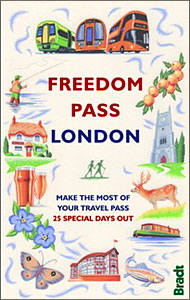
- Freedom Pass London
- Since its creation over 40 years ago, London`s Freedom Pass concessionary travel scheme has continued to grow in popularity and there are now over 1 million registered holders. Whether a fruit picker or forager, a rambler or angler, or simply someone who enjoys the quirky charm of a local pub, Bradt`s new Freedom Pass is the perfect read to... Lire la suite

Stanfords
United Kingdom
United Kingdom
- DK Eyewitness Naples and the Amalfi Coast
- Discover a city that has stood the test of time.Whether you want to immerse yourself in the past at Pompeii and Herculaneum, relax with an alfresco drink by the turquoise waters of Capri or take a dip in Ischia`s thermal spas, your DK Eyewitness travel guide makes sure you experience all that Naples and the Amalfi Coast have to offer.One of the... Lire la suite

Stanfords
United Kingdom
United Kingdom
- Shadowplay - Longlisted for the 2020 Walter Scott Prize for Historical Ficiton
- Longlisted for the 2020 Walter Scott Prize for Historical FictionShortlisted for the Costa Novel Award 2019Winner of the Irish Book Awards Novel of the Year”Breathtaking... A hugely entertaining book about the grand scope of friendship and love” GuardianLondon, 1878. Fresh from life in Dublin, Bram Stoker – now manager of the Lyceum Theatre –... Lire la suite
Stanfords
United Kingdom
United Kingdom
- New York`s 50 best places to take tea
- Taking tea is a convivial activity--a perfect way for friends to get together--and yet the ritual is also contemplative. Simultaneously stimulating and soothing, tea relaxes the body and rejuvenates the soul. In New York City, the venues for taking tea are as varied as the delights of the brew itself. Completely revised and updated for its new... Lire la suite

Stanfords
United Kingdom
United Kingdom
- DK Eyewitness Travel Guide New York City
- Whether you want to visit the iconic Empire State Building, take a leisurely stroll through Central Park, or sample the sublime cocktails in East Village, your DK Eyewitness travel guide makes sure you experience all that New York City has to offer.Dynamic and diverse, New York City is bursting at the seams with unmissable sights,... Lire la suite

Stanfords
United Kingdom
2015
United Kingdom
2015
- Azores: Car Tours and Walks
- The Azores in the Sunflower Landscapes guide series; exploring the best walking and touring possibilities in the region or area. Detailed information about touring by hired car or public transport, as well as on foot, is provided, helping walkers to navigate and plan day-trips. Shorter strolls are also included as an alternative for each main... Lire la suite

Stanfords
United Kingdom
United Kingdom
- Frommer`s New Orleans Day by Day
- Packed with color photos, this bestselling guide offers itineraries that show you how to see the best of the New Orleans in a short time--with bulleted maps that lead the way from sight to sight. Featuring a full range of area and thematic tours, plus dining, lodging, shopping, nightlife, and practical visitor info, Frommer`s New Orleans day by... Lire la suite

Stanfords
United Kingdom
United Kingdom
- Fuerteventura
- Fuerteventura in the Sunflower Landscapes guide series; exploring the best walking and touring possibilities in the region or area. Detailed information about touring by hired car or public transport, as well as on foot is provided, helping walkers to navigate and plan day-trips. Shorter strolls are also included as an alternative for each main... Lire la suite

Stanfords
United Kingdom
2015
United Kingdom
2015
- Paxos: Car Tours and Walks
- Paxos is the Sunflower Landscapes guide to exploring the best walking and touring possibilities on the island. The guide covers a range of routes including walks in Gaios, Bogdanatika, Loggos, Lakka and Antixpaxos. A double-sided, fold-out touring map at the back of the book gives an overview of the island and the location of each walk.... Lire la suite

Stanfords
United Kingdom
United Kingdom
- A Horse Walks into a Bar
- The setting is a comedy club in a small Israeli town. An audience that has come expecting an evening of amusement instead sees a comedian falling apart on stage; an act of disintegration, a man crumbling, as a matter of choice, before their eyes. They could get up and leave, or boo and whistle and drive him from the stage, if they were not so... Lire la suite

Stanfords
United Kingdom
United Kingdom
- DK Eyewitness Sardinia 14/5/20
- An atmospheric island bursting with history, culture and natural beauty.Whether you want to hike across rugged mountains, spot flamingoes near Cagliari or simply sip a glass of Cannonau overlooking the sparkling turquoise waters of the mediterranean, your DK Eyewitness travel guide makes sure you experience all that Sardinia has to offer.... Lire la suite

Stanfords
United Kingdom
United Kingdom
- Azores - 6th ed.
- The Azores in the Sunflower Landscapes guide series; exploring the best walking and touring possibilities in the region or area. Detailed information about touring by hired car or public transport, as well as on foot, is provided, helping walkers to navigate and plan day-trips. Shorter strolls are also included as an alternative for each main... Lire la suite

Stanfords
United Kingdom
United Kingdom
- DK Eyewitness Travel Guide: London
- The ideal travel companion, full of insider advice on what to see and do, plus detailed itineraries and comprehensive maps for exploring this historic city. This new edition comes complete with five exclusive audio walks to help you get the most from your trip.Explore London`s world-class museums, uncover the city`s history at Westminster Abbey... Lire la suite
Cartes

Stanfords
United Kingdom
United Kingdom
- Oni - Utsera Resort - Ghebi Resort Geoland 7
- Oni - Utsera Resort - Ghebi Resort area of the Caucasus Mountains in Georgia at 1:50,000 on a double-sided, contoured and GPS compatible map from Geoplan, with an overprint providing tourist information including local accommodation and sights.Maps in this series have contours at 20m intervals, with additional relief shading and numerous spot... Lire la suite

Stanfords
United Kingdom
United Kingdom
- Khiratadi (114) (2980 08)
- Khiratadi, sheet no. 2980-08, in the topographic survey of Nepal at 1:50,000 published by the Nepali Government in the late 1990s and early 2000s and produced from remote sensing data by Finnish cartographers as part of that country’s international aid program. The maps cover 15’ x 15’ quadrangles.IMPORTANT – PLEASE NOTE BEFORE ORDERING:... Lire la suite
Stanfords
United Kingdom
United Kingdom
- Mukot
- Mukot, sheet no. 2883-02, in the topographic survey of Nepal at 1:50,000 published by the Nepali Government in the late 1990s and early 2000s and produced from remote sensing data by Finnish cartographers as part of that country’s international aid program. The maps cover 15’ x 15’ quadrangles.IMPORTANT – PLEASE NOTE BEFORE ORDERING:... Lire la suite
Stanfords
United Kingdom
United Kingdom
- Mt. Everest (Sagarmatha) - Hinku Himal
- Mount Everesr (Sagarmatha) - Hinku Himal, sheet no. 2786-04, in the topographic survey of Nepal at 1:50,000 published by the Nepali Government in the late 1990s and early 2000s and produced from remote sensing data by Finnish cartographers as part of that country’s international aid program. The maps cover 15’ x 15’ quadrangles.IMPORTANT –... Lire la suite
Stanfords
United Kingdom
United Kingdom
- Sisne
- Sisne, sheet no. 2883-03, in the topographic survey of Nepal at 1:50,000 published by the Nepali Government in the late 1990s and early 2000s and produced from remote sensing data by Finnish cartographers as part of that country’s international aid program. The maps cover 15’ x 15’ quadrangles.IMPORTANT – PLEASE NOTE BEFORE ORDERING:... Lire la suite
Stanfords
United Kingdom
United Kingdom
- Barhabise
- Barhabise, sheet no. 2785-04, in the topographic survey of Nepal at 1:50,000 published by the Nepali Government in the late 1990s and early 2000s and produced from remote sensing data by Finnish cartographers as part of that country’s international aid program. The maps cover 15’ x 15’ quadrangles.IMPORTANT – PLEASE NOTE BEFORE ORDERING:... Lire la suite
Stanfords
United Kingdom
United Kingdom
- Kolti
- Kolti, sheet no. 2981-07 in the topographic survey of Nepal at 1:50,000 published by the Nepali Government in the late 1990s and early 2000s and produced from remote sensing data by Finnish cartographers as part of that country’s international aid program. The maps cover 15’ x 15’ quadrangles.IMPORTANT – PLEASE NOTE BEFORE ORDERING:... Lire la suite
Stanfords
United Kingdom
United Kingdom
- Topkegola
- Topkegola, sheet no. 2787-07, in the topographic survey of Nepal at 1:50,000 published by the Nepali Government in the late 1990s and early 2000s and produced from remote sensing data by Finnish cartographers as part of that country’s international aid program. The maps cover 15’ x 15’ quadrangles.IMPORTANT – PLEASE NOTE BEFORE ORDERING:... Lire la suite

Stanfords
United Kingdom
United Kingdom
- St Andrews Bay - Royal Bay, South Georgia BAS Geomorphology Map
- Geomorphology map of the St Andrews Bay - Royal Bay area of South Georgia at 1:50,000 from the British Antarctic Survey. BAS ref. for this title is BAS (Misc) 1. Thei is the folded version of this title which is also available flat.PLEASE NOTE: to see the list of other detailed topographic and specialist maps from BAS please click on the series... Lire la suite
Stanfords
United Kingdom
United Kingdom
- Samagau
- Samagau, sheet no. 2884-07, in the topographic survey of Nepal at 1:50,000 published by the Nepali Government in the late 1990s and early 2000s and produced from remote sensing data by Finnish cartographers as part of that country’s international aid program. The maps cover 15’ x 15’ quadrangles.IMPORTANT – PLEASE NOTE BEFORE ORDERING:... Lire la suite
Stanfords
United Kingdom
United Kingdom
- Panlham
- Panlham, sheet no. 2983-12, in the topographic survey of Nepal at 1:50,000 published by the Nepali Government in the late 1990s and early 2000s and produced from remote sensing data by Finnish cartographers as part of that country’s international aid program. The maps cover 15’ x 15’ quadrangles.IMPORTANT – PLEASE NOTE BEFORE ORDERING:... Lire la suite
Stanfords
United Kingdom
United Kingdom
- Ghunsa Khola - Olanchungola
- Ghunsa Khola - Olanchungola, sheet no. 2787-08, in the topographic survey of Nepal at 1:50,000 published by the Nepali Government in the late 1990s and early 2000s and produced from remote sensing data by Finnish cartographers as part of that country’s international aid program. The maps cover 15’ x 15’ quadrangles.IMPORTANT – PLEASE NOTE... Lire la suite
Stanfords
United Kingdom
United Kingdom
- Khalanga Baja (Darchula)
- Khalanga Baja (Darchula), sheet no. 2980-03 / 3080-15, in the topographic survey of Nepal at 1:50,000 published by the Nepali Government in the late 1990s and early 2000s and produced from remote sensing data by Finnish cartographers as part of that country’s international aid program. The maps cover 15’ x 15’ quadrangles.IMPORTANT – PLEASE... Lire la suite

Stanfords
United Kingdom
United Kingdom
- Busen Region - South Georgia BAS Wall Map
- South Georgia and its offshore islands in the South Atlantic presented by the British Antarctic Survey on a double-sided map combining topographic mapping of the whole island at 1:200,000 scale and detailed topographic mapping of the route of Shackleton’s crossing in May 1916 at 1:40,000 scale.On one side is a map presenting the topography by... Lire la suite
Stanfords
United Kingdom
United Kingdom
- Lamsun
- Lamsun, sheet no. 2883-06, in the topographic survey of Nepal at 1:50,000 published by the Nepali Government in the late 1990s and early 2000s and produced from remote sensing data by Finnish cartographers as part of that country’s international aid program. The maps cover 15’ x 15’ quadrangles.IMPORTANT – PLEASE NOTE BEFORE ORDERING:... Lire la suite