
Quantock Hills
Description
A range of hills in Somerset, southwestern England. There is open heathland as well as pasture, parkland and woods.
Sentiers de cette région
Liens
Données
Rapports
Guides et cartes
Hébergement
Organisations
Voyagistes
GPS
Autre
Livres

Stanfords
United Kingdom
United Kingdom
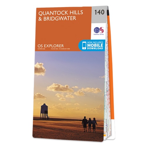
- Quantock Hills & Bridgwater OS Explorer Active Map 140 (waterproof)
- Quantock Hills & Bridgwater area on a detailed topographic and GPS compatible map No. 140, waterproof version, from the Ordnance Survey’s 1:25,000 Explorer series.MOBILE DOWNLOADS: this title and all the other OS Explorer maps include a code for downloading after purchase the digital version onto your smartphone or tablet for viewing on the OS... Lire la suite
- Also available from:
- The Book Depository, United Kingdom


Stanfords
United Kingdom
2017
United Kingdom
2017
- Quantock Hills & Bridgwater OS Explorer Map 140 (paper)
- Quantock Hills & Bridgwater area on a detailed topographic and GPS compatible map No. 140, paper version, from the Ordnance Survey’s 1:25,000 Explorer series. MOBILE DOWNLOADS: this title and all the other OS Explorer maps include a code for downloading after purchase the digital version onto your smartphone or tablet for viewing on the OS... Lire la suite
- Also available from:
- The Book Depository, United Kingdom
- De Zwerver, Netherlands

De Zwerver
Netherlands
2017
Netherlands
2017
Cartes

Stanfords
United Kingdom
United Kingdom
- Exmoor & Taunton Cycling Map 84
- Exmoor and Taunton area of Devon and Somerset at 1:100,000 on a handy size, 50x35cm, double-sided contoured map from Croydecycle, printed on waterproof and tear-resistant synthetic paper and showing National Cycle routes and numerous local facilities, including campsites, pubs, etc. Coverage extends from Combe Martin, Barnstaple and South... Lire la suite

Stanfords
United Kingdom
United Kingdom
- Minehead and Brendon Hills 1809
- Map No. 181, Minehead and Brendon Hills 1809, in the Cassini Historical Series of old Ordnance Survey mapping of England and Wales at 1:50,000 in a format designed to offer a convenient comparison with the present day coverage from the OS, and most locations in three different editions. Old historical maps have been combined so that the sheet... Lire la suite
Stanfords
United Kingdom
United Kingdom
- Minehead and Brendon Hills 1919
- Map No. 181, Minehead and Brendon Hills 1919, in the Cassini Historical Series of old Ordnance Survey mapping of England and Wales at 1:50,000 in a format designed to offer a convenient comparison with the present day coverage from the OS, and most locations in three different editions. Old historical maps have been combined so that the sheet... Lire la suite
Stanfords
United Kingdom
United Kingdom
- Minehead and Brendon Hills 1898-1900
- Map No. 181, Minehead and Brendon Hills 1898-1900, in the Cassini Historical Series of old Ordnance Survey mapping of England and Wales at 1:50,000 in a format designed to offer a convenient comparison with the present day coverage from the OS, and most locations in three different editions. Old historical maps have been combined so that the... Lire la suite

Stanfords
United Kingdom
United Kingdom
- Minehead and Brendon Hills 1809- 1919 (3-map set)
- Map No. 181, Minehead and Brendon Hills 1919, in the Cassini Historical Series of old Ordnance Survey mapping of England and Wales at 1:50,000 in a format designed to offer a convenient comparison with the present day coverage from the OS, and most locations in three different editions. Old historical maps have been combined so that the sheet... Lire la suite

Stanfords
United Kingdom
United Kingdom
- South West Mountain Biking - Quantocks, Exmoor, Dartmoor
- Vertebrate`s ”South West Mountain Biking – Quantocks, Exmoor, Dartmoor” is the second edition of their bestselling guide to mountain biking in the South West of England. Featured are 26 of the best mountain bike rides in Dartmoor, Exmoor and the Quantock Hills, between 10km and 30km in length, suitable for all levels of mountain bikers.Each... Lire la suite
- Also available from:
- Bol.com, Netherlands
- Bol.com, Belgium

Bol.com
Netherlands
Netherlands
- South West Mountain Biking - Quantocks, Exmoor, Dartmoor
- South West Mountain Biking - Quantocks, Exmoor, Dartmoor - is the full second edition of the bestselling guide to the outstanding mountain biking in the south west of England. Featured are 26 of the best mountain bike rides in Dartmoor, Exmoor and the Quantock Hills, between 10km and 30km in length, suitable for all levels of mountain bikers.... Lire la suite
Bol.com
Belgium
Belgium
- South West Mountain Biking - Quantocks, Exmoor, Dartmoor
- South West Mountain Biking - Quantocks, Exmoor, Dartmoor - is the full second edition of the bestselling guide to the outstanding mountain biking in the south west of England. Featured are 26 of the best mountain bike rides in Dartmoor, Exmoor and the Quantock Hills, between 10km and 30km in length, suitable for all levels of mountain bikers.... Lire la suite