
Three Peaks
Description
The "Three Peaks" refer to the highest peaks in Scotland, England and Wales. The Three Peaks challenge involves climbing Snowdon, Scafell Pike and Ben Nevis, in under 24 hours.
Liens
Données
Rapports
Guides et cartes
Hébergement
Organisations
Voyagistes
GPS
Autre
Livres

Stanfords
United Kingdom
2019
United Kingdom
2019
- West Highland Way: Glasgow to Fort William
- Fully revised 7th edition. The West Highland Way passes through some of the most spectacular scenery in all of Britain. From the outskirts of Glasgow it winds for 96 miles (154.5km) along the wooded banks of Loch Lomond, across the wilderness of Rannoch Moor, over the mountains above Glencoe to a dramatic finish passing Ben Nevis - Britain`s... Lire la suite

Stanfords
United Kingdom
United Kingdom
- Snowdon & Caernarfon OS Landranger Active Map 115 (waterproof)
- Waterproof and tear-resistant OS Active version of map No. 115 from the Ordnance Survey’s Landranger series at 1:50,000, with contoured and GPS compatible topographic mapping plus tourist information.MOBILE DOWNLOADS: As well as the physical edition of the map, each Landranger title now includes a code for downloading after purchase its digital... Lire la suite

Stanfords
United Kingdom
2015
United Kingdom
2015
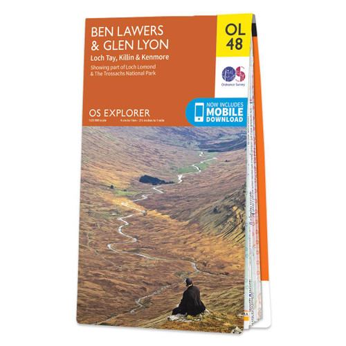
- Ben Lawyers & Glen Lyon - Loch Tay, Killin & Kenmore OS Explorer Map OL48 (paper)
- Ben Lawyers and Glen Lyon area of the Scottish Highlands on a detailed topographic and GPS compatible map OL48, paper version, from the Ordnance Survey’s 1:25,000 Explorer series. Coverage includes part of the Loch Rannoch and Glen Lyon National Scenic Area, 22 Munro peaks including An Stuc, Carn Gorm, Meall Glas and Sgiath Chuil, Loch Tay with... Lire la suite
- Also available from:
- The Book Depository, United Kingdom
- De Zwerver, Netherlands


Stanfords
United Kingdom
2021
United Kingdom
2021
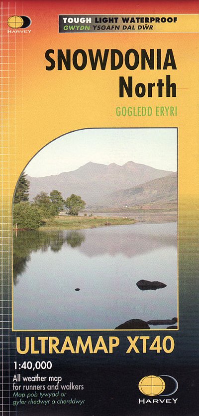
- Snowdonia North Harvey Ultramap XT40
- The northern part of Snowdonia with Snowdon and the Glyders and Carnedds peaks at 1:40,000 on a waterproof and tear-resistant, pocket-size Ultramap from Harvey Map Services with the same cartography as their Superwalker map of this area. The map is double-sided with an overlap between the sides; coverage extends from west of Llanberis eastwards... Lire la suite
- Also available from:
- The Book Depository, United Kingdom
- De Zwerver, Netherlands


Stanfords
United Kingdom
2015
United Kingdom
2015
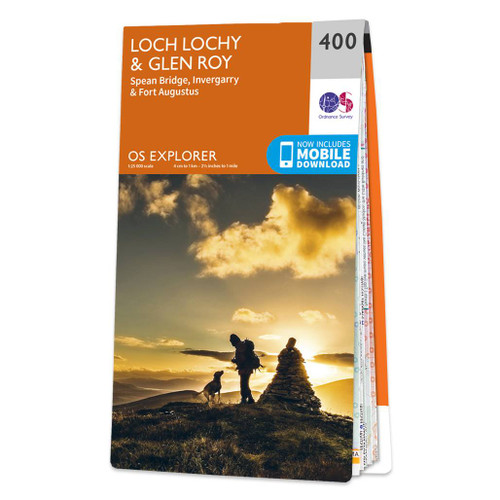
- Loch Lochy & Glen Roy - Spean Bridge, Invergarry & Fort Augustus OS Explorer Map 400 (paper)
- Loch Lochy, Glen Roy, Spean Bridge, Invergarry and Fort Augustus area on a detailed topographic and GPS compatible map No. 400, paper version, from the Ordnance Survey’s 1:25,000 Explorer series. MOBILE DOWNLOADS: this title and all the other OS Explorer maps include a code for downloading after purchase the digital version onto your smartphone... Lire la suite
- Also available from:
- The Book Depository, United Kingdom
- De Zwerver, Netherlands


Stanfords
United Kingdom
2014
United Kingdom
2014
- The Mountains of England and Wales: Vol. 1 - Wales
- The Mountains of England and Wales - Volume 1 is John and Anne Nuttall’s Cicerone guide to walking the highest summits in the country. The guide describes the ascent of all 190 mountains in Wales and is a companion to the authors’ similar work on England. Each of the mountains are grouped by range, allowing walkers to easily find relevant and... Lire la suite
- Also available from:
- The Book Depository, United Kingdom

The Book Depository
United Kingdom
2014
United Kingdom
2014
- The Mountains of England and Wales: Vol 1 Wales
- The Nuttalls are hills over 2000ft high in England and Wales. The 190 Nuttalls in Wales are split into: Carneddau, Glyders, Snowdon, Moel Hebog, Moelwyns, Arenigs, Berwyns, Arans, Rhinogs, Cadair Idris, central Wales, Black Mountains, Brecon Beacons. Definitive lists, detailed route descriptions, maps and drawings of Wales' highest peaks. Lire la suite

Stanfords
United Kingdom
2015
United Kingdom
2015
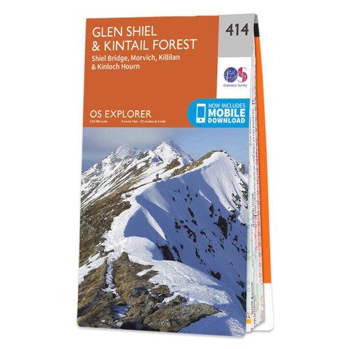
- Glen Shiel & Kintail Forest - Shiel Bridge, Morvich, Killilan & Kinloch Hourn OS Explorer Map 414 (paper)
- Glen Shiel, Kintail Forest, Shiel Bridge, Morvich, Killilan and Kinloch Hourn area on a detailed topographic and GPS compatible map No. 414, paper version, from the Ordnance Survey’s 1:25,000 Explorer series. MOBILE DOWNLOADS: this title and all the other OS Explorer maps include a code for downloading after purchase the digital version onto... Lire la suite
- Also available from:
- The Book Depository, United Kingdom
- De Zwerver, Netherlands

De Zwerver
Netherlands
2015
Netherlands
2015

Stanfords
United Kingdom
United Kingdom
- Three Peaks and Howgill Fells Walks
- This new title is the second in an improved series of Paul Hannon`s walking guides. A range of enhancements see two previous titles merge to cover a broader, logically grouped area. This volume merges the Three Peaks and Howgill Fells areas, which already meet in Dentdale, virtually all within the Yorkshire Dales National Park. The new series... Lire la suite
- Also available from:
- The Book Depository, United Kingdom

The Book Depository
United Kingdom
United Kingdom
- Three Peaks & Howgill Fells
- The Western Yorkshire Dales Lire la suite

Stanfords
United Kingdom
2019
United Kingdom
2019
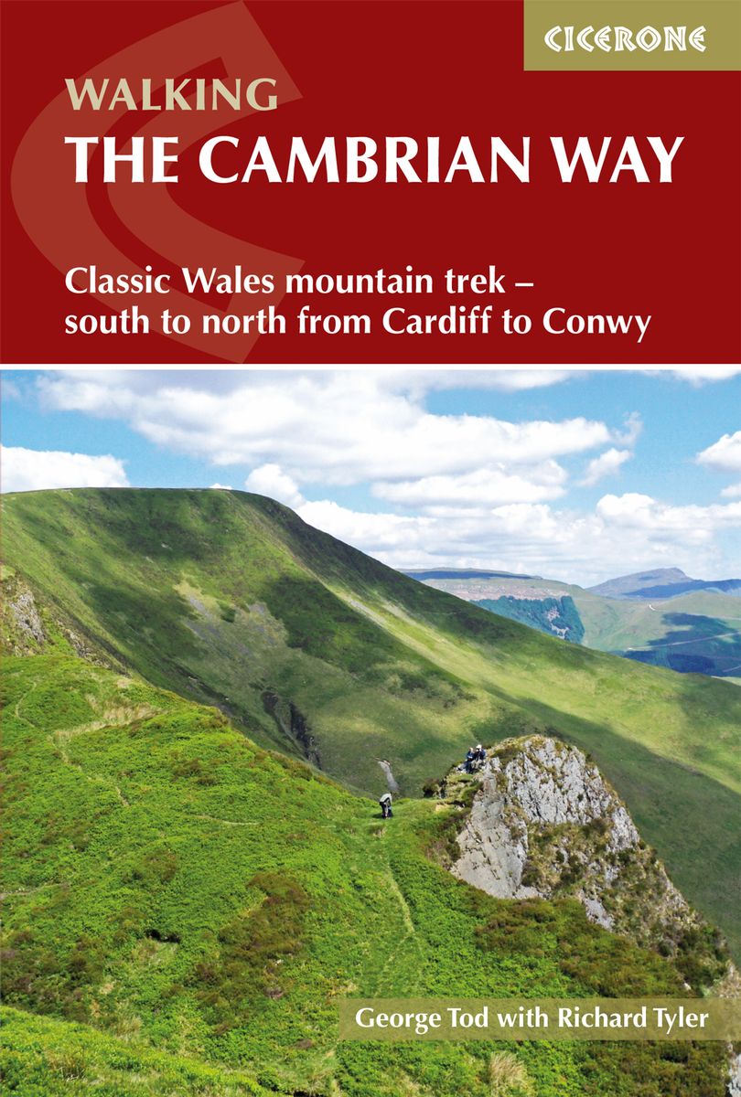
- The Cambrian Way: Classic Wales mountain trek - south to north from Cardiff to Conwy
- Dubbed `the mountain connoisseurs` walk`, the Cambrian Way stretches 479km between the mighty castles of Cardiff in the south and Conwy on the north coast. Traversing the heartland of Wales, the challenging route crosses the Brecon Beacons, the Cambrian Mountains and Snowdonia, passing through two national parks and visiting many of the... Lire la suite
- Also available from:
- The Book Depository, United Kingdom
- De Zwerver, Netherlands

The Book Depository
United Kingdom
2019
United Kingdom
2019
- The Cambrian Way
- Classic Wales mountain trek - south to north from Cardiff to Conwy Lire la suite
De Zwerver
Netherlands
2019
Netherlands
2019
- Wandelgids The Cambrian Way | Cicerone
- Guidebook to the Cambrian Way, a challenging three-week mountain trek through Wales from Cardiff to Conwy. The 470km unwaymarked route is presented from south to north. Often sticking to long, beautiful ridgelines, it crosses wild and rugged terrain and visits many of Wales's highest mountains, including Snowdon. Lire la suite

Stanfords
United Kingdom
United Kingdom
- National Three Peaks Adventure Atlas: Ben Nevis, Scafell Pike, Snowdon
- National Three Peaks Adventure Atlas from A-Z Map Company with cartography of the Ordnance Survey’s 1:25,000 Explorer series covering Ben Nevis, Scafell Pike and Snowdon supplemented by A-Z’s road mapping linking these three areas. Mapping of each peak at 25K is presented with additional information on access, general advice, etc, plus OR codes... Lire la suite
- Also available from:
- The Book Depository, United Kingdom


The Book Depository
United Kingdom
2021
United Kingdom
2021
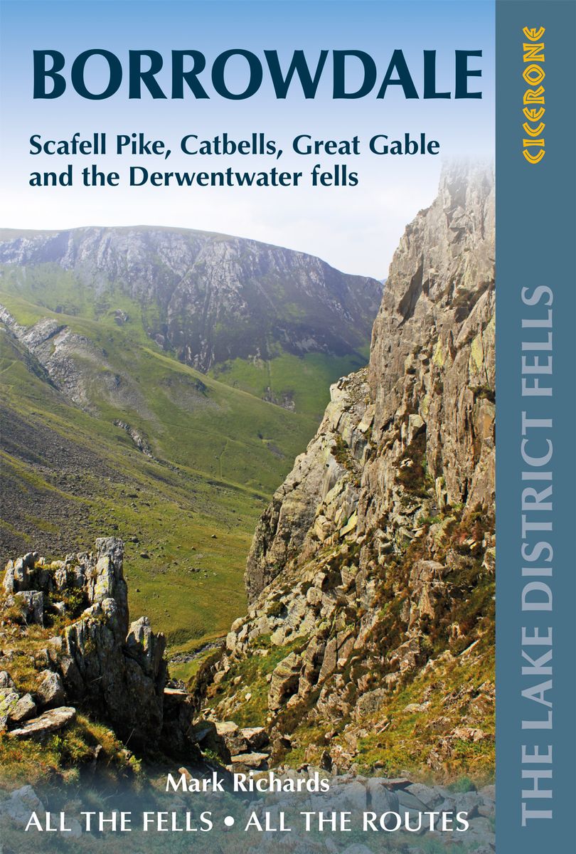
- Walking the Lake District Fells - Borrowdale
- Scafell Pike, Catbells, Great Gable and the Derwentwater fells Lire la suite
- Also available from:
- De Zwerver, Netherlands
De Zwerver
Netherlands
2021
Netherlands
2021
- Wandelgids The Lake District Fells Borrowdale walking guide | Cicerone
- Scafell Pike, Catbells, Great Gable and the Derwentwater fells Lire la suite

- Also available from:
- De Zwerver, Netherlands
De Zwerver
Netherlands
2021
Netherlands
2021

Stanfords
United Kingdom
2015
United Kingdom
2015
- Lake District: High Level and Fell Walks: 30 Best Fell Walks
- This guidebook collects the best 30 high fell walks in the Lake District. Every route is graded for difficulty and ranges between 7-23km, and includes annotated OS maps and variant routes. The walks are divided into 6 sections according to where walkers can start: the Keswick area, Borrowdale and Buttermere, the Western Valleys, Coniston and... Lire la suite
- Also available from:
- The Book Depository, United Kingdom

The Book Depository
United Kingdom
2015
United Kingdom
2015
- Lake District: High Level and Fell Walks
- Walking in the Lake District - the highest mountains in England Lire la suite

Stanfords
United Kingdom
2015
United Kingdom
2015
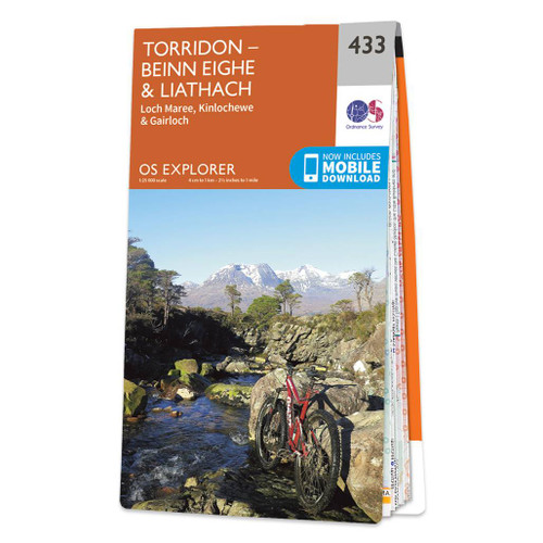
- Torridon - Beinn Eighe & Liathach - Loch Maree, Kinlochewe & Gairloch OS Explorer Map 433 (paper)
- Torridon, Beinn Eighe, Liathach, Loch Maree, Kinlochewe and Gairloch area on a detailed topographic and GPS compatible map No. 433, paper version, from the Ordnance Survey’s 1:25,000 Explorer series. MOBILE DOWNLOADS: this title and all the other OS Explorer maps include a code for downloading after purchase the digital version onto your... Lire la suite
- Also available from:
- The Book Depository, United Kingdom
- De Zwerver, Netherlands

De Zwerver
Netherlands
2015
Netherlands
2015

Stanfords
United Kingdom
United Kingdom
- Everest England
- A unique hill-walking guide with a culminative ascent of the height of Everest, written in Peter Owen Jones` unique descriptive style. Scaling the peaks of Everest, the world`s highest mountain, is the ultimate physical and mental challenge that the human race can aspire to. But as it takes years of preparation and a minimum of £25,000 to... Lire la suite
- Also available from:
- The Book Depository, United Kingdom

Cartes

Stanfords
United Kingdom
United Kingdom
- National 3 Peaks Challenge Minimaps Set: Ben Nevis, Scafell Pike and Snowdon.
- The three peaks which are part of the National Three Peaks Challenge: Ben Nevis, Scafell Pike and Snowdon shown on handy size, waterproof and tear-resistant extracts from the Ordnance Survey 1:25,000 Explorer series. The three maps are sold together in a presentation wallet which also includes brief descriptions and spaces for recording your... Lire la suite

Stanfords
United Kingdom
United Kingdom
- Penrith and Keswick 1901-1904
- Map No. 90, Penrith and Keswick 1901-1904, in the Cassini Historical Series of old Ordnance Survey mapping of England and Wales at 1:50,000 in a format designed to offer a convenient comparison with the present day coverage from the OS, and most locations in three different editions. Old historical maps have been combined so that the sheet... Lire la suite
Stanfords
United Kingdom
United Kingdom
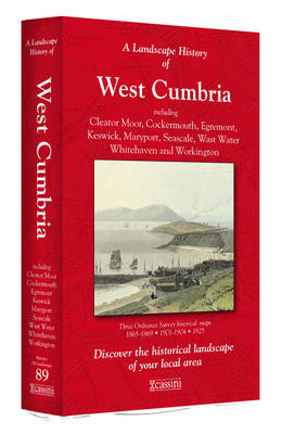
- West Cumbria 1864-1869
- Map No. 89, West Cumbria 1864-1869, in the Cassini Historical Series of old Ordnance Survey mapping of England and Wales at 1:50,000 in a format designed to offer a convenient comparison with the present day coverage from the OS, and most locations in three different editions. Old historical maps have been combined so that the sheet lines... Lire la suite
Stanfords
United Kingdom
United Kingdom
- Snowdon / Yr Wyddfa 1903-1910
- Map No. 115, Snowdon / Yr Wyddfa 1903-1910, in the Cassini Historical Series of old Ordnance Survey mapping of England and Wales at 1:50,000 in a format designed to offer a convenient comparison with the present day coverage from the OS, and most locations in three different editions. Old historical maps have been combined so that the sheet... Lire la suite
Stanfords
United Kingdom
United Kingdom
- Penrith and Keswick 1864-1869
- Map No. 90, Penrith and Keswick 1864-1869, in the Cassini Historical Series of old Ordnance Survey mapping of England and Wales at 1:50,000 in a format designed to offer a convenient comparison with the present day coverage from the OS, and most locations in three different editions. Old historical maps have been combined so that the sheet... Lire la suite
Stanfords
United Kingdom
United Kingdom
- West Cumbria 1864-1925 (3-map set)
- Map No. 89, West Cumbria 1864-1925 (3-map set), in the Cassini Historical Series of old Ordnance Survey mapping of England and Wales at 1:50,000 in a format designed to offer a convenient comparison with the present day coverage from the OS, and most locations in three different editions. Old historical maps have been combined so that the sheet... Lire la suite
Stanfords
United Kingdom
United Kingdom
- Snowdon / Yr Wyddfa 1840-1841
- Map No. 115, Snowdon / Yr Wyddfa 1840-1841, in the Cassini Historical Series of old Ordnance Survey mapping of England and Wales at 1:50,000 in a format designed to offer a convenient comparison with the present day coverage from the OS, and most locations in three different editions. Old historical maps have been combined so that the sheet... Lire la suite
Stanfords
United Kingdom
United Kingdom
- Penrith and Keswick 1864-1925 (3-map set)
- Map No. 90, Penrith and Keswick 1864-1925 (3-map set), in the Cassini Historical Series of old Ordnance Survey mapping of England and Wales at 1:50,000 in a format designed to offer a convenient comparison with the present day coverage from the OS, and most locations in three different editions. Old historical maps have been combined so that... Lire la suite
Stanfords
United Kingdom
United Kingdom
- West Cumbria 1925
- Map No. 89, West Cumbria 1925, in the Cassini Historical Series of old Ordnance Survey mapping of England and Wales at 1:50,000 in a format designed to offer a convenient comparison with the present day coverage from the OS, and most locations in three different editions. Old historical maps have been combined so that the sheet lines correspond... Lire la suite
Stanfords
United Kingdom
United Kingdom
- Snowdon / Yr Wyddfa 1840-1922 (3-map set)
- Map No. 115, Snowdon / Yr Wyddfa 1840-1922 (3-map set), in the Cassini Historical Series of old Ordnance Survey mapping of England and Wales at 1:50,000 in a format designed to offer a convenient comparison with the present day coverage from the OS, and most locations in three different editions. Old historical maps have been combined so that... Lire la suite

Stanfords
United Kingdom
United Kingdom
- The Three Peaks Challenge - Snowdon OS Explorer Map
- The mountains of the Three Peaks Challenge - Ben Nevis, Scafell Pike and Snowdon – on extracts from the Ordnance Survey 1:25,000 Explorer series, with enlargements of the summits, extracts from regional mapping to show road access, and an overview road map linking the three peaks.The area around each peak is presented on a 36x36cm panel with an... Lire la suite
Stanfords
United Kingdom
United Kingdom
- Penrith and Keswick 1925
- Map No. 90, Penrith and Keswick 1925, in the Cassini Historical Series of old Ordnance Survey mapping of England and Wales at 1:50,000 in a format designed to offer a convenient comparison with the present day coverage from the OS, and most locations in three different editions. Old historical maps have been combined so that the sheet lines... Lire la suite
Stanfords
United Kingdom
United Kingdom
- Snowdon / Yr Wyddfa 1922
- Map No. 115, Snowdon / Yr Wyddfa 1922, in the Cassini Historical Series of old Ordnance Survey mapping of England and Wales at 1:50,000 in a format designed to offer a convenient comparison with the present day coverage from the OS, and most locations in three different editions. Old historical maps have been combined so that the sheet lines... Lire la suite
Stanfords
United Kingdom
United Kingdom
- West Cumbria 1901-1904
- Map No. 89, West Cumbria 1901-1904, in the Cassini Historical Series of old Ordnance Survey mapping of England and Wales at 1:50,000 in a format designed to offer a convenient comparison with the present day coverage from the OS, and most locations in three different editions. Old historical maps have been combined so that the sheet lines... Lire la suite

Stanfords
United Kingdom
United Kingdom
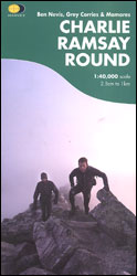
- Charlie Ramsay Round: Ben Nevis, Grey Corries and Mamores
- Charlie Ramsay Round, a route from the Ben Nevis Youth Hostel across the peak itself and 23 more summits including the Grey Corries and Mamores ranges, presented at 1:40,000 on a contoured, GPS compatible map from Harvey Map Services, printed on light, waterproof and tear-resistant paper. Contours are at 15m intervals enhanced by graphic relief... Lire la suite
- Also available from:
- The Book Depository, United Kingdom
The Book Depository
United Kingdom
United Kingdom
- Charlie Ramsay Round
- Charlie Ramsay Round, a route from the Ben Nevis Youth Hostel across the peak itself and 23 more summits including the Grey Corries and Mamores ranges, presented at 1:40,000 on a contoured, GPS compatible map from Harvey Map Services, printed on light, waterproof and tear-resistant paper. Contours are at 15m intervals enhanced by graphic relief... Lire la suite