
Andalucía
Description
Autonomous region in the south of Spain.
Sentiers de cette état
Liens
Données
Rapports
Guides et cartes
Hébergement
Organisations
Voyagistes
GPS
Autre
Livres

Stanfords
United Kingdom
United Kingdom
- Walking The Camino: A Modern Pilgrimage To Santiago
- In May 2006, armed only with a small rucksack and a staff, Tony Kevin, an overweight, sedentary, 63- year-old former diplomat, set off on an eight-week trek across Spain. But this was not just a very long walk - it was a pilgrimage. From Granada, in the southeast, to Santiago de Compostela, in the far northwest, Tony followed the Via Mozarabe... Lire la suite

Stanfords
United Kingdom
United Kingdom
- Sierra Nevada Mountain Guidebook
- Sierra Nevada Mountain Guidebook in English from Editorial Penibetica, publishers of a wide range of detailed, contoured walking maps of popular hiking areas of Andalucía. Colour extracts from their maps, overprinted with 40 routes, accompany the text.The guide is divided into colour-coded sections covering walks from different locations such... Lire la suite

Stanfords
United Kingdom
United Kingdom
- Walking in Andalucía
- Walking in Andalucía is an illustrated guide to the best walks in the diverse terrain of southern Spain’s natural parks. 36 full- and half-day walks, most of which are circular, are featured in six of Andalusia’s natural parks: Grazalema, La Alpujarra, Cazorla, Los Alcornocales, Aracena and La Axarquia. The guide contains clear and detailed... Lire la suite

Stanfords
United Kingdom
United Kingdom
- DK Eyewitness Seville and Andalucia
- Your journey starts here. Featuring DK`s much-loved maps and illustrations, walks and information, plus all new, full-colour photography, this 100% updated guide to Seville and Andalucía brings you the best of this stunning Spanish region and its capital in a brand-new, lightweight format.What`s inside?- full-colour photography, hand-drawn... Lire la suite

The Book Depository
United Kingdom
2018
United Kingdom
2018
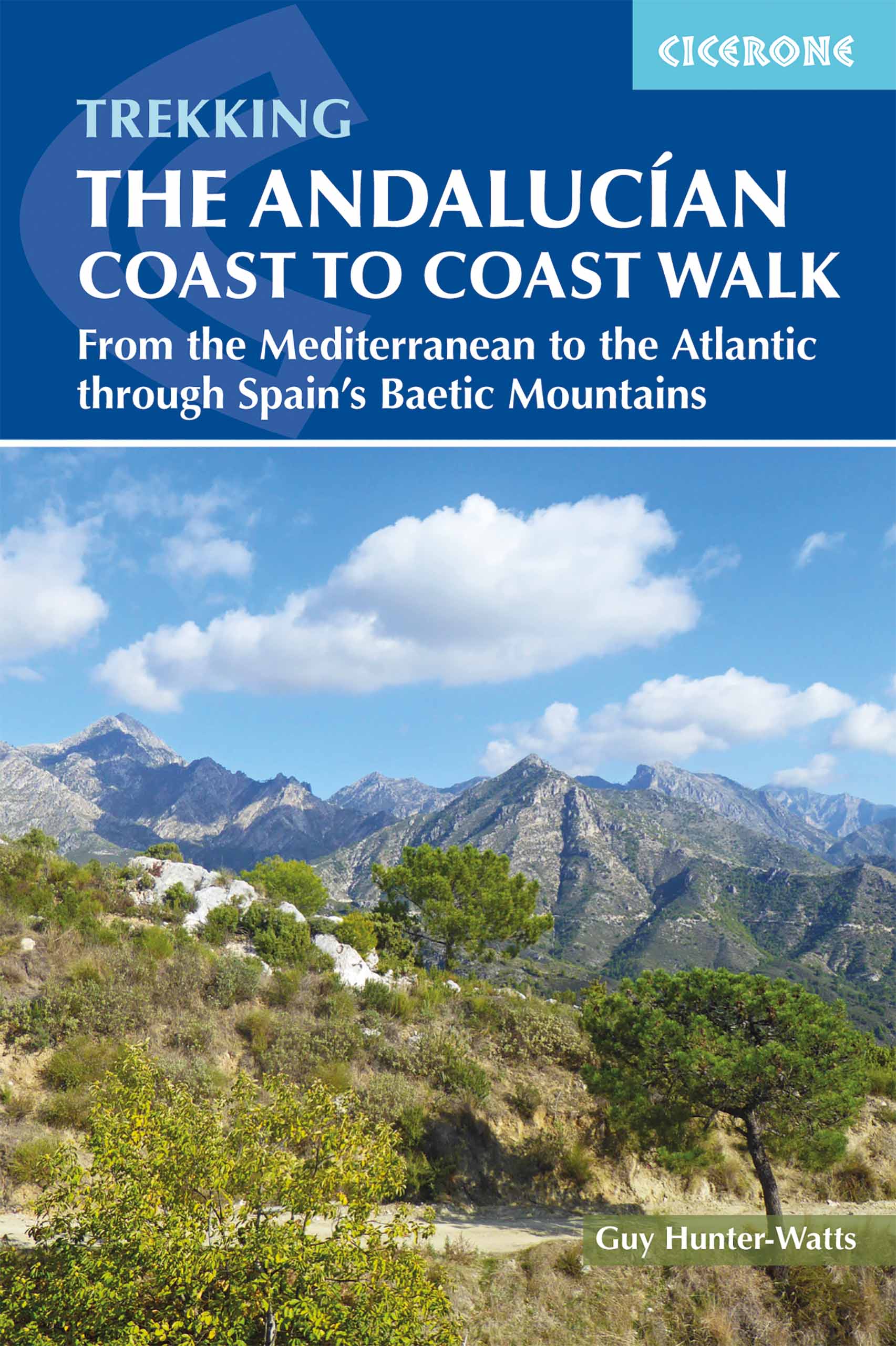
- The Andalucian Coast to Coast Walk
- From the Mediterranean to the Atlantic through the Baetic Mountains Lire la suite
- Also available from:
- De Zwerver, Netherlands
De Zwerver
Netherlands
2018
Netherlands
2018
- Wandelgids The Andalucian Coast to Coast Walk - Andalusie | Cicerone
- Guidebook to the Andalucian Coast to Coast Walk, a 440km, 21-day route from Maro on the Mediterranean coast to Bolonia, on the Atlantic. The route, which passes through 7 Natural Parks, links some of Andalucía's most beautiful villages and passes historical sites of both Roman and Moorish origins, including Ronda and Tarifa. Lire la suite

Bol.com
Netherlands
2011
Netherlands
2011
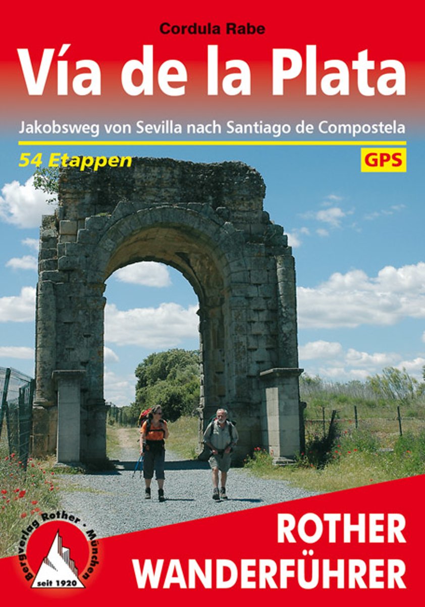
- Vía de la Plata
- Die von Sevilla nach Santiago de Compostela f hrende V a de la Plata erfreut sich einer stetig wachsenden Beliebtheit als Fernwanderroute. Freunde des ber hmten Camino franc s, des von den Pyren en nach Westen verlaufenden Jakobsweges, sch tzen die fast 1000 Kilometer lange S d-Nord-Strecke als noch wenig frequentierte, ruhigere Alternative.... Lire la suite
- Also available from:
- Bol.com, Belgium
- De Zwerver, Netherlands
Bol.com
Belgium
2011
Belgium
2011
- Vía de la Plata
- Die von Sevilla nach Santiago de Compostela f hrende V a de la Plata erfreut sich einer stetig wachsenden Beliebtheit als Fernwanderroute. Freunde des ber hmten Camino franc s, des von den Pyren en nach Westen verlaufenden Jakobsweges, sch tzen die fast 1000 Kilometer lange S d-Nord-Strecke als noch wenig frequentierte, ruhigere Alternative.... Lire la suite
De Zwerver
Netherlands
2020
Netherlands
2020
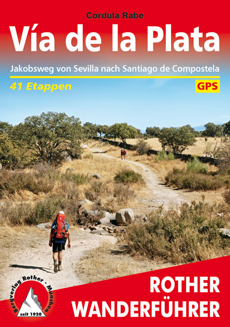
- Wandelgids 291 Via de la Plata | Rother Bergverlag
- Uitstekende beschrijvingen van deze steeds populairder wordende pelgrimstocht! Met alle noodzakelijke info. Zie voor beschrijving de duitse tekst hieronder ..... Die von Sevilla nach Santiago de Compostela führende Vía de la Plata erfreut sich einer stetig wachsenden Beliebtheit als Fernwanderroute. Freunde des berühmten Camino francés, des von... Lire la suite
Bol.com
Netherlands
2018
Netherlands
2018
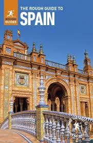
- The Rough Guide to Spain
- Discover Spain with the most incisive and entertaining guidebook on the market. Whether you plan on exploring Andalucia's White Towns, sampling the legendary nightlife of Madrid or hiking in the Picos de Euuropa, this new edition of The Rough Guide to Spain will show you the ideal places to sleep, eat, drink, shop and visit along the way.... Lire la suite
- Also available from:
- Bol.com, Belgium
Bol.com
Belgium
2018
Belgium
2018
- The Rough Guide to Spain
- Discover Spain with the most incisive and entertaining guidebook on the market. Whether you plan on exploring Andalucia's White Towns, sampling the legendary nightlife of Madrid or hiking in the Picos de Euuropa, this new edition of The Rough Guide to Spain will show you the ideal places to sleep, eat, drink, shop and visit along the way.... Lire la suite

Stanfords
United Kingdom
United Kingdom
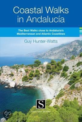
- Coastal Walks in Andalucía
- Coastal Walks in Andalucía from Guy Hunter-Watts is an illustrated guide to the best trails close to the Mediterranean and Atlantic Coastline of Andalucía, inland from the famous beaches of Vejer, Tarifa, Bolonia, Gibraltar, Estepona, Marbella, Mijas, Nerja and Maro.The guide features 43 full and half day walks, mostly circular routes in seven... Lire la suite
- Also available from:
- Bol.com, Netherlands
- Bol.com, Belgium
Bol.com
Netherlands
Netherlands
- Coastal Walks in Andalucia
- A guidebook to 40 half and full day coastal walks in Andalucía. The graded routes, which are suitable for any reasonably fit walker, range from 6km to 19.5km and can be walked all year round. The walks are located in seven of the region's most beautiful National Parks and protected areas (including La Breña y las Marismas, Los Alcornocales y... Lire la suite
Bol.com
Belgium
Belgium
- Coastal Walks in Andalucia
- A guidebook to 40 half and full day coastal walks in Andalucía. The graded routes, which are suitable for any reasonably fit walker, range from 6km to 19.5km and can be walked all year round. The walks are located in seven of the region's most beautiful National Parks and protected areas (including La Breña y las Marismas, Los Alcornocales y... Lire la suite
Bol.com
Netherlands
Netherlands
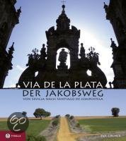
- Via de la Plata - der Jakobsweg
- Die Via de la Plata ist die zweite große Pilgerroute Spaniens - und die große Alternative zum Camino Francés. Der über 1000 Kilometer lange Weg durch Andalusien, die Extremadura, Kastilien und Galizien bis nach Santiago entfaltet die ganze landschaftliche und kulturelle Schönheit Spaniens und ermöglicht auch heute noch ursprüngliche... Lire la suite
- Also available from:
- Bol.com, Belgium
Bol.com
Belgium
Belgium
- Via de la Plata - der Jakobsweg
- Die Via de la Plata ist die zweite große Pilgerroute Spaniens - und die große Alternative zum Camino Francés. Der über 1000 Kilometer lange Weg durch Andalusien, die Extremadura, Kastilien und Galizien bis nach Santiago entfaltet die ganze landschaftliche und kulturelle Schönheit Spaniens und ermöglicht auch heute noch ursprüngliche... Lire la suite
Bol.com
Netherlands
2015
Netherlands
2015
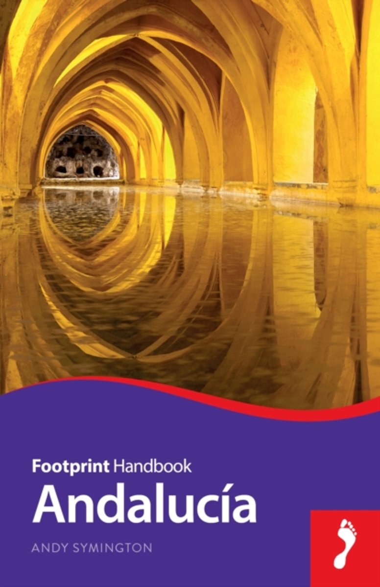
- Andalucía
- Andalucía is home to a cornucopia of historical treasures and rich layers of culture resplendent with color. Footprint's 8th edition Andalucía Handbook will guide you from the noble churches & tasty tapas of Sevilla to lush green hills crowned with postcard-pretty white villages.• Great coverage of the activities and sights in the 8 provinces... Lire la suite
- Also available from:
- Bol.com, Belgium
- De Zwerver, Netherlands
Bol.com
Belgium
2015
Belgium
2015
- Andalucía
- Andalucía is home to a cornucopia of historical treasures and rich layers of culture resplendent with color. Footprint's 8th edition Andalucía Handbook will guide you from the noble churches & tasty tapas of Sevilla to lush green hills crowned with postcard-pretty white villages.• Great coverage of the activities and sights in the 8 provinces... Lire la suite

De Zwerver
Netherlands
2015
Netherlands
2015
- Reisgids Handbook Andalucia - Andalusië | Footprint
- Zo mogelijk nog betere gids dan de Lonely Planet. Vol met de praktische informatie over reizen, slapen etc. Goede verwijzingen naar websites en veel mailadressen. Zelfde soort informatie als de Lonely Planet, diepgaander met vooral meer tips in de minder bekende gebieden. Engelstalig. Andalucia is home to a cornucopia of historical treasures... Lire la suite
Bol.com
Netherlands
Netherlands
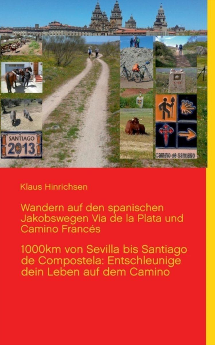
- Wandern Auf Den Spanischen Jakobswegen Via de La Plata Und Camino Frances
- Neben den ausf hrlichen Tagesberichten ber das Erlebte auf der Via de la Plata und dem Camino Frances war es mein erkl rtes Ziel, den Pilgerfreunden einen Wanderf hrer mit allen notwendigen Informationen in kompakter Weise zur Hand zu geben, damit der Weg zu einem unbeschwerten, unvergleichlichen Erlebnis wird. Dieser Ratgeber und... Lire la suite
- Also available from:
- Bol.com, Belgium
Bol.com
Belgium
Belgium
- Wandern Auf Den Spanischen Jakobswegen Via de La Plata Und Camino Frances
- Neben den ausf hrlichen Tagesberichten ber das Erlebte auf der Via de la Plata und dem Camino Frances war es mein erkl rtes Ziel, den Pilgerfreunden einen Wanderf hrer mit allen notwendigen Informationen in kompakter Weise zur Hand zu geben, damit der Weg zu einem unbeschwerten, unvergleichlichen Erlebnis wird. Dieser Ratgeber und... Lire la suite
Bol.com
Netherlands
Netherlands
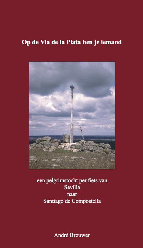
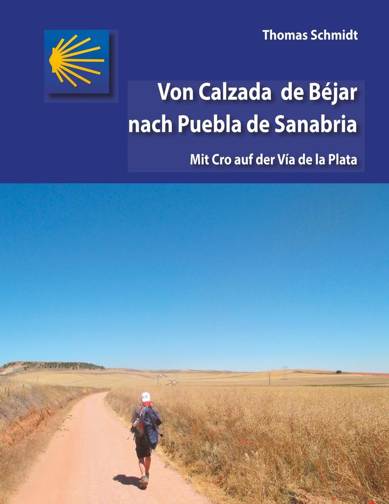
- Von Calzada de Béjar nach Puebla de Sanabria
- Zugegeben: Wie bei vielen Pilgerschwestern und -brüdern fing die Inspiration auch bei mir mit Hape Kerkeling an. Sein Buch kam zum richtigen Zeitpunkt. Als ich es verschlungen hatte, wurde mir klar, dass auch ich bald mal weg auf dem Camino sein würde. Schon seit Monaten suchte ich beharrlich nach einem Weg aus der Krise. Der Jakobsweg hat mir... Lire la suite
- Also available from:
- Bol.com, Belgium
Bol.com
Belgium
Belgium
- Von Calzada de Béjar nach Puebla de Sanabria
- Zugegeben: Wie bei vielen Pilgerschwestern und -brüdern fing die Inspiration auch bei mir mit Hape Kerkeling an. Sein Buch kam zum richtigen Zeitpunkt. Als ich es verschlungen hatte, wurde mir klar, dass auch ich bald mal weg auf dem Camino sein würde. Schon seit Monaten suchte ich beharrlich nach einem Weg aus der Krise. Der Jakobsweg hat mir... Lire la suite
De Zwerver
Netherlands
Netherlands
Cartes

Stanfords
United Kingdom
United Kingdom
- Andalusia Autonomous Community CNIG Physical Road Map
- Andalucía Autonomous Region of Spain at 1:400,000 on a large physical map from the IGN/CNIG - country’s civilian survey organization providing an excellent picture of the region’s topography, from the peaks of Sierra Nevada to the marshes of the Doñana National Park.Relief shading is enhanced by bright altitude colouring, with plenty of names... Lire la suite
Stanfords
United Kingdom
United Kingdom
- Canary Islands Autonomous Region CNIG Physical Road Map
- Canary Islands Autonomous Region of Spain at 1:350,000 on a large physical map from the IGN/CNIG - country’s civilian survey organization providing an excellent picture of the region’s topography, from the peaks of the highest part of the Pyrenees, across the valley of the Ebro, to the sierras of southern Teruel province. Icons prominently... Lire la suite

Stanfords
United Kingdom
United Kingdom
- Valencia - Alicante - Murcia 500K CNIG Regional Map No. 9
- The Mediterranean coast of Spain from north of Valencia to Costa Blanca and inland to include Sierras de Cazorla and Segura in north-eastern Andalucía, at 1:500,000 in a series of regional road maps from the country’s civilian survey organization IGN-CNIG (Instituto Geográfico Nacional - Centro Nacional de Información Geográfica), vividly... Lire la suite

Stanfords
United Kingdom
United Kingdom
- Landscapes along the River Ter Ed. Alpina 40K Map
- Landscapes along the River Ter map in an extensive and very popular series of walking maps from Editorial Alpina covering the Pyrenees, Catalonia and other selected hiking areas in Spain, including Picos de Europa, Sierra Nevada and parts of Andalucía, Majorca, etc. Scales vary from 1:50,000 to 1:10,000, with the majority of the titles at... Lire la suite

Stanfords
United Kingdom
United Kingdom
- Andalucía West: Córdoba - Seville - Málaga 500K CNIG Regional Map No. 11
- The western part of Andalucía, from Córdoba to the Straits of Gibraltar and extending along the Mediterranean coast eastwards beyond the Costa del Sol and Málaga to Nerja, at 1:500,000 in a series of regional road maps from the country’s civilian survey organization IGN-CNIG (Instituto Geográfico Nacional - Centro Nacional de Información... Lire la suite

Stanfords
United Kingdom
United Kingdom
- Vall de Barravés - Ribagorça Editorial Alpina
- Val de Barravés - Ribagorça at 1:25,000 in an extensive and very popular series of walking maps from Editorial Alpina covering the Pyrenees, Catalonia and other selected hiking areas in Spain, including Picos de Europa, Sierra Nevada and parts of Andalucía, Majorca, etc.Scales of maps in this series vary from 1:50,000 to 1:10,000, with the... Lire la suite

Stanfords
United Kingdom
United Kingdom
- Marismas del Odiel Natural Park CNIG Map
- Marismas del Odiel Natural Park on the coast of western Andalucía around Huelva on a large, contoured and GPS compatible map at 1:25,000 from IGN/CNIG using cartography of their civilian topographic survey of Spain. Boundaries of various reserves in this area of wetlands popular with bird watchers are prominently marked. Contours are 10m... Lire la suite

Stanfords
United Kingdom
United Kingdom
- Andalucía East: Granada - Almería - Murcia 500K CNIG Regional Map No. 12
- The eastern part of Andalucía with Granada and Sierra Nevada, extending along the Mediterranean coast from Velez-Malága to Cartagena and Mar Menor, at 1:500,000 in a series of regional road maps from the country’s civilian survey organization IGN-CNIG (Instituto Geográfico Nacional - Centro Nacional de Información Geográfica), vividly... Lire la suite

Stanfords
United Kingdom
United Kingdom
- Torcal de Antequera - Lagoons Fuente de Piedra, Campillos, Ratosa & Archidona Editorial Penibetica SPANISH
- Torcal de Antequera and Lagunas Fuente de Piedra in central Andalucía near Antequera on a set of two separate, contoured, GPS compatible maps from Editorial Penibetica, highlighting local hiking trails. Accompanying SPANISH language booklet provides descriptions of recommended walking trails and details of campsites and huts, etc.A map at... Lire la suite

Stanfords
United Kingdom
United Kingdom
- Aragón Autonomous Region 300K CNIG Physical Road Map
- Aragón Autonomous Region of Spain at 1:300,000 on a large physical map from the IGN/CNIG - country’s civilian survey organization providing an excellent picture of the region’s topography, from the peaks of the highest part of the Pyrenees, across the valley of the Ebro, to the sierras of southern Teruel province. Icons prominently highlight... Lire la suite

Stanfords
United Kingdom
United Kingdom
- Valles de Belagua y Roncal Editorial Alpina
- Valles de Belagua & Roncal in an extensive and very popular series of walking maps from Editorial Alpina covering the Pyrenees, Catalonia and other selected hiking areas in Spain, including Picos de Europa, Sierra Nevada and parts of Andalucía, Majorca, etc. Scales vary from 1:50,000 to 1:10,000, with the majority of the titles at 1:25,000. The... Lire la suite

Stanfords
United Kingdom
United Kingdom
- Catalonia Auotomous Community CNIG Physical Road Map
- Catalonia Autonomous Region of Spain at 1:300,000 on a large physical map from the IGN/CNIG - country’s civilian survey organization providing an excellent picture of the region’s topography, from the peaks of the highest part of the Pyrenees, across the valley of the Ebro, to the sierras of southern Teruel province. Icons prominently highlight... Lire la suite

Stanfords
United Kingdom
United Kingdom
- Mora
- Topographic survey of Portugal at 1:50,000 from the Instituto Geográfico Português, the country’s civilian survey organisation. The maps have contours at 25m intervals and in addition to the standard features shown on topographic mapping at this scale also indicate various types of vegetation (vineyards, olive groves, etc). Each sheet covers an... Lire la suite
- Also available from:
- Stanfords, United Kingdom

Stanfords
United Kingdom
United Kingdom
- Mora
- Topographic survey of Portugal at 1:50,000 from the Instituto Geográfico do Exército, the country’s military survey organisation. The maps have contours at 20m intervals and in addition to the standard features shown on topographic mapping at this scale also indicate various types of terrain or vegetation (sand, terraces, rocks, woodlands,... Lire la suite

Stanfords
United Kingdom
United Kingdom
- Sierra de María-Los Vélez Natural Park Editorial Piolet Hiking Map
- Sierra de María – Los Vélez Natural Park at 1:40,000 on a detailed, GPS compatible topographic map from the Instituto de Cartografia de Andalucía, the region’s official survey organization, printed on light, waterproof and tear-resistant synthetic paper. The map has contours at 20m intervals plus relief shading, with colours and symbols... Lire la suite

Stanfords
United Kingdom
United Kingdom
- Val d`Aran by UTMB Editorial Alpina Trail running race Map
- Val d`Aran in an extensive and very popular series of walking maps from Editorial Alpina covering the Pyrenees, Catalonia and other selected hiking areas in Spain, including Picos de Europa, Sierra Nevada and parts of Andalucía, Majorca, etc. Scales vary from 1:50,000 to 1:10,000, with the majority of the titles at 1:25,000. The maps have... Lire la suite