
Pico, Azores
Description

Pico is the second largest of the nine Azores, and belongs to the central group of islands. It houses the highest mountain of the Azores, Mount Pico, 2351 m. This forbidding black stratovolcano can be climbed, but that’s not without danger. Choose a clear day, take enough water because their is no source, and be sure to be in a good shape, especially when going down through the tiring volcanic grit. If you don’t feel sure, take a guide.
This spectacular cone is not the only interesting aspect of Pico. Even more intriguing is the long string of small cones and lakes extending from the eastern point of the stretched island towards mount pico. Parts are overgrown with shrubs and forest, protecting even some of the original endemic vegetation. Along the northeast coast, several shorter and easy trails are set out. Much of the lush coast is still wooded.
Check the list of all nine Azores islands.
Liens
Données
Rapports
Guides et cartes
Hébergement
Organisations
Voyagistes
GPS
Autre
Livres

United Kingdom
- Azores - 6th ed.
- The Azores in the Sunflower Landscapes guide series; exploring the best walking and touring possibilities in the region or area. Detailed information about touring by hired car or public transport, as well as on foot, is provided, helping walkers to navigate and plan day-trips. Shorter strolls are also included as an alternative for each main... Lire la suite

United Kingdom
- Azores Tour & Trail Super-Durable Map
- For the best adventures, use the best map. Azores Tour & Trail Super-Durable Map is the most detailed, accurate, toughest, large scale map of these 9 islands that you can buy. Super-Durable Maps now come with a 2 year adventurous use wear and tear guarantee, see Discovery Walking Guides website for details. 1:60,000 scale for each island, Sao... Lire la suite

United Kingdom
2015
- Azores: Car Tours and Walks
- The Azores in the Sunflower Landscapes guide series; exploring the best walking and touring possibilities in the region or area. Detailed information about touring by hired car or public transport, as well as on foot, is provided, helping walkers to navigate and plan day-trips. Shorter strolls are also included as an alternative for each main... Lire la suite

United Kingdom
2021
- DK Eyewitness Portugal
- Welcome to Portugal, a sunseekers` paradise.Whether you`re looking for world-renowned beaches, serene hilltop villages, verdant islands, or captivating cities, your DK Eyewitness travel guide makes sure you experience all that Portugal has to offer.Small but immensely varied, Portugal offers countless opportunities for adventure. From the... Lire la suite

United Kingdom
2018
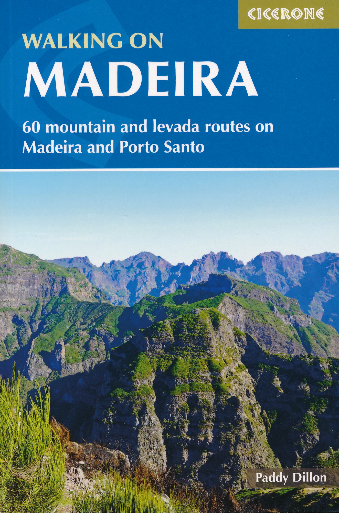
- Walking on Madeira: 60 mountain and levada routes on Madeira and Porto Santo
- This guide describes a varied selection of 57 walks on the Portuguese island of Madeira, exploring the dramatic cliff coastline, scenic levadas (irrigation channels), dense laurisilva `cloud` forests and high mountain peaks, plus three walks on neighbouring Porto Santo. There are routes to suit all abilities, from easy, level levada walks to... Lire la suite
- Also available from:
- The Book Depository, United Kingdom
- De Zwerver, Netherlands

United Kingdom
2018
- Walking on Madeira
- 60 mountain and levada routes on Madeira and Porto Santo Lire la suite
Netherlands
2018
- Wandelgids Walking on Madeira | Cicerone
- A walking guide to the islands of Madeira and Porto Santo. Selection of varied day walks exploring Madeira's network of levadas (water channels) as well as routes across steep and rugged mountains, with slopes of bare rock or laurisilva 'cloud' forest. The neighbouring island of Porto Santo offers easy walking and a sandy beach. Lire la suite

United Kingdom
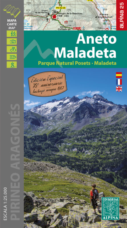
- Aneto - Maladeta - PN Posets Editorial Alpina
- The highest part of the Spanish Pyrenees, the Maladeta massif with Pico de Aneto including the surrounding valleys of Benasque and Barraves, at 1:25,000 on a contoured and GPS compatible map from Editorial Alpina, accompanied by a booklet with English language descriptions of recommended walks and climbs, accommodation details, etc.Vivid... Lire la suite
- Also available from:
- The Book Depository, United Kingdom
- De Zwerver, Netherlands

United Kingdom
- Aneto Maladeta - PN Posets-Maladeta 2 maps
- The highest part of the Spanish Pyrenees, the Maladeta massif with Pico de Aneto including the surrounding valleys of Benasque and Barraves, at 1:25,000 on a contoured and GPS compatible map from Editorial Alpina, accompanied by a booklet with English language descriptions of recommended walks and climbs, accommodation details, etc.Vivid... Lire la suite
Netherlands
- Wandelkaart 15 Aneto - Maladeta | Editorial Alpina
- The highest part of the Spanish Pyrenees, the Maladeta massif with Pico de Aneto including the surrounding valleys of Benasque and Barraves, at 1:25,000 on a contoured and GPS compatible map from Editorial Alpina, accompanied by a booklet with English language descriptions of recommended walks and climbs, accommodation details, etc.Vivid... Lire la suite

United Kingdom
2018
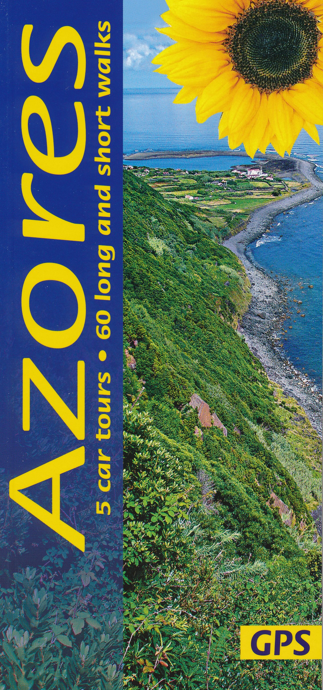
- Azores Sunflower Landscape Guide
- The Azores, nine islands in the Atlantic halfway between the Old World and the New, rise above sea level from a depth of several thousand metres. They are all volcanic in origin and all are covered in this guide.They are not the remains of the legendary continent of Atlantis, which is said to have sunk in the ocean once upon a time.... Lire la suite
- Also available from:
- The Book Depository, United Kingdom
- De Zwerver, Netherlands

United Kingdom
2018
- Azores Sunflower Guide
- 60 long and short walks with detailed maps and GPS; 5 car tours with pull-out map Lire la suite

United Kingdom
2022
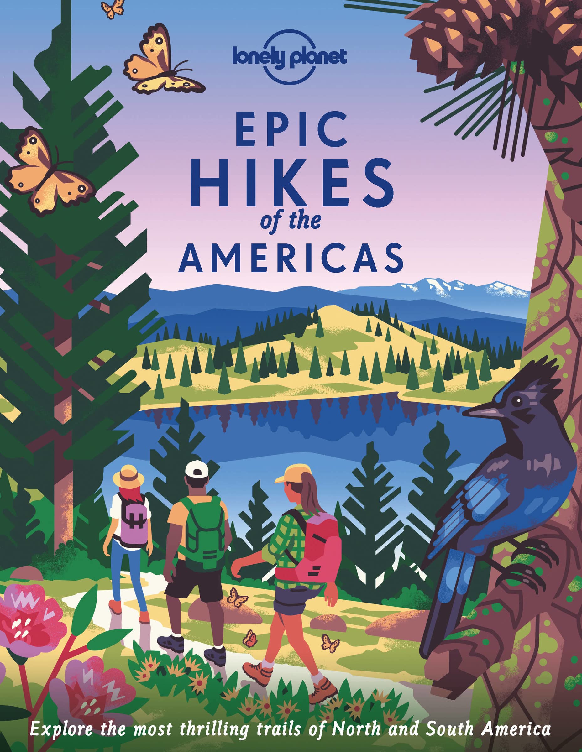
- Epic Hikes of the Americas
- Lace up your hiking boots for the next in Lonely Planet`s highly successful Epic Hikes series, this time exploring 50 of the Americas` most rewarding treks and trails. From Canada`s longest hut-to-hut hike, the Sunshine Coast Trail, to a descent through Havasu Canyon in the USA, and the Santa Cruz Trail of northern Peru, we cover a huge variety... Lire la suite
- Also available from:
- The Book Depository, United Kingdom
- De Zwerver, Netherlands

United Kingdom
2022
- Lonely Planet Epic Hikes of the Americas
- Lace up your hiking boots for the next in Lonely Planet`s highly successful Epic Hikes series, this time exploring 50 of the Americas` most rewarding treks and trails. From Canada`s longest hut-to-hut hike, the Sunshine Coast Trail, to a descent through Havasu Canyon in the USA, and the Santa Cruz Trail of northern Peru, we cover a huge variety... Lire la suite
Netherlands
2022
- Wandelgids Epic Hikes of the Americas | Lonely Planet
- Lace up your hiking boots for the next in Lonely Planet`s highly successful Epic Hikes series, this time exploring 50 of the Americas` most rewarding treks and trails. From Canada`s longest hut-to-hut hike, the Sunshine Coast Trail, to a descent through Havasu Canyon in the USA, and the Santa Cruz Trail of northern Peru, we cover a huge variety... Lire la suite

United Kingdom
2019
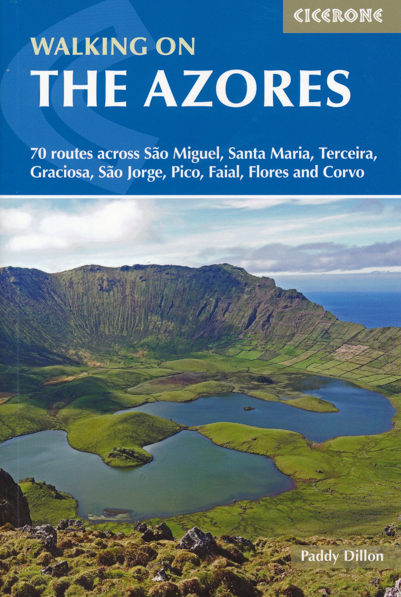
- Walking on the Azores: 70 routes across Sao Miguel, Santa Maria, Terceira, Graciosa, Sao Jorge, Pico, Faial, Flores and Corvo
- A comprehensive guide to walking in the Azores. The guidebook is divided into three island groups: Eastern Group (covering São Miguel and Santa Maria); Central Group (Terceira, Graciosa, São Jorge, Pico and Faial); and Western Group (Flores and Corvo). Most the 70 routes presented here use the Azores` official waymarked trail network and range... Lire la suite
- Also available from:
- The Book Depository, United Kingdom
- De Zwerver, Netherlands

United Kingdom
2019
- Walking on the Azores
- 70 routes across Sao Miguel, Santa Maria, Terceira, Graciosa, Sao Jorge, Pico, Faial, Flores and Corvo Lire la suite
Netherlands
2019
- Wandelgids Walking on the Azores - Azoren | Cicerone
- Guidebook to 70 walks on the Azores, a remote archipelago in the North Atlantic Ocean. Most of the walks are easy or moderate, with a few graded difficult. The selection is spread across all nine islands, offering much variety, from easy village-to-village walks to remote and mountainous walks, including Portugal's highest mountain, Pico. Lire la suite

United Kingdom
2019
- The Pyrenean Haute Route
- There are three main trekking routes across the Pyrenees from coast to coast: of these, the Pyrenean Haute Route (or HRP for Haute Route Pyreneenne) is the most challenging - and arguably, the most spectacular. Unlike the GR10 and GR11, it is not waymarked and borders on mountaineering at times, sticking as closely as possible to the main... Lire la suite
- Also available from:
- The Book Depository, United Kingdom
- De Zwerver, Netherlands


Netherlands
2022
- Wandelgids Pyrenean Haute Route - a high level trail, Pyreneeën HRP | Cicerone
- Guidebook to trekking the Pyrenean Haute Route, which zigzags across the Franco-Spanish border, staying close to the main ridge in the highest and most spectacular central Pyrenees. It covers 750km with over 40km of ascent, so is suitable for experienced mountain walkers only. The largely unwaymarked route is presented in 45 stages. Lire la suite
Netherlands
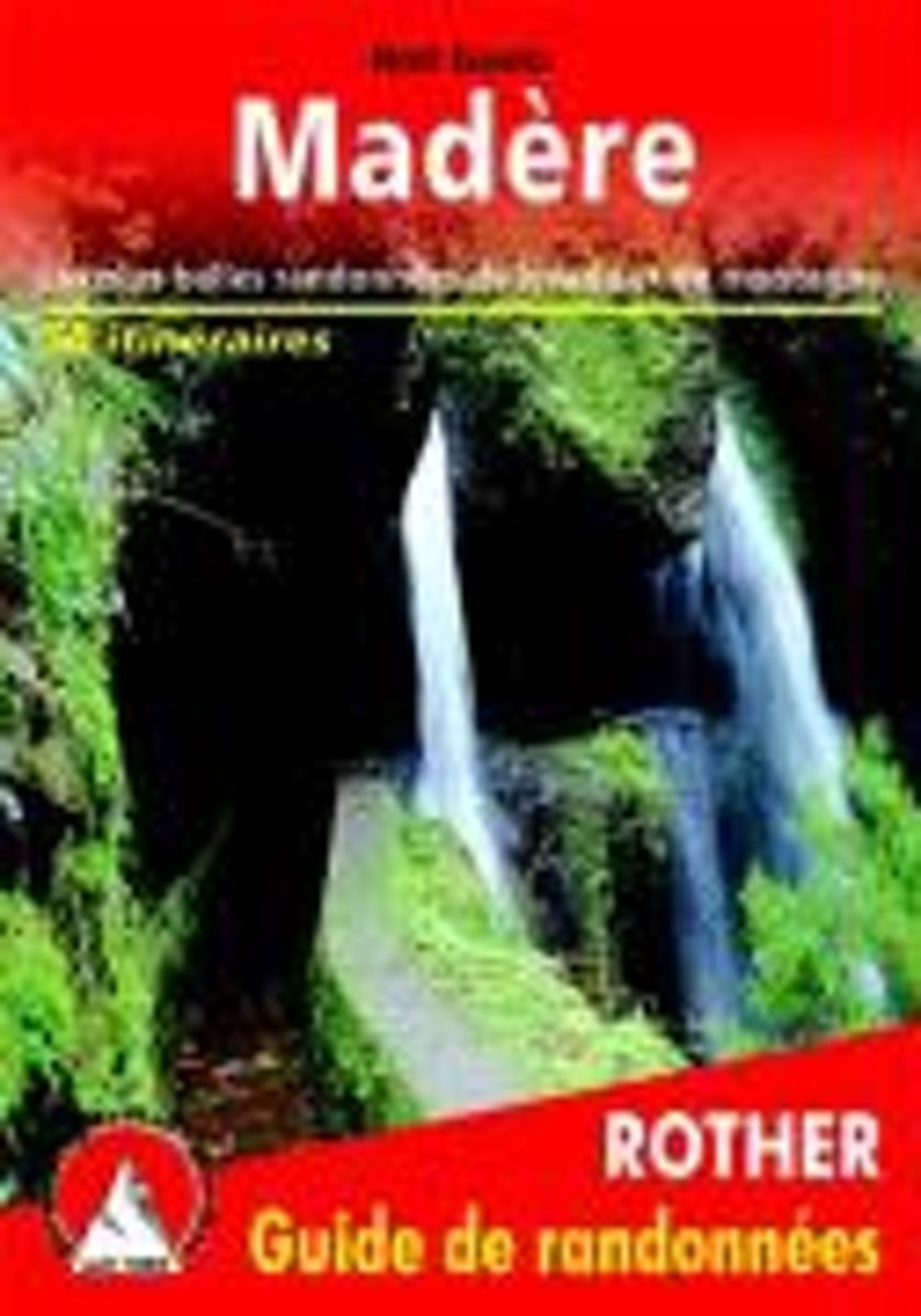
- Mad re (Madeira - franz sische Ausgabe)
- Les plus belles randonnées de levada et de montagne Lire la suite
- Also available from:
- Bol.com, Belgium
Belgium
- Mad re (Madeira - franz sische Ausgabe)
- Les plus belles randonnées de levada et de montagne Lire la suite

Netherlands
- Lonely Planet Mexico
- hangout with howler monkeys near a Mayan ruin, scale the Pico de Orizaba (Mexico's tallest mountain), visit mummies on Day of the Dead, or nap in a Yucatecan hamock - this guide has it all - ventures beyond tacos to discover the best of Mexican cuisine - special section on artesanias (handicrafts) - 161 detailed maps for discovering Mayan... Lire la suite
- Also available from:
- Bol.com, Belgium
Belgium
- Lonely Planet Mexico
- hangout with howler monkeys near a Mayan ruin, scale the Pico de Orizaba (Mexico's tallest mountain), visit mummies on Day of the Dead, or nap in a Yucatecan hamock - this guide has it all - ventures beyond tacos to discover the best of Mexican cuisine - special section on artesanias (handicrafts) - 161 detailed maps for discovering Mayan... Lire la suite
Netherlands
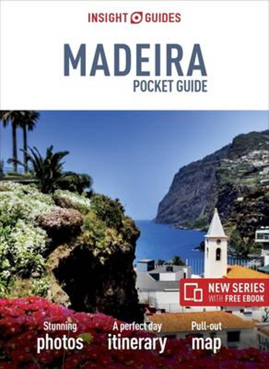
- Insight Guides Pocket Madeira
- From the gorgeous capital of Funchal, to the wealth of hidden coves and beaches on the island, to the hiking trails of Pico do Arieiro, Madeira has much to tempt the visitor. Insight Pocket Guide Madeira is a concise, full-colour travel guide that combines lively text with vivid photography to highlight the best that this island has to... Lire la suite
- Also available from:
- Bol.com, Belgium
Belgium
- Insight Guides Pocket Madeira
- From the gorgeous capital of Funchal, to the wealth of hidden coves and beaches on the island, to the hiking trails of Pico do Arieiro, Madeira has much to tempt the visitor. Insight Pocket Guide Madeira is a concise, full-colour travel guide that combines lively text with vivid photography to highlight the best that this island has to... Lire la suite
Netherlands
2016
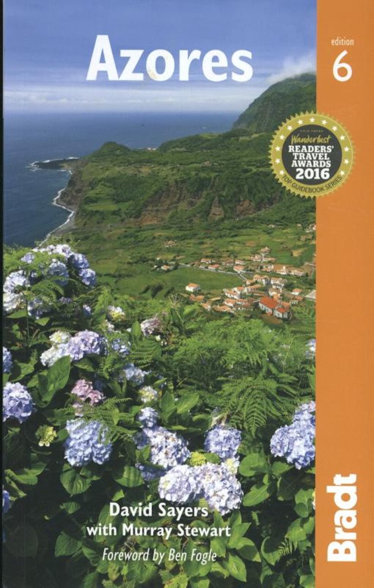
- Azores
- The sixth edition of the only full-blown guide to the beguiling islands of this mid-Atlantic Portugese archipelagoBradt's Azores guidebook is the only comprehensive guidebook to the nine-island archipelago, a nature-lovers' wilderness perched at the western extremity of Europe in the mid-Atlantic, and one of the best places in the world for... Lire la suite
- Also available from:
- Bol.com, Belgium
Belgium
2016
- Azores
- The sixth edition of the only full-blown guide to the beguiling islands of this mid-Atlantic Portugese archipelagoBradt's Azores guidebook is the only comprehensive guidebook to the nine-island archipelago, a nature-lovers' wilderness perched at the western extremity of Europe in the mid-Atlantic, and one of the best places in the world for... Lire la suite

Netherlands
- Cape Verde Islands
- Adrift in the Atlantic Ocean, one of the attractions of the Cape Verde Islands is the watersports; surfing, windsurfing, diving, and fishing. Travelers are also lured to the islands by the promise of scenic hikes around the dramatic terrain of these volcanic outcrops, including the climb up the Pico de Fogo volcanic cone. Many... Lire la suite
- Also available from:
- Bol.com, Belgium
Belgium
- Cape Verde Islands
- Adrift in the Atlantic Ocean, one of the attractions of the Cape Verde Islands is the watersports; surfing, windsurfing, diving, and fishing. Travelers are also lured to the islands by the promise of scenic hikes around the dramatic terrain of these volcanic outcrops, including the climb up the Pico de Fogo volcanic cone. Many... Lire la suite
Cartes
United Kingdom
- Flores South - Azores 2
- Topographic survey of Portugal at 1:25,000 from the Instituto Geográfico do Exército, the country’s military survey organisation.Map legend and a glossary of terms used on the maps include English.To see all the titles in this series please click on the series link. Lire la suite
United Kingdom
- Pico - Candelaria - Azores 10
- Topographic survey of Portugal at 1:25,000 from the Instituto Geográfico do Exército, the country’s military survey organisation.Map legend and a glossary of terms used on the maps include English.To see all the titles in this series please click on the series link. Lire la suite
United Kingdom
- S. Jorge - Calheta - Azores 18
- Topographic survey of Portugal at 1:25,000 from the Instituto Geográfico do Exército, the country’s military survey organisation.Map legend and a glossary of terms used on the maps include English.To see all the titles in this series please click on the series link. Lire la suite
United Kingdom
- S. Miguel - Bretanha - Azores 26
- Topographic survey of Portugal at 1:25,000 from the Instituto Geográfico do Exército, the country’s military survey organisation.Map legend and a glossary of terms used on the maps include English.To see all the titles in this series please click on the series link. Lire la suite
United Kingdom
- Corvo - Azores 3
- Topographic survey of Portugal at 1:25,000 from the Instituto Geográfico do Exército, the country’s military survey organisation.Map legend and a glossary of terms used on the maps include English.To see all the titles in this series please click on the series link. Lire la suite
United Kingdom
- Pico - S.Mateus - Azores 11
- Topographic survey of Portugal at 1:25,000 from the Instituto Geográfico do Exército, the country’s military survey organisation.Map legend and a glossary of terms used on the maps include English.To see all the titles in this series please click on the series link. Lire la suite
United Kingdom
- S. Jorge - Faja do Sanguinhal - Azores 19
- Topographic survey of Portugal at 1:25,000 from the Instituto Geográfico do Exército, the country’s military survey organisation.Map legend and a glossary of terms used on the maps include English.To see all the titles in this series please click on the series link. Lire la suite
United Kingdom
- S. Miguel - Candelaria - Azores 27
- Topographic survey of Portugal at 1:25,000 from the Instituto Geográfico do Exército, the country’s military survey organisation.Map legend and a glossary of terms used on the maps include English.To see all the titles in this series please click on the series link. Lire la suite
United Kingdom
- Faial - North Beach - Azores 4
- Topographic survey of Portugal at 1:25,000 from the Instituto Geográfico do Exército, the country’s military survey organisation.Map legend and a glossary of terms used on the maps include English.To see all the titles in this series please click on the series link. Lire la suite
United Kingdom
- Pico - Lajes do Pico - Azores 12
- Topographic survey of Portugal at 1:25,000 from the Instituto Geográfico do Exército, the country’s military survey organisation.Map legend and a glossary of terms used on the maps include English.To see all the titles in this series please click on the series link. Lire la suite
United Kingdom
- S. Jorge - Topo - Azores 20
- Topographic survey of Portugal at 1:25,000 from the Instituto Geográfico do Exército, the country’s military survey organisation.Map legend and a glossary of terms used on the maps include English.To see all the titles in this series please click on the series link. Lire la suite
United Kingdom
- S. Miguel - Ribeira Grande - Azores 28
- Topographic survey of Portugal at 1:25,000 from the Instituto Geográfico do Exército, the country’s military survey organisation.Map legend and a glossary of terms used on the maps include English.To see all the titles in this series please click on the series link. Lire la suite

United Kingdom
- Pico del Veleta CNIG Topo 1027-3
- Topographic coverage of mainland Spain at 1:25,000 published by the Centro Nacional de Información Geograficá, the country’s civilian survey organization. The maps have contours at 10m intervals and colouring and/or graphics to show different types of vegetation or land use. Boundaries of national parks and other protected areas are marked. In... Lire la suite
United Kingdom
- Faial - Pedro Miguel - Azores 5
- Topographic survey of Portugal at 1:25,000 from the Instituto Geográfico do Exército, the country’s military survey organisation.Map legend and a glossary of terms used on the maps include English.To see all the titles in this series please click on the series link. Lire la suite
United Kingdom
- Pico - Piedade - Azores 13
- Topographic survey of Portugal at 1:25,000 from the Instituto Geográfico do Exército, the country’s military survey organisation.Map legend and a glossary of terms used on the maps include English.To see all the titles in this series please click on the series link. Lire la suite