Táin Way
Description
- Name Táin Way
- Distance de sentier 40 km, 25 milles
- Durée en jours 2 jours
- Début de sentier Carlingford
- Fin de sentier Carlingford
- Classement Traildino MW, Marche modérée, sentier de randonnée
- Classement Traversée de montagne T1, Randonnée
Táin Way, Carlingford - Carlingford, 40 km, 2 days
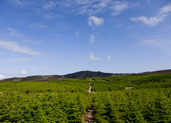
This path is situated at Irelands West coast, in county Lough, from where it is only a small distance to Ulster. The path describes a circle on the Cooley Peninsula. It climbs the steep and open mountains and you will have great views on clear days. The lower slopes consist of grazing land, and with the small forests and the many hedges, it is a friendly contrast to the mountain ridges. The medieval character of Carlingford, the start and end of the path, is preserved.
Accommodation is no problem; the peninsula is quite populated.
Select some tracks
☐Táin Way, 40km


