
Hamburg
Description
Sentiers de cette état
Liens
Données
Rapports
Guides et cartes
Hébergement
Organisations
Voyagistes
GPS
Autre
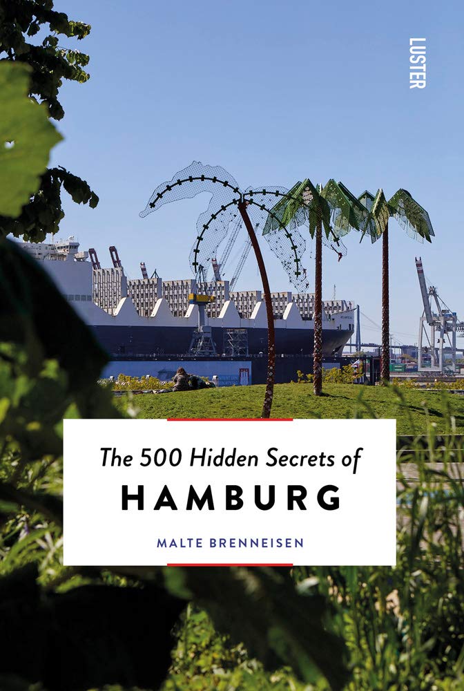
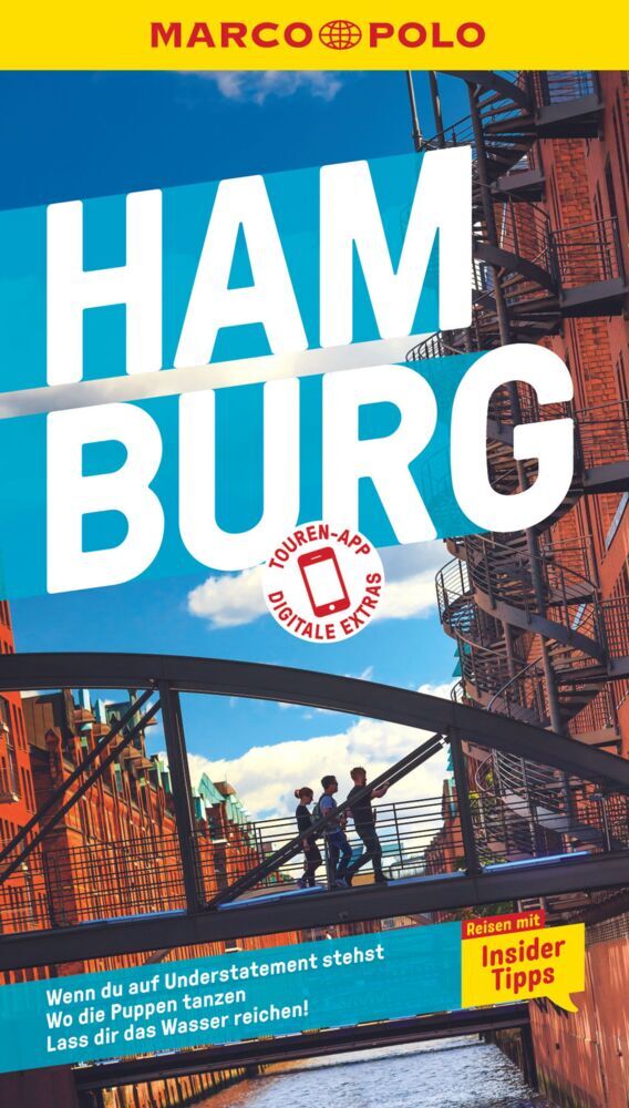
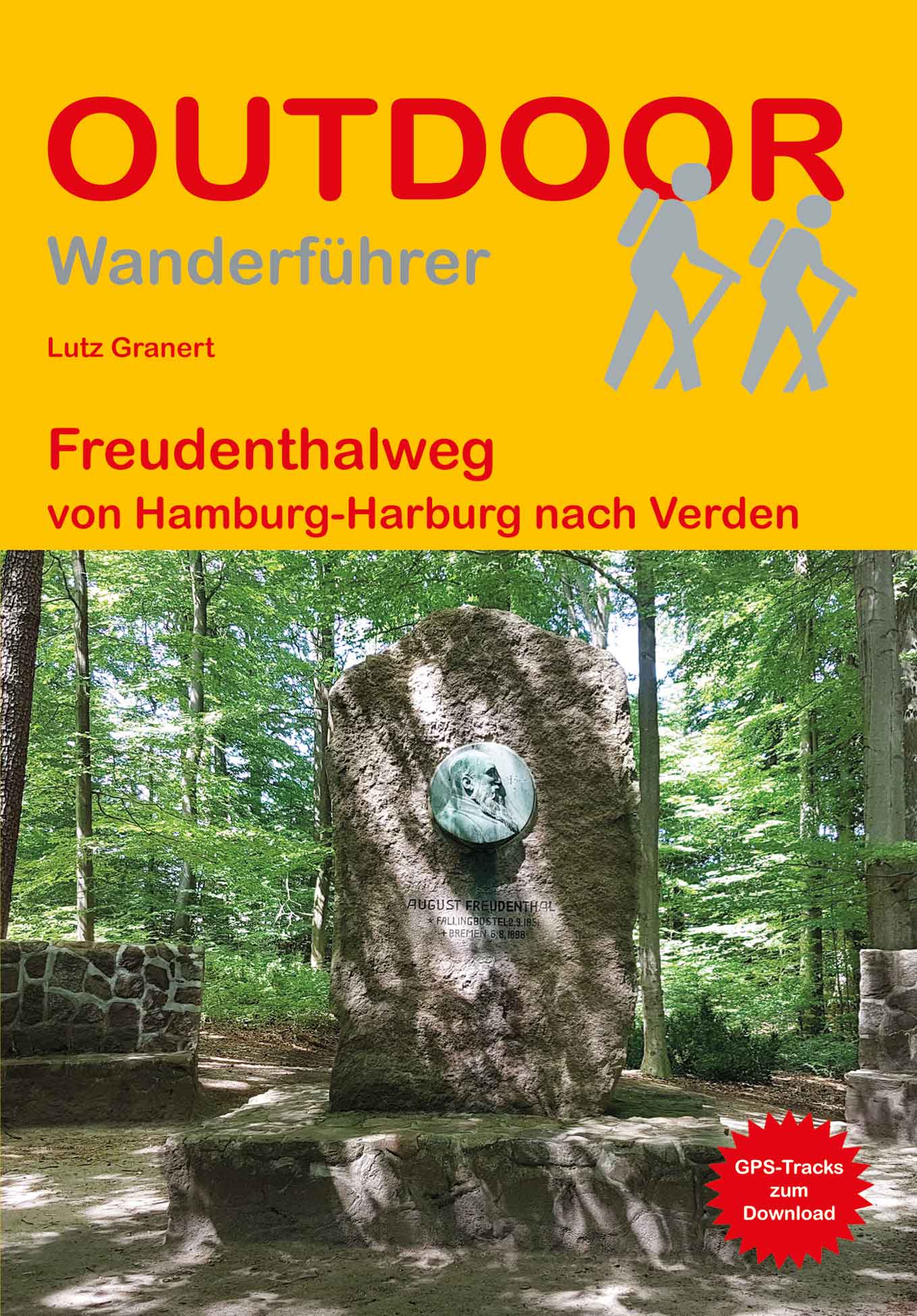
Livres

- Also available from:
- De Zwerver, Netherlands

De Zwerver
Netherlands
2017
Netherlands
2017
- Wandelgids 411 Kautokeino - Nordkap E1 | Conrad Stein Verlag
- Handzaam boekje met de routebeschrijving inclusief een heleboel praktische informatie. De beschrijving is uitstekend, maar kaarten zijn wat beperkt. Duits. Die 330 km lange Wanderung auf dem E1 von Kautokeino zum Nordkap ist ein unvergessliches Wanderabenteuer. In 15 Etappen laufen Sie durch die Wildnis Nordnorwegens und überqueren die... Lire la suite

Bol.com
Netherlands
Netherlands
- Wissensmanagement Und Altere Belegschaft Am Beispiel Der Toyota Motor Corporation
- Magisterarbeit aus dem Jahr 2011 im Fachbereich Orientalistik / Sinologie - Japanologie, Note: 1,3, Universitat Hamburg, Sprache: Deutsch, Abstract: Wissen wird neben Arbeit, Boden und Kapital seit neuerer Zeit als vierter Produktionsfaktor angesehen. Mit Ubergang der Industriegesellschaft in eine Dienstleistungsgesellschaft gewinnt das Wissen... Lire la suite
- Also available from:
- Bol.com, Belgium
Bol.com
Belgium
Belgium
- Wissensmanagement Und Altere Belegschaft Am Beispiel Der Toyota Motor Corporation
- Magisterarbeit aus dem Jahr 2011 im Fachbereich Orientalistik / Sinologie - Japanologie, Note: 1,3, Universitat Hamburg, Sprache: Deutsch, Abstract: Wissen wird neben Arbeit, Boden und Kapital seit neuerer Zeit als vierter Produktionsfaktor angesehen. Mit Ubergang der Industriegesellschaft in eine Dienstleistungsgesellschaft gewinnt das Wissen... Lire la suite
Bol.com
Netherlands
Netherlands
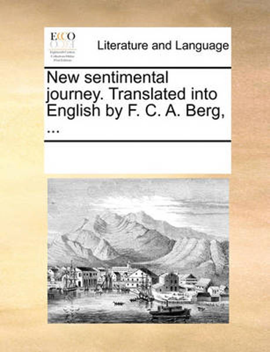
- New Sentimental Journey. Translated Into English by F. C. A. Berg, ...
- The 18th century was a wealth of knowledge, exploration and rapidly growing technology and expanding record-keeping made possible by advances in the printing press. In its determination to preserve the century of revolution, Gale initiated a revolution of its own: digitization of epic proportions to preserve these invaluable works in the... Lire la suite
- Also available from:
- Bol.com, Belgium
Bol.com
Belgium
Belgium
- New Sentimental Journey. Translated Into English by F. C. A. Berg, ...
- The 18th century was a wealth of knowledge, exploration and rapidly growing technology and expanding record-keeping made possible by advances in the printing press. In its determination to preserve the century of revolution, Gale initiated a revolution of its own: digitization of epic proportions to preserve these invaluable works in the... Lire la suite
Bol.com
Netherlands
Netherlands
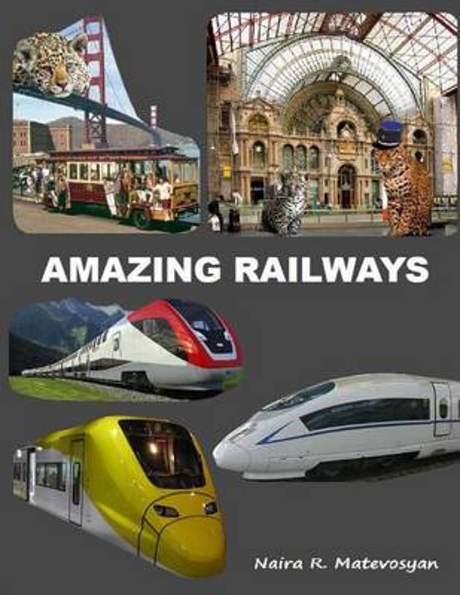
- Amazing Railways
- AUTHORS` NOTE:Boys, boys, boys.... An infant baby-boy enjoys the cartoony micro-world where trains, trams, monorails, tunnels, bridges are recurring themes. Bedtime can be a battle at times, but baby-boy usually cooperates once he puts his head on a pillow with train, taking that train to his dreams. Then he plays with Chubby Choo Choo soft... Lire la suite
- Also available from:
- Bol.com, Belgium
Bol.com
Belgium
Belgium
- Amazing Railways
- AUTHORS` NOTE:Boys, boys, boys.... An infant baby-boy enjoys the cartoony micro-world where trains, trams, monorails, tunnels, bridges are recurring themes. Bedtime can be a battle at times, but baby-boy usually cooperates once he puts his head on a pillow with train, taking that train to his dreams. Then he plays with Chubby Choo Choo soft... Lire la suite

De Zwerver
Netherlands
2022
Netherlands
2022
De Zwerver
Netherlands
2021
Netherlands
2021
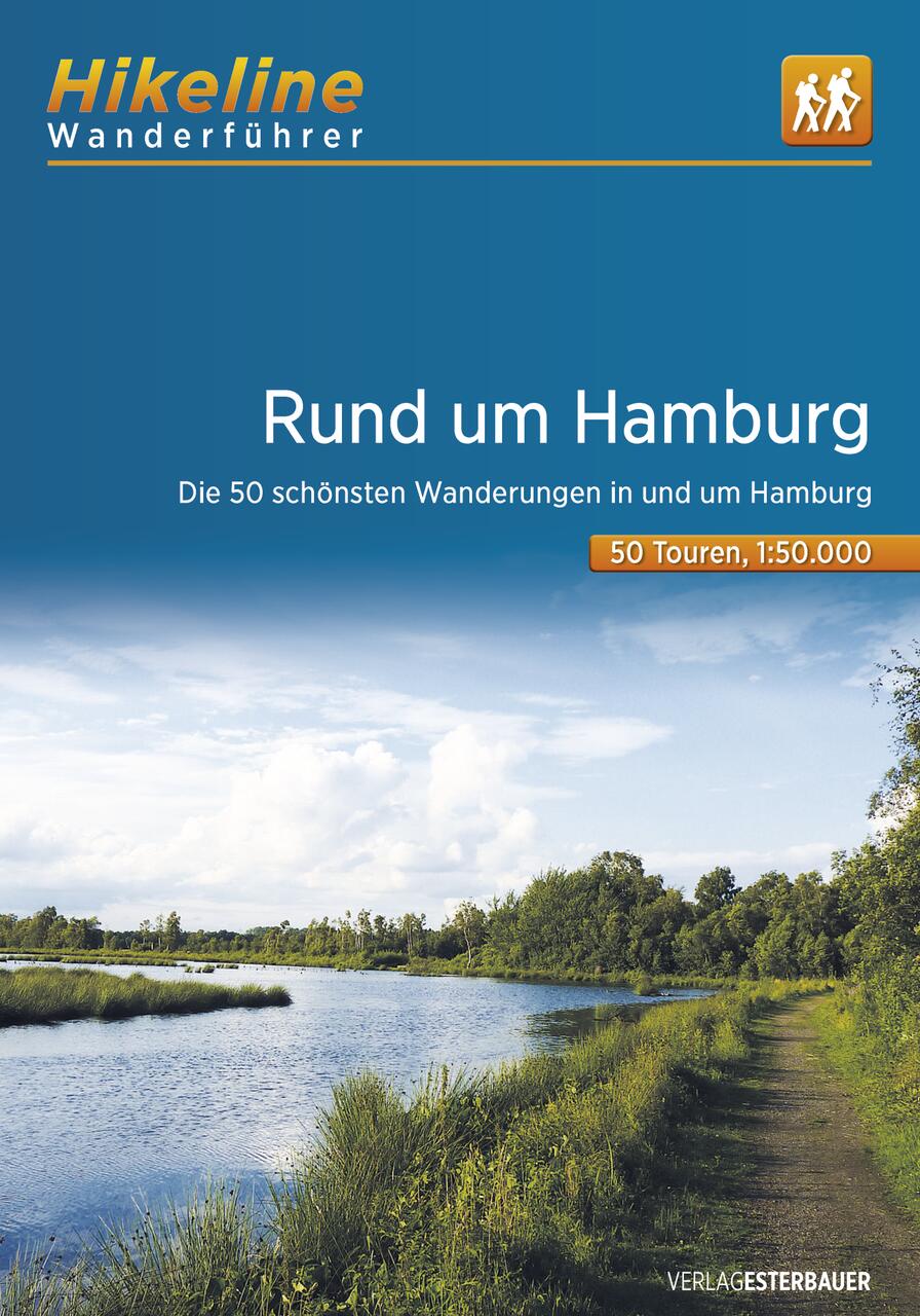
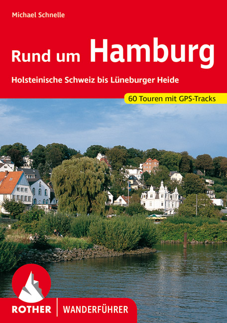
- Wandelgids Rund um Hamburg | Rother Bergverlag
- Uitstekende wandelgids met een groot aantal dagtochten in dal en hooggebergte. Met praktische informatie en beperkt kaartmateriaal! Wandelingen in verschillende zwaarte weergegeven in rood/blauw/zwart. 50 Wanderungen in Hamburgs Umland, nicht nur für Wochenendausflügler Das Umland Hamburgs ist von einer beeindruckenden landschaftlichen Vielfalt... Lire la suite
Bol.com
Netherlands
Netherlands
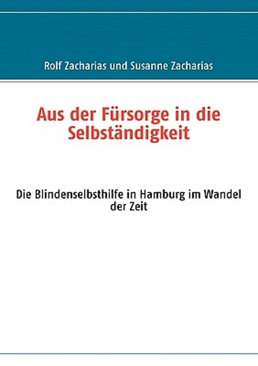
- Aus Der Fursorge in Die Selbstandigkeit
- 2009 ist das Jubil umsjahr der sehbehinderten und blinden Menschen in Hamburg. Am 4. Januar vor 200 Jahren wurde Louis Braille geboren und vor 100 Jahren der Blinden- und Sehbehindertenverein Hamburg gegr ndet.Die Erfindung des Buchdrucks von Johann Gutenberg l ste eine Revolution aus. Die M glichkeit, Gedanken und Schriften auf einfache Weise... Lire la suite
- Also available from:
- Bol.com, Belgium
Bol.com
Belgium
Belgium
- Aus Der Fursorge in Die Selbstandigkeit
- 2009 ist das Jubil umsjahr der sehbehinderten und blinden Menschen in Hamburg. Am 4. Januar vor 200 Jahren wurde Louis Braille geboren und vor 100 Jahren der Blinden- und Sehbehindertenverein Hamburg gegr ndet.Die Erfindung des Buchdrucks von Johann Gutenberg l ste eine Revolution aus. Die M glichkeit, Gedanken und Schriften auf einfache Weise... Lire la suite

De Zwerver
Netherlands
2011
Netherlands
2011
- Reisgids Kunstreiseführer Peloponnes | Dumont
- Epochenschwerpunkte der Peloponnes sind das 2. Jahrtausend v. Chr. mit seiner faszinierenden, von Heinrich Schliemann wiederentdeckten prähistorischen Kultur der Mykener, der archaisch-klassischen griechischen Kunst vom 6. bis zum 4. Jh. v. Chr. und schließlich der späten Blüte der byzantinischen Kultur im 11. und 12. Jahrhundert. Der Autor... Lire la suite
Cartes

Stanfords
United Kingdom
United Kingdom
- Monte Carpegna - Sasso di Simone
- Map No. 16, Monte Carpegna - Sasso di Simone, in series of contoured, GPS compatible hiking maps at 1:25,000 from the Istituto Geografico Adriatico, covering mainly the spine of the Apennines along the borders of Tuscany, Emilia-Romagna, Umbria and the Marches.Map in this series have contours at 25m intervals with additional shading and... Lire la suite

Stanfords
United Kingdom
United Kingdom
- Hamburg to Rügen Cycle Route Bikeline Map-Guide
- Hamburg to Rügen Cycle Route, a 523km long cycle trail across Mecklenburg - Western Pomerania presented by the Verlag Esterbauer in guide with maps at 1:75,000 showing the route and its variants. Extensive information is conveyed by symbols, indicating road surface, campsites and other accommodation, repair workshops, recreational facilities,... Lire la suite

Stanfords
United Kingdom
United Kingdom
- Appennino Tosco-Romagnolo East
- Map No. 135, Appennino Tosco-Romagnolo East, in a series of GPS compatible hiking maps at 1:50,000 from the Istituto Geografico Adriatico, covering parts of central Italy: eastern Tuscany, with northern Umbria and the Marches, plus the south-eastern of part of Emilia-Romagna.The maps have contours at 50m intervals with additional shading and... Lire la suite

Stanfords
United Kingdom
United Kingdom
- Foreste Casentinesi NP Monti Editore 20
- Map No. 20, Foreste Casentinesi: Campigna, Camaldoli, Chiusi dell Verna, in series of contoured, GPS compatible hiking maps at 1:25,000 from the Istituto Geografico Adriatico, covering mainly the spine of the Apennines along the borders of Tuscany, Emilia-Romagna, Umbria and the Marches.Map in this series have contours at 25m intervals with... Lire la suite
Stanfords
United Kingdom
United Kingdom
- Alta Val Tiberina
- Map No. 125, Alta Val Tiberina, in a series of GPS compatible hiking maps at 1:50,000 from the Istituto Geografico Adriatico, covering parts of central Italy: eastern Tuscany, with northern Umbria and the Marches, plus the south-eastern of part of Emilia-Romagna.The maps have contours at 50m intervals with additional shading and numerous spot... Lire la suite
Stanfords
United Kingdom
United Kingdom
- Colline di Rimini
- Map No. 124, Colline di Rimini, in a series of GPS compatible hiking maps at 1:50,000 from the Istituto Geografico Adriatico, covering parts of central Italy: eastern Tuscany, with northern Umbria and the Marches, plus the south-eastern of part of Emilia-Romagna. This title covers the holiday resorts on the Adriatic coast around Rimini,... Lire la suite

Stanfords
United Kingdom
United Kingdom
- Kitchener - Waterloo Street Atlas
- Street atlas of Kitchener and the surrounding area, including Ayr, Baden, Blair, Bloomingdale, Brant, Brantford, Breslau, Bridgeport, Cambridge, Conestogo, Doon, Elmira, Elora, Erin, Fergus, Galt, Guelph, Hespeler, Kitchener, Mannheim, New Hamburg, Paris, Preston, Rockwood, St. Jacobs, Salem and Waterloo. The atlas, which includes a listing for... Lire la suite
Stanfords
United Kingdom
United Kingdom
- Riviera Cesenate - San Marino
- Map No. 128, Riviera Cesenate - San Marino, in a series of GPS compatible hiking maps at 1:50,000 from the Istituto Geografico Adriatico, covering parts of central Italy: eastern Tuscany, with northern Umbria and the Marches, plus the south-eastern of part of Emilia-Romagna.The maps have contours at 50m intervals with additional shading and... Lire la suite

Stanfords
United Kingdom
United Kingdom
- Hamburg F&B
- Indexed street map of Hamburg at 1:20,000 from Freytag & Berndt with an enlargement of the New Town at 1:10,000. Mapping is bright, colourful and clear, with one-way streets shown, as well as the U-bahn, S-bahn, bus and rail networks with stops clearly indicated. Shipping routes are also displayed.Points of interest such as the city’s docks,... Lire la suite

Stanfords
United Kingdom
United Kingdom
- Hamburg Borch
- Excellent laminated and waterproof map for visitors to Hamburg, combining a plan of the city with an enlargement for the town centre, a plan of Blankenese, a plan of Hamburg’s port area, and a map of the city’s environs. The main plan at 1:22,000 extends north from the Elbe to the airport, west to the E45 motorway and Volkspark, and east to... Lire la suite
Stanfords
United Kingdom
United Kingdom
- Alta Val Marecchia
- Map No. 126, Alta Val Marecchia, in a series of GPS compatible hiking maps at 1:50,000 from the Istituto Geografico Adriatico, covering parts of central Italy: eastern Tuscany, with northern Umbria and the Marches, plus the south-eastern of part of Emilia-Romagna.The maps have contours at 50m intervals with additional shading and numerous spot... Lire la suite
Stanfords
United Kingdom
United Kingdom
- Heerweg-Ochsenweg Cycle Route - Fredrikshavn to Hamburg
- The Heerweg-Ochsenweg Cycle Route, a 540-km “Army and Oxen” route from Viborg across the length of Jutland to Hamburg, presented by the Verlag Esterbauer in a guide with maps at 1:75,000 showing the route and its variants. Extensive information is conveyed by symbols, indicating road surface, campsites and other accommodation, repair... Lire la suite
Stanfords
United Kingdom
United Kingdom
- Alta Valle del Santerno 23
- Map No. 22, Alta Valle del Lamone: Alto Appennino Faentino – Anello di Marradi, in series of contoured, GPS compatible hiking maps at 1:25,000 from the Istituto Geografico Adriatico, covering mainly the spine of the Apennines along the borders of Tuscany, Emilia-Romagna, Umbria and the Marches.Map in this series have contours at 25m intervals... Lire la suite

Stanfords
United Kingdom
United Kingdom
- North Sea Coast Cycle Route 3 - Hamburg to Danish Border
- The North Sea Cycle Route Part 3 – a 371-km long section from Hamburg to the Danish border, including coverage of the North Frisian Islands, presented by Verlag Esterbauer in a guide with maps at 1:75,000 showing the route and its variants. Extensive information is conveyed by symbols, indicating road surface, campsites and other accommodation,... Lire la suite

Stanfords
United Kingdom
United Kingdom
- Hamburg - Lübeck - Lüneburg ADAC Street Atlas
- Hamburg Region Street Atlas in a series of detailed atlases covering the whole of Germany at 1:20,000 with UTM coordinates for GPS navigation, postal codes and public transport, published by ADAC, the country’s largest motoring organization. The plans name all the individual streets and indicate all the main landmarks and public buildings. All... Lire la suite