
Berchtesgadener Alpen
Description

The Berchtesgaden Alps is one of the highest areas in Germany. Around the pitturesque Königsee rise the bare jagged mountains, as pimples out of the green woods and meadows. Watzmann is the highest mountain here (2.713 m), just a little lower than the Zugspitze, but 100% German.
This part of the Northern Limestone Alps intrudes into Austrian territory, more or less like a bag. The area is not far from Salzburg. The Berchtesgadener Alps continue on the Austrian side of the border, and the highest summit here is the Hochkönig, 2.941 m.
One of the attractions is the Steinernes Meer, the stony sea, a barren plateau with rocks, rocks, rocks.
Yes, walking is excellent here. Not only because of the many (more than 40) huts. But also because of the variety of trails, from easy to very challenging. The geological origin of the mountains is karst, and this means lots of hard rock and ... klettersteige, if you like them. Bonus is the relative calmness on the Austrian side, since the masses are draw to the areas with the big names, further south.
Carte


Sentiers de cette région
Liens
Données
Rapports
Guides et cartes
Hébergement
Organisations
Voyagistes
GPS
Autre
Livres

United Kingdom
2018
- Walking in the Bavarian Alps
- A comprehensive guidebook detailing walks in Germany`s Bavarian Alps. Lying along the German-Austrian border in a thin sliver of land roughly 300km long, this area contains some of the most spectacular walking and beautiful scenery that Germany has to offer. 70 graded walks explore mountain landscapes, wild mountain gorges and alpine meadows as... Lire la suite
- Also available from:
- The Book Depository, United Kingdom
- De Zwerver, Netherlands

United Kingdom
2018
- Walking in the Bavarian Alps
- 70 mountain walks and treks in southern Germany Lire la suite

Netherlands
2018
- Wandelgids Beieren - Walking in the Bavarian Alps | Cicerone
- Guidebook to mountain walks and treks in the Bavarian Alps, on the border of Germany and Austria, between Lake Constance and Berchtesgaden. Accessible from Munich, Salzburg and Innsbruck, these 70 routes range from half-day walks to 3-day hut-to-hut treks. Highlights include the Königssee and Breitach, Partnach and Höllental gorges. Lire la suite
Netherlands
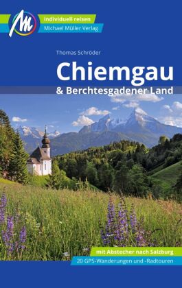
- Winterwandern Berchtesgaden - Chiemgau - Salzburg
- Verschneite Landschaft genießen, frische Winterluft schnuppern, in einer gemütlichen Alm einkehren, mit dem Schlitten ins Tal sausen, auch in der kalten Jahreszeit draußen in den Bergen sein - Winterwandern liegt nicht nur im Trend, es macht einfach Spaß!Die kompetenten Gebietskenner Andrea und Andreas Strauß stellen in diesem Rother Wanderbuch... Lire la suite
- Also available from:
- Bol.com, Belgium
Belgium
- Winterwandern Berchtesgaden - Chiemgau - Salzburg
- Verschneite Landschaft genießen, frische Winterluft schnuppern, in einer gemütlichen Alm einkehren, mit dem Schlitten ins Tal sausen, auch in der kalten Jahreszeit draußen in den Bergen sein - Winterwandern liegt nicht nur im Trend, es macht einfach Spaß!Die kompetenten Gebietskenner Andrea und Andreas Strauß stellen in diesem Rother Wanderbuch... Lire la suite

Netherlands
- Un Jubilado En Los Alpes
- Se aproximaba el verano y era necesario decidirse. Entre unos pocos proyectos previstos hasta esos dias, que habian ido surgiendo en mi imaginacion durante el invierno, se fueron concretando a mitad de la primavera la posibilidad de caminar por el Himalaya, en Cachemira, recorrer algunos valles del Caucaso al norte de Georgia o atravesar los... Lire la suite
- Also available from:
- Bol.com, Belgium
Belgium
- Un Jubilado En Los Alpes
- Se aproximaba el verano y era necesario decidirse. Entre unos pocos proyectos previstos hasta esos dias, que habian ido surgiendo en mi imaginacion durante el invierno, se fueron concretando a mitad de la primavera la posibilidad de caminar por el Himalaya, en Cachemira, recorrer algunos valles del Caucaso al norte de Georgia o atravesar los... Lire la suite
Netherlands
- Fietskaart 3336 Berchtesgadener Land - Salzburg | Kompass
- Die Fahrradkarte die alles kann, das bedeutet:- übersichtliche Kartografie, detailgenaue Infos zu Wegbeschaffenheit und Verkehrsbelastung- handliches Format – passend für den Radkartenhalter- Reichweitenassistenten: Reicht der E-Bike-Akku? Easy Touren-Planung mit dem KOMPASS-Reichweitenassistenten.- Steigungspfeile: Bergauf oder bergab? Die... Lire la suite

Netherlands
2022
Netherlands
- Kompass WA594 Chiemgau, Berchtesgadenerland
- Die KOMPASS Wander-Atlanten überzeugen durch: ausgewogene Tourenwahl für jede Kondition, mindestens 100 Tourenvorschläge,In deze Duitstalige Kompass wandelatlas vindt u de 120 mooiste wandelingen in het gebied • Routes voor zowel getrainde als ongetrainde wandelaars • gedetailleerde kaarten • duidelijke routebeschrijvingen met fraaie foto's •... Lire la suite
- Also available from:
- Bol.com, Belgium
Belgium
- Kompass WA594 Chiemgau, Berchtesgadenerland
- Die KOMPASS Wander-Atlanten überzeugen durch: ausgewogene Tourenwahl für jede Kondition, mindestens 100 Tourenvorschläge,In deze Duitstalige Kompass wandelatlas vindt u de 120 mooiste wandelingen in het gebied • Routes voor zowel getrainde als ongetrainde wandelaars • gedetailleerde kaarten • duidelijke routebeschrijvingen met fraaie foto's •... Lire la suite

Netherlands
- Hiking in Switzerland
- This is the official guidebook to the Swiss section of the Via Alpina (National Route 1), published by the Swiss Hiking Federation. The Via Alpina is a network of five long-distance hiking routes which cross eight Alpine countries from Trieste to Monaco - over 5,000 kilometres of hiking trails in total. On Swiss soil, National Route 1 Via... Lire la suite
- Also available from:
- Bol.com, Belgium
Belgium
- Hiking in Switzerland
- This is the official guidebook to the Swiss section of the Via Alpina (National Route 1), published by the Swiss Hiking Federation. The Via Alpina is a network of five long-distance hiking routes which cross eight Alpine countries from Trieste to Monaco - over 5,000 kilometres of hiking trails in total. On Swiss soil, National Route 1 Via... Lire la suite

United Kingdom
2017
- The Swiss Alpine Pass Route - via Alpina Route 1: Trekking East to West Across Switzerland
- This guidebook presents the stunning Alpine Pass Route, now fully waymarked as Via Alpina 1. The 360km trail traverses Switzerland from east to west, from Sargans near the Liechtenstein border to Montreux on Lac Leman (Lake Geneva). Crossing sixteen Alpine passes, it showcases some of the country`s most breathtaking mountain landscapes,... Lire la suite
- Also available from:
- Bol.com, Netherlands
- Bol.com, Belgium

Netherlands
2017
- The Swiss alpine pass route - Via Alpina route 1
- This guidebook presents the stunning Alpine Pass Route, now fully waymarked as Via Alpina 1. The 360km trail traverses Switzerland from east to west, from Sargans near the Liechtenstein border to Montreux on Lac Léman (Lake Geneva). Crossing sixteen Alpine passes, it showcases some of the country's most breathtaking mountain landscapes,... Lire la suite
Belgium
2017
- The Swiss alpine pass route - Via Alpina route 1
- This guidebook presents the stunning Alpine Pass Route, now fully waymarked as Via Alpina 1. The 360km trail traverses Switzerland from east to west, from Sargans near the Liechtenstein border to Montreux on Lac Léman (Lake Geneva). Crossing sixteen Alpine passes, it showcases some of the country's most breathtaking mountain landscapes,... Lire la suite

Netherlands
- Berlin, Potsdam, Oranienberg & Beyond
- We travel to grow -- our Adventure Guides show you how. Experience the places you visit more directly, freshly, intensely than you would otherwise -- sometimes best done on foot, in a canoe, or through cultural adventures like art courses, cooking classes, learning the language, meeting the people, joining in the festivals and celebrations.... Lire la suite
- Also available from:
- Bol.com, Belgium
Belgium
- Berlin, Potsdam, Oranienberg & Beyond
- We travel to grow -- our Adventure Guides show you how. Experience the places you visit more directly, freshly, intensely than you would otherwise -- sometimes best done on foot, in a canoe, or through cultural adventures like art courses, cooking classes, learning the language, meeting the people, joining in the festivals and celebrations.... Lire la suite
Netherlands
- Wandelkaart - Pelgrimsroute (kaart) Overzichtskaart Europese Pelgrimspaden - Europa Pilgerwege | Freytag & Berndt
- De grote overzichtskaart van alle Pelgrimswegen in Europa. In één oogopslag krijg je een geweldig goed overzicht van zo ongeveer alle mogelijkheden om op bedevaart te gaan. In het begeleidende boekje worden ze stuk voor stuk in het (zeer) kort beschreven. Als je een overzicht wenst of droomt van een lange bedevaart is dit je kaart! Lire la suite
Netherlands
2022
Netherlands
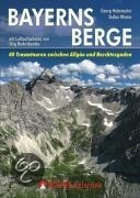
- Bayerns Berge
- Warum in die Ferne schweifen und eine weite Anreise in die Zentralalpen in Kauf nehmen, wenn das Gute so nahe liegt? Der bayerische Alpenbogen zwischen Allgäu und Berchtesgaden - die Allgäuer Alpen, die Ammergauer Alpen, das Wettersteingebirge, die Bayerischen Voralpen mit Estergebirge, Walchenseebergen, Benediktenwandgruppe und... Lire la suite
- Also available from:
- Bol.com, Belgium
Belgium
- Bayerns Berge
- Warum in die Ferne schweifen und eine weite Anreise in die Zentralalpen in Kauf nehmen, wenn das Gute so nahe liegt? Der bayerische Alpenbogen zwischen Allgäu und Berchtesgaden - die Allgäuer Alpen, die Ammergauer Alpen, das Wettersteingebirge, die Bayerischen Voralpen mit Estergebirge, Walchenseebergen, Benediktenwandgruppe und... Lire la suite

Netherlands
2008
- Wandelgids Arnoweg - Der Salzburger Rundwanderweg | Rother Bergverlag
- Dieser gemeinsam mit dem Tourismusverband SalzburgerLand herausgegebene Wanderführer beschreibt detailliert alle Etappen des erst 1999 aus der Taufe gehobenen Arnowegs. Anlaß für die Errichtung dieses Weitwanderwegs war das 1200jährige Jubiläum der Erzdiözese Salzburg, 798 nämlich wurde Bischof Arno zum Erzbischof dieser großen Kirchenprovinz... Lire la suite
Netherlands
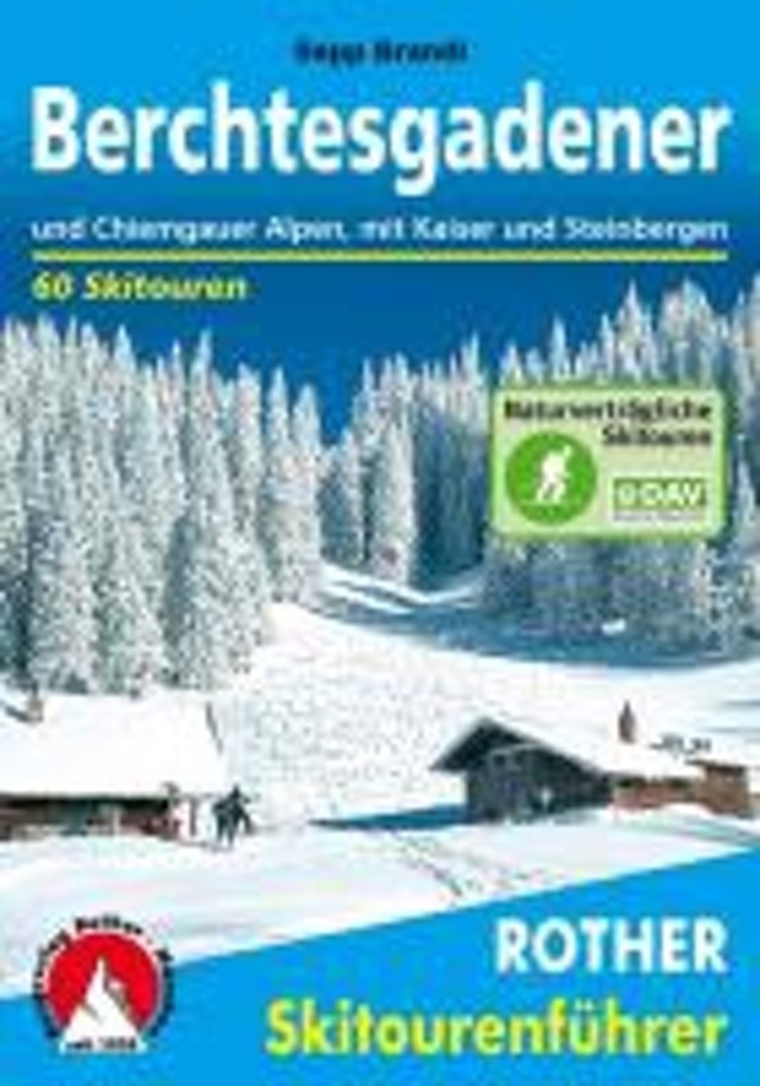
- Berchtesgadender und Chiemgauer Alpen
- Die Berge um das Dreil ndereck von Bayern, Salzburg und Tirol, bieten Skitouren f r jeden Geschmack: Hier locken die Chiemgauer und Dientner Berge mit reizvollem Almgl nde, w hrend das Kaisergebirge, die Loferer und Leoganger Steinberge sowie das Steinerne Meer die Skibergsteiger mit Fr hjahrsfirn unter grandioser Felskulisse bezaubern. In den... Lire la suite
- Also available from:
- Bol.com, Belgium
Belgium
- Berchtesgadender und Chiemgauer Alpen
- Die Berge um das Dreil ndereck von Bayern, Salzburg und Tirol, bieten Skitouren f r jeden Geschmack: Hier locken die Chiemgauer und Dientner Berge mit reizvollem Almgl nde, w hrend das Kaisergebirge, die Loferer und Leoganger Steinberge sowie das Steinerne Meer die Skibergsteiger mit Fr hjahrsfirn unter grandioser Felskulisse bezaubern. In den... Lire la suite

United Kingdom
2015
- Crete High Mountain Walks, the White Mountains, Mt Ida and Lassithi - 3rd ed.
- The High Mountains of Crete is Loraine Wilson’s authoritative Cicerone guide to the best walking routes in Crete’s mountainous regions. The guide covers walks in the well-known Samaria Gorge and the other dramatic gorges and numerous peaks rising to over 2100m, alongside high mountain plains, forested crags, massive cliffs and remote beaches.... Lire la suite
- Also available from:
- The Book Depository, United Kingdom
- Bol.com, Netherlands
- Bol.com, Belgium
- De Zwerver, Netherlands

United Kingdom
2015
- The High Mountains of Crete
- The White Mountains, Psiloritis and Lassithi Mountains Lire la suite

Netherlands
2015
- The high mountains of Crete
- Guidebook to walking and trekking the high mountains of Crete. The largest of the Greek Islands, Crete's mountains provide breathtaking walking and wilderness on this popular island. The routes in this guidebook are graded for difficulty and range from short, easy strolls to challenging, multi-day treks, providing options for all walkers. In... Lire la suite
Belgium
2015
- The high mountains of Crete
- Guidebook to walking and trekking the high mountains of Crete. The largest of the Greek Islands, Crete's mountains provide breathtaking walking and wilderness on this popular island. The routes in this guidebook are graded for difficulty and range from short, easy strolls to challenging, multi-day treks, providing options for all walkers. In... Lire la suite

Netherlands
2015
- Wandelgids The high mountains of Crete - Kreta | Cicerone
- Guidebook of walking routes in Crete's mountains, covering the Lefka Ori (White Mountains), Mount Ida (the Psiloritis range), the Lassithi mountains and E4 trail. Each of the 87 walks is graded, in a range between 2 and 28km with various longer options, covering a multitude of terrains from rugged mountain ridges to forested crags and beaches. Lire la suite
Cartes

United Kingdom
- Zell am See - Kaprun - Saalbach F&B WK382
- Zell-am-See - Kaprun - Saalbach area of the Austrian Alps presented at 1:50,000 in a series of contoured and GPS compatible outdoor leisure map from Freytag & Berndt with hiking and cycling routes, mountain huts, campsites and youth hostels, local bus stops, plus other tourist information. To see the list of currently available titles in this... Lire la suite

United Kingdom
- Goms - Aletsch
- Goms - Aletsch area of the Bernese Oberland at 1:50,000 in a series from Hallwag covering Switzerland’s popular hiking regions on light, waterproof and tear-resistant maps highlighting long-distance paths: the nine national routes plus special regional routes, as well as other local hiking trails.Cartography is similar to that used both in... Lire la suite

United Kingdom
- Hohe Wand - Schneebergland - Gutenstein Alps - Piestingtal - Lilienfeld F&B WK012
- Hohe Wand - Piestingtal - Triestingtal - Gölsental - Gutensteier Alpen – Lilienfeld area south-west of Vienna presented at 1:50,000 in a series of contoured and GPS compatible outdoor leisure map from Freytag & Berndt with hiking and cycling routes, mountain huts, campsites and youth hostels, local bus stops, plus other tourist information.To... Lire la suite

United Kingdom
- Styrian Winelands - Southwest Styria F&B WK411
- Styrian Winelands area south-eastern Austria presented at 1:50,000 in a series of contoured and GPS compatible outdoor leisure map from Freytag & Berndt with hiking and cycling routes, mountain huts, campsites and youth hostels, local bus stops, plus other tourist information. To see the list of currently available titles in this series please... Lire la suite

United Kingdom
- Heidiland - UNESCO Tectonic Arena Sardona 50K K+F Hiking Map No. 33
- Heidiland, including the Swiss Tectonic Arena Sardona – a UNESCO World Heritage Site, at 1:50,000 in Kümmerly + Frey’s hiking series of Switzerland printed on light, waterproof and tear-resistant plastic paper. Coverage includes Walensee, Flumserberg, Pizol, Weisstannental, Sarganserland and Taminatal. Hiking trails highlighted on the map... Lire la suite

United Kingdom
- Val Brembana - Valsassina - Le Grigne: Lecco - Bergamo 50K IGC Map No. 22
- Val Brembana - Valsassina - Le Grigne area including Lecco and Bergamo in a series contoured hiking maps at 1:50,000 with local trails, long-distance footpaths, mountain accommodation, etc. from the Turin based Istituto Geografico Centrale.Maps in this series have contours at 50m intervals, enhanced by shading and graphic relief. An overprint... Lire la suite

United Kingdom
- Lake Constance - Königssee Cycle Route Bikeline Map-Guide
- Lake Constance - Königssee Cycle Route, a 400-km long cycle trail along the whole length of the German Alps from Lindau to Berchtesgaden, presented by the Verlag Esterbauer in a guide with maps at 1:50,000 showing the route and its variants. Extensive information is conveyed by symbols, indicating road surface, campsites and other... Lire la suite
United Kingdom
- Adelboden - Lenk
- Adelboden - Lenk area of the western Bernese Oberland, from Gstaad to Frutigen and Leukerbad at 1:50,000 in a series from Hallwag covering Switzerland’s popular hiking regions on light, waterproof and tear-resistant maps highlighting long-distance paths: the nine national routes plus special regional routes, as well as other local hiking... Lire la suite
United Kingdom
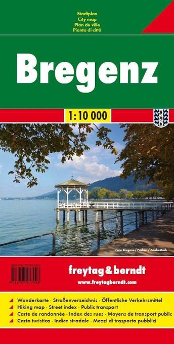
- Bregenz F&B
- Indexed street plan of Bregenz extending north along the Bodensee coast to Lochau and Unter Hochsteg. Detail includes pedestrianised areas, railways, bus routes and cycle paths. Notable buildings are highlighted in red, and symbols indicate post offices, hostels, campsites and car parks.On the reverse is a 1:50,000 contoured map of the... Lire la suite

United Kingdom
- Cinque Terre - Golfo del Tigullio: La Spezia - Sestri Levante - Rapallo - Genoa 50K IGC Map No. 23
- Cinque Terre - Golfo del Tigullio area of the Italian Riviera from genoa to la Spezia including Sestri Levante and Rapallo in a series contoured hiking maps at 1:50,000 with local trails, long-distance footpaths, mountain accommodation, etc. from the Turin based Istituto Geografico Centrale.Maps in this series have contours at 50m intervals,... Lire la suite

United Kingdom
- Ebermannstadt E10
- Ebermannstadt in a series of GPS compatible recreational editions of the Bavarian topographic survey at 1:25,000, with waymarked hiking trails and cycling routes, campsites and youth hostels, etc. Coverage includes Gößweinstein, Waischenfeld, Wiesenttal, Pottenstein, Pretzfeld, Heiligenstadt i.OFr.Contours used in this map vary between 5 to 20m... Lire la suite

United Kingdom
- Hungarian National Long-distance Blue Trail (E4): Visegrad to Irott-ko
- Hiking guide to the north-western section of Hungary’s National Blue Trail which forms part of the E4 European long-distance footpath. The guide covers the route from the historic town of Visegrád on the Danube, across the Buda Hills on the outskirts of Budapest and the Bakony Hills along the north-eastern shore of Lake Balaton, to Írott-ko in... Lire la suite
United Kingdom
- Haslital: Grindelwald - Engelberg 50K Hallwag Outdoor Map No. 5
- Haslital area, from Grindelwald to Engelberg, at 1:50,000 in a series from Hallwag covering Switzerland’s popular hiking regions on light, waterproof and tear-resistant maps highlighting long-distance paths: the nine national routes plus special regional routes, as well as other local hiking trails.Cartography is similar to that used both in... Lire la suite

United Kingdom
- Transrhodopi - Long distance hiking and biking trail From Trigrad to Ivaylovgrad
- Western Rhodope Mountains at 1:100,000 on a contoured GPS compatible map from Domino extending from just west of the Pirin National Park to Asenovgrad in the north-east. The map is double-sided with a good overlap between the sides. Topography is shown by contours at 50m intervals with relief shading and spot heights, plus colouring for... Lire la suite

United Kingdom
- Berchtesgaden – Bad Reichenhall – Königsee K+F Outdoor Map 8
- Berchtesgaden - Bad Reichenhall - Königsee area of the German Alps at 1:35,000 from Kümmerly+Frey in a series GPS compatible, double-sided maps printed on durable, waterproof and tear-resistant plastic paper; contoured, with hiking and cycle routes, other recreational activities, etc. Maps in this series are at a scale of either 1:50,000 or... Lire la suite