
Tirol
Description
Bundesland in the west of Austria, with many of the finest hiking and climbing areas of the country. In a broader sense, Tirol is the larger region that also embraces parts of northern Italy.
Sentiers de cette état
- AdlerwegGPX
- Berliner HöhenwegGPX
- E10GPX
- E4GPX
- E5GPX
- Karwendel Höhenweg
- Lasörling HöhenwegGPX
- Lechtaler HöhenwegGPX
- LechwegGPX
- Meraner HöhenwegGPX
- Südalpenweg - 3GPX
- Stubaier HöhenwegGPX
- Tauernhöhenweg
- Tiroler Höhenweg
- Traumpfad München-VenedigGPX
- Venediger HöhenwegGPX
- Verwall Höhenweg
- Via AlpinaGPX
- Voralpenweg - 4GPX
- Zentralalpenweg - 2GPX
Liens
Données
Rapports
Guides et cartes
Hébergement
Organisations
Voyagistes
GPS
Autre
Livres

Stanfords
United Kingdom
United Kingdom
- Tannheimer Tal F&B WK5352
- Tannheimer Tal - Füssen - Forchach area of the Austrian and Bavarian Alps presented at 1:35,000 in a series of contoured and GPS compatible outdoor leisure map from Freytag & Berndt with hiking and cycling routes, mountain huts, campsites and youth hostels, local bus stops, plus other tourist information. Cartography is an enlargement of the... Lire la suite
Stanfords
United Kingdom
United Kingdom
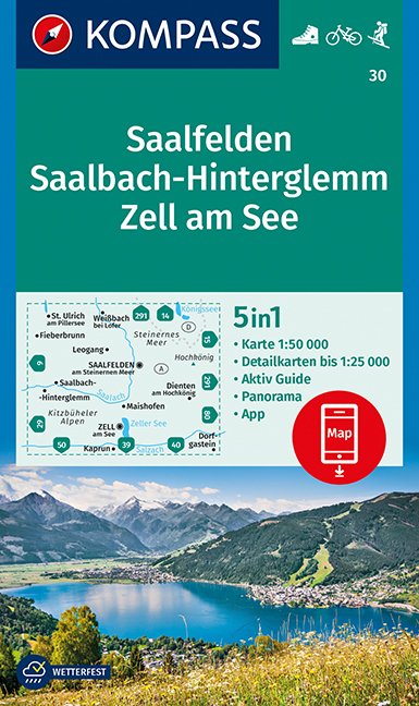
- Saalfelden - Saalbach-Hinterglemm - Zell am See Kompass 30
- Saalfelden - Saalbach - Zell am See (No. 30), a detailed, GPS compatible map at 1:50,000 from Kompass with local and long-distance footpaths, cycling routes, accommodation, etc, printed on durable, waterproof and tear-resistant synthetic paper. This title has on the reverse an additional panorama map of the region.KOMPASS HIKING & RECREATIONAL... Lire la suite

Stanfords
United Kingdom
United Kingdom
- Radstadt - Schladming - Flachau Kompass 31
- Radstadt - Schladming - Flachau area of the Austrian Alps on a detailed, GPS compatible map at 1:50,000 from Kompass with local and long-distance footpaths, cycling routes, accommodation, etc, printed on durable, waterproof and tear-resistant synthetic paper. KOMPASS HIKING & RECREATIONAL MAPS: this title is part of an extensive series covering... Lire la suite

Stanfords
United Kingdom
United Kingdom
- Tyrol Mountain Bike Trail (1000km) Bikeline Atlas
- A 1000-km long mountain bike trail in the very heart of the Austrian Alps in a 172-page German language guide from Verlag Esterbauer. The route, which can be divided into shorter circuits, takes in many of the region’s top tourist destinations including Innsbruck, Kitzbühel, Mayrhofen, Kufstein, Landeck, Ischgl, St. Anton, etc. IMPORTANT -... Lire la suite

Stanfords
United Kingdom
United Kingdom
- Landeck - Nauders - Samnaungruppe Kompass 42
- Landeck - Nauders - Samnaungruppe (No. 42), a detailed, GPS compatible map at 1:50,000 from Kompass with local and long-distance footpaths, cycling routes, accommodation, etc, printed on durable, waterproof and tear-resistant synthetic paper. KOMPASS HIKING & RECREATIONAL MAPS:This title is part of an extensive series covering Austria, much of... Lire la suite

The Book Depository
United Kingdom
2018
United Kingdom
2018
- The Karnischer Hohenweg
- A 1-2 week trek on the Carnic Peace Trail: Austria and Italy Lire la suite
- Also available from:
- De Zwerver, Netherlands

De Zwerver
Netherlands
2018
Netherlands
2018
- Wandelgids Trekking the Karnischer Höhenweg | Cicerone
- English-language guidebook to the Karnischer Höhenweg, a 206km waymarked hut-to-hut trek along the border between Italy and Austria. Also known as the Carnic Peace Trail, it runs west to east along the Ridge of the Carnic Alps, the site of the WW1 front line. With information on planning your trip, accommodation and the history of the area. Lire la suite

Stanfords
United Kingdom
2018
United Kingdom
2018
- Innsbruck Mountain Adventures: Summer routes for a multi-activity holiday around the capital of Austria`s Tirol
- This guidebook presents 60 routes covering some of the best day walks, scrambles, hut-to-hut walks, alpine mountaineering, sport climbing, via ferratas, mountain-biking routes, road rides, city and trail runs and family activities the Innsbruck area has to offer. Ideal for a multi-activity holiday or for the keen amateur seeking a summary of... Lire la suite
- Also available from:
- The Book Depository, United Kingdom
- De Zwerver, Netherlands

The Book Depository
United Kingdom
2018
United Kingdom
2018
- Innsbruck Mountain Adventures
- Summer routes for a multi-activity holiday around the capital of Austria's Tirol Lire la suite

De Zwerver
Netherlands
2018
Netherlands
2018
- Klimgids - Klettersteiggids Innsbruck Mountain Adventures | Cicerone
- Summer routes for a multi-activity holiday around the capital of Austria's Tirol Lire la suite

De Zwerver
Netherlands
2016
Netherlands
2016
- Wandelgids Tauern-Höhenweg | Rother Bergverlag
- Uitstekende beschrijvingen van deze steeds populairder wordende bergtocht! Met alle noodzakelijke info. Zie voor beschrijving de duitse tekst hieronder ..... Nicht nur im Bann von Großglockner und Großvenediger erstreckt sich auf einer Gesamtlänge von etwa 200 Kilometern der Tauern-Höhenweg, der alle Gebirgsgruppen der Niederen und Hohen Tauern... Lire la suite
De Zwerver
Netherlands
2020
Netherlands
2020
De Zwerver
Netherlands
2010
Netherlands
2010
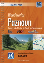
- Wandelgids Hikeline Paznaun | Esterbauer
- Handzame gids met een goede beschrijving van een groot aantal dagtochten in dit gebied. De gids is in spiraalbinding en elke pagina is op scheur- en watervast papier gedrukt. Daar is echt over nagedacht! Streckencharakteristik Länge, Höhenmeter und Anforderungen Die 40 Touren dieses Buches decken eine große Bandbreite von kurzen Spaziergängen... Lire la suite

De Zwerver
Netherlands
2021
Netherlands
2021
- Wandelgids Adlerweg - Adelaarsweg | Rother Bergverlag
- De Rother wandelgidsen beschrijven zeer goed de wandelingen in specifieke gebieden. In de gids vindt men kaarten, routebeschrijvingen en de nodige praktische informatie om van de wandelingen/trekkings een geslaagde onderneming te maken. 31 Höhenprofile; 32 Wanderkärtchen im Maßstab 1:75.000, zwei Übersichtskarten; GPS-Tracks zum Download »Auf... Lire la suite

De Zwerver
Netherlands
2011
Netherlands
2011
- Wandelgids Tirol Oberinntal | Rother Bergverlag
- 50 Touren zwischen Innsbruck und Arlberg Rother Wanderbuch. 1. Auflage. Lire la suite
Bol.com
Netherlands
Netherlands
- BergWelten
- "Armchair travelling" nennen die Engländer Reiseliteratur, und dieses Lesebuch lädt Sie auf eine sehr vergnügliche "Lesereise" in die weite Welt der Berge ein. Ihre Begleiter sind dabei deutschsprachige Top-JournalistInnen, deren Reportagen in renommierten Zeitungen und Magazinen wie "Die Zeit", "Süddeutsche Zeitung", "Frankfurter Allgemeine",... Lire la suite
- Also available from:
- Bol.com, Belgium
Bol.com
Belgium
Belgium
- BergWelten
- "Armchair travelling" nennen die Engländer Reiseliteratur, und dieses Lesebuch lädt Sie auf eine sehr vergnügliche "Lesereise" in die weite Welt der Berge ein. Ihre Begleiter sind dabei deutschsprachige Top-JournalistInnen, deren Reportagen in renommierten Zeitungen und Magazinen wie "Die Zeit", "Süddeutsche Zeitung", "Frankfurter Allgemeine",... Lire la suite

De Zwerver
Netherlands
2011
Netherlands
2011
- Wandelgids Hikeline Rund um die Zugspitze | Esterbauer
- Handzame gids met een goede beschrijving van een groot aantal dagtochten in dit gebied. De gids is in spiraalbinding en elke pagina is op scheur- en watervast papier gedrukt. Daar is echt over nagedacht! Streckencharakteristik Länge, Höhenmeter und Etappen Die insgesamt 50 Touren dieses Buches decken eine große Bandbreite von kurzen... Lire la suite
Bol.com
Netherlands
Netherlands
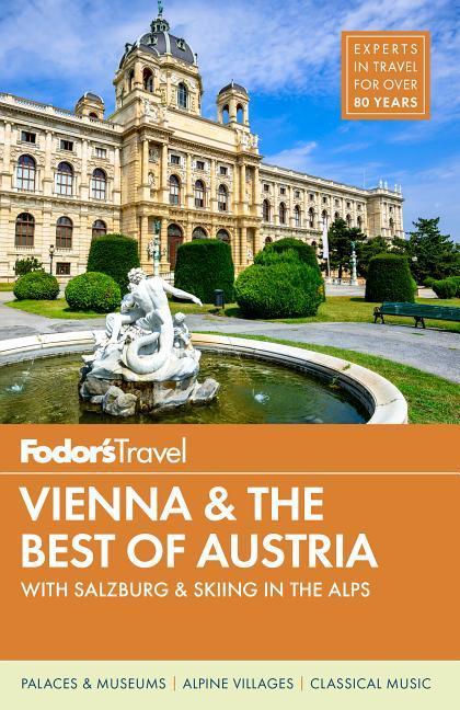
- Fodor's Vienna and the Best of Austria
- Written by local experts, Fodor's travel guides have been offering advice and professionally vetted recommendations for all tastes and budgets for 80 years.With its old-world charm, musical heritage, and alpine landscapes, Vienna and Austria offer choices for every traveler. Fodors Vienna and the Best of Austria captures the top experiences... Lire la suite
- Also available from:
- Bol.com, Belgium
Bol.com
Belgium
Belgium
- Fodor's Vienna and the Best of Austria
- Written by local experts, Fodor's travel guides have been offering advice and professionally vetted recommendations for all tastes and budgets for 80 years.With its old-world charm, musical heritage, and alpine landscapes, Vienna and Austria offer choices for every traveler. Fodors Vienna and the Best of Austria captures the top experiences... Lire la suite
Cartes

Stanfords
United Kingdom
United Kingdom
- Achensee - Rofan - Unterinntal F&B WK321
- Achensee - Rofan - Unterinntal area of the Austrian Alps north-east of Innsbruck presented at 1:50,000 in a series of contoured and GPS compatible outdoor leisure map from Freytag & Berndt with hiking and cycling routes, mountain huts, campsites and youth hostels, local bus stops, plus other tourist information. To see the list of currently... Lire la suite

Stanfords
United Kingdom
United Kingdom
- Styrian Winelands - Southwest Styria F&B WK411
- Styrian Winelands area south-eastern Austria presented at 1:50,000 in a series of contoured and GPS compatible outdoor leisure map from Freytag & Berndt with hiking and cycling routes, mountain huts, campsites and youth hostels, local bus stops, plus other tourist information. To see the list of currently available titles in this series please... Lire la suite

Stanfords
United Kingdom
United Kingdom
- Goms - Aletsch
- Goms - Aletsch area of the Bernese Oberland at 1:50,000 in a series from Hallwag covering Switzerland’s popular hiking regions on light, waterproof and tear-resistant maps highlighting long-distance paths: the nine national routes plus special regional routes, as well as other local hiking trails.Cartography is similar to that used both in... Lire la suite

Stanfords
United Kingdom
United Kingdom
- Zell am See - Kaprun - Saalbach F&B WK382
- Zell-am-See - Kaprun - Saalbach area of the Austrian Alps presented at 1:50,000 in a series of contoured and GPS compatible outdoor leisure map from Freytag & Berndt with hiking and cycling routes, mountain huts, campsites and youth hostels, local bus stops, plus other tourist information. To see the list of currently available titles in this... Lire la suite

Stanfords
United Kingdom
United Kingdom
- Mayrhofen - Zillertal Alps - Gerlos - Krimml - Tuxertal - Zell im Zillertal F&B WK152
- Mayrhofen - Zillertal Alps - Gerlos - Krimml - Tuxertal - Zell im Zillertal area of the Austrian Alps presented at 1:50,000 in a series of contoured and GPS compatible outdoor leisure map from Freytag & Berndt with hiking and cycling routes, mountain huts, campsites and youth hostels, local bus stops, plus other tourist information.To see the... Lire la suite

Stanfords
United Kingdom
United Kingdom
- Val Venosta / Vinschgau K+F Outdoor Map 1
- Val Venosta / Vinschgau area in the Dolomites at 1:50,000 in a series of waterproof and tear-resistant, GPS compatible and contoured recreational maps from Kümmerly + Frey with both local and long-distance hiking and cycling trails, ski routes, sites for other outdoor pursuits, accommodation, bus stops, etc. Coverage includes the Ortles/Ortler... Lire la suite
Stanfords
United Kingdom
United Kingdom
- Haslital: Grindelwald - Engelberg 50K Hallwag Outdoor Map No. 5
- Haslital area, from Grindelwald to Engelberg, at 1:50,000 in a series from Hallwag covering Switzerland’s popular hiking regions on light, waterproof and tear-resistant maps highlighting long-distance paths: the nine national routes plus special regional routes, as well as other local hiking trails.Cartography is similar to that used both in... Lire la suite

Stanfords
United Kingdom
United Kingdom
- Zillertal Alps - Tux Alps Kompass 37
- Zillertal Alps - Mayrhofen - Zell am Ziller - Tuxer Voralpen (No. 37), a detailed, GPS compatible map at 1:50,000 from Kompass with local and long-distance footpaths, cycling routes, accommodation, etc, printed on durable, waterproof and tear-resistant synthetic paper. KOMPASS HIKING & RECREATIONAL MAPS:This title is part of an extensive series... Lire la suite

Stanfords
United Kingdom
United Kingdom
- Val Brembana - Valsassina - Le Grigne: Lecco - Bergamo 50K IGC Map No. 22
- Val Brembana - Valsassina - Le Grigne area including Lecco and Bergamo in a series contoured hiking maps at 1:50,000 with local trails, long-distance footpaths, mountain accommodation, etc. from the Turin based Istituto Geografico Centrale.Maps in this series have contours at 50m intervals, enhanced by shading and graphic relief. An overprint... Lire la suite
Stanfords
United Kingdom
United Kingdom
- Stubai Alps Kompass 83
- Stubai Alps (No. 83), a detailed, GPS compatible map at 1:50,000 from Kompass with local and long-distance footpaths, cycling routes, accommodation, etc, printed on durable, waterproof and tear-resistant synthetic paper. This title has on the reverse an additional panorama map of the region.KOMPASS HIKING & RECREATIONAL MAPS:This title is part... Lire la suite

Stanfords
United Kingdom
United Kingdom
- Olympus Geopsis 139
- Mt Olympus in a series of waterproof and tear-resistant hiking maps at scales varying from 1:50,000 to 1:10,000, with a UTM grid for GPS users. Contour interval varies depending on the scale, on most maps it is 20m. Relief shading, spot heights, springs, seasonal streams and, in most titles, landscape/land-use variations, e.g. forests,... Lire la suite
Stanfords
United Kingdom
United Kingdom
- Montreux
- Montreux - Col du Pillon area at 1:50,000 in a series from Hallwag covering Switzerland’s popular hiking regions on light, waterproof and tear-resistant maps highlighting long-distance paths: the nine national routes plus special regional routes, as well as other local hiking trails.Cartography is similar to that used both in Hallwag’s hiking... Lire la suite

Stanfords
United Kingdom
United Kingdom
- Cinque Terre - Golfo del Tigullio: La Spezia - Sestri Levante - Rapallo - Genoa 50K IGC Map No. 23
- Cinque Terre - Golfo del Tigullio area of the Italian Riviera from genoa to la Spezia including Sestri Levante and Rapallo in a series contoured hiking maps at 1:50,000 with local trails, long-distance footpaths, mountain accommodation, etc. from the Turin based Istituto Geografico Centrale.Maps in this series have contours at 50m intervals,... Lire la suite
Stanfords
United Kingdom
United Kingdom
- Venedigergruppe - Oberpinzgau Kompass 38
- Venedigergruppe - Oberpinzgau (No. 38), a detailed, GPS compatible map at 1:50,000 from Kompass with local and long-distance footpaths, cycling routes, accommodation, etc, printed on durable, waterproof and tear-resistant synthetic paper. This title has on the reverse an additional panorama map of the region.KOMPASS HIKING & RECREATIONAL... Lire la suite

Stanfords
United Kingdom
United Kingdom
- Granatspitzgruppe Alpenverein KOMBI Map 39
- Granatspitzgruppe area of the Alps in a combined hiking and ski edition at 1:25,000 from a series of detailed, GPS compatible maps published by the DAV - Deutscher Alpenverein and produced by the German and Austrian Alpine Clubs using cartography from their respective survey organizations. Maps in this series have topography vividly presented... Lire la suite