
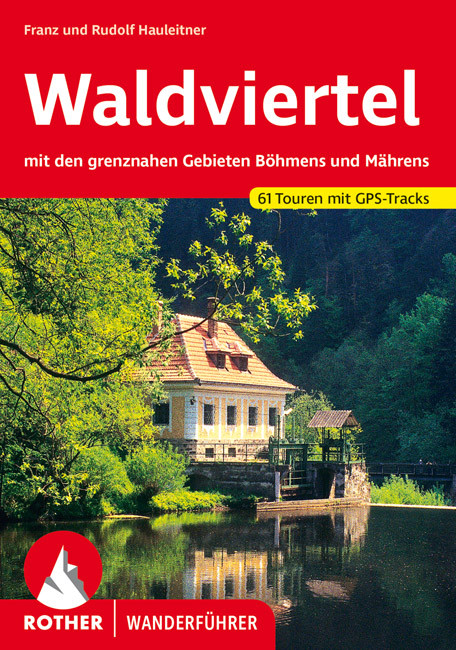
Waldviertel
Description
The Wald Viertel, or forest quarter, is an attractive region North of the line Linz - Wien, so North of the Donau. This area, bordering on the Czech Republic, is hilly but is not part of the Alps.
Sentiers de cette région
Liens
Données
Rapports
Guides et cartes
Hébergement
Organisations
Voyagistes
GPS
Autre
Livres

Stanfords
United Kingdom
United Kingdom
- Waldviertel North - Gmund - Heidenreichstein - Waidhofen & Raabs a.d.T. - Trebon F&B WK075
- Waldviertel North - Gmünd - Heidenreichstein - Waidhofen a.d.T. - Raabs a.d.T. – Trebon area of eastern Austria presented at 1:50,000 in a series of contoured and GPS compatible outdoor leisure map from Freytag & Berndt with hiking and cycling routes, mountain huts, campsites and youth hostels, local bus stops, plus other tourist information.To... Lire la suite
De Zwerver
Netherlands
2022
Netherlands
2022
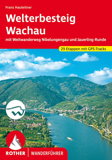
- Wandelgids Welterbesteig Wachau (tussen Krems en Melk, Donau, Oostenrijk) | Rother Bergverlag
- Duidelijk en volledig wandelgidsje zoals we van Rother gewend zijn. De eerste uitgave van dit gebied met 2 grote tochten in 21 etappes beschreven, tezamen goed voor 270 kilometer wandelplezier tussen Melk en Krems aan de Donau in Oostenrijk. 270 Wanderkilometer beiderseits der Donau zwischen Krems und Melk (180 km Welterbesteig und 90 km... Lire la suite
Bol.com
Netherlands
2015
Netherlands
2015
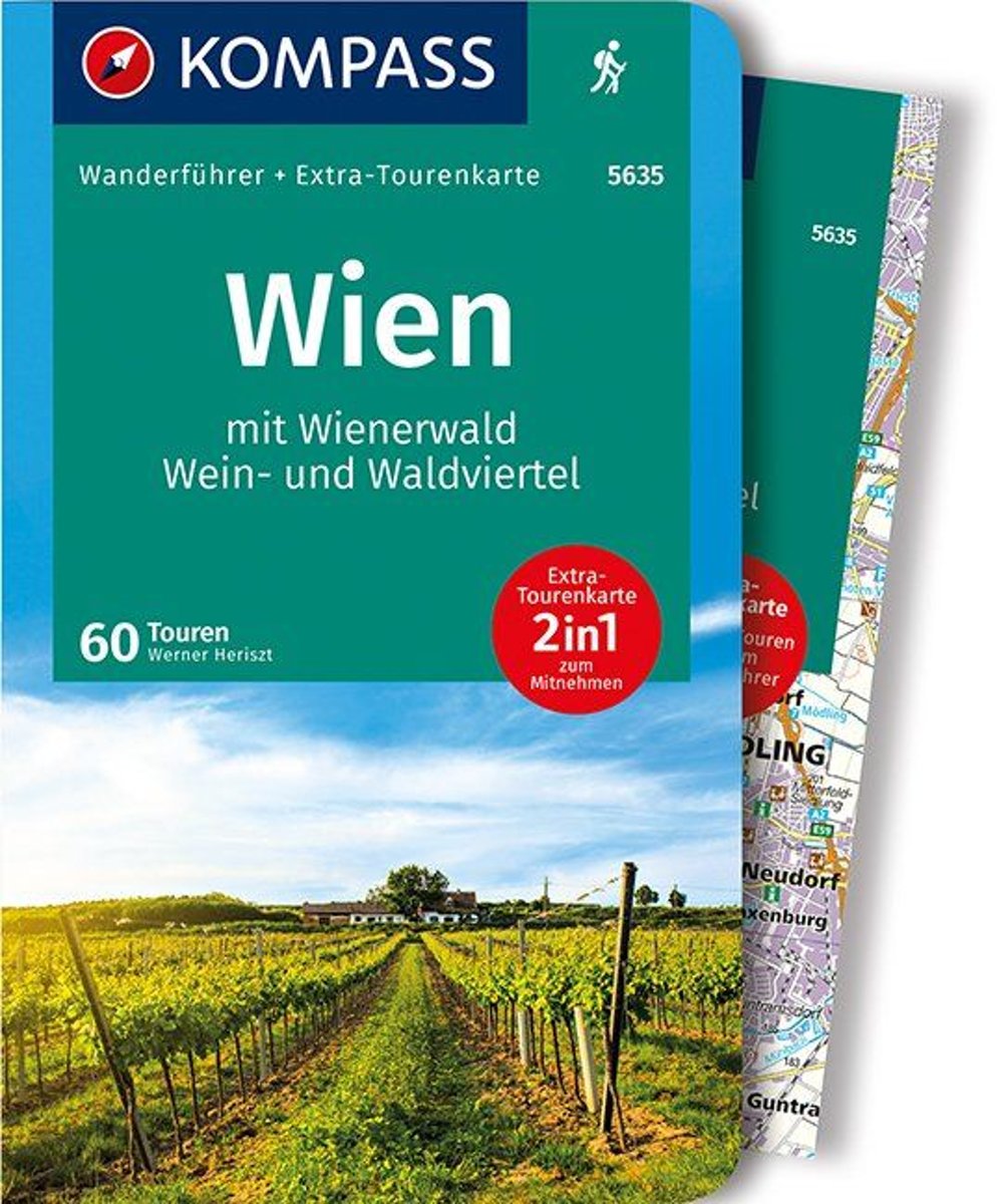
- WF5635 Wenen • Wienerwald • Wein- und Waldviertel Kompass
- Destination:. Der Wienerwald als klassisches Wandergebiet in Wien sowie seiner unmittelbaren Umgebung bietet zahlreiche Wanderrouten, die oft sogar bestens mit Bim und Bus erreichbar sind. Gerade entlang der Thermenlinie bieten die herrlichen Föhrenbestände Genusstouren für die ganze Familie und jede Jahreszeit.. Als Wanderregion bis vor kurzem... Lire la suite
- Also available from:
- Bol.com, Belgium
Bol.com
Belgium
2015
Belgium
2015
- WF5635 Wenen • Wienerwald • Wein- und Waldviertel Kompass
- Destination:. Der Wienerwald als klassisches Wandergebiet in Wien sowie seiner unmittelbaren Umgebung bietet zahlreiche Wanderrouten, die oft sogar bestens mit Bim und Bus erreichbar sind. Gerade entlang der Thermenlinie bieten die herrlichen Föhrenbestände Genusstouren für die ganze Familie und jede Jahreszeit.. Als Wanderregion bis vor kurzem... Lire la suite
De Zwerver
Netherlands
2017
Netherlands
2017
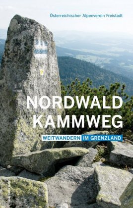
- Wandelgids Nordwaldkammweg | Anton Pustet
- Weitwandern im Grenzland Lire la suite
De Zwerver
Netherlands
2014
Netherlands
2014
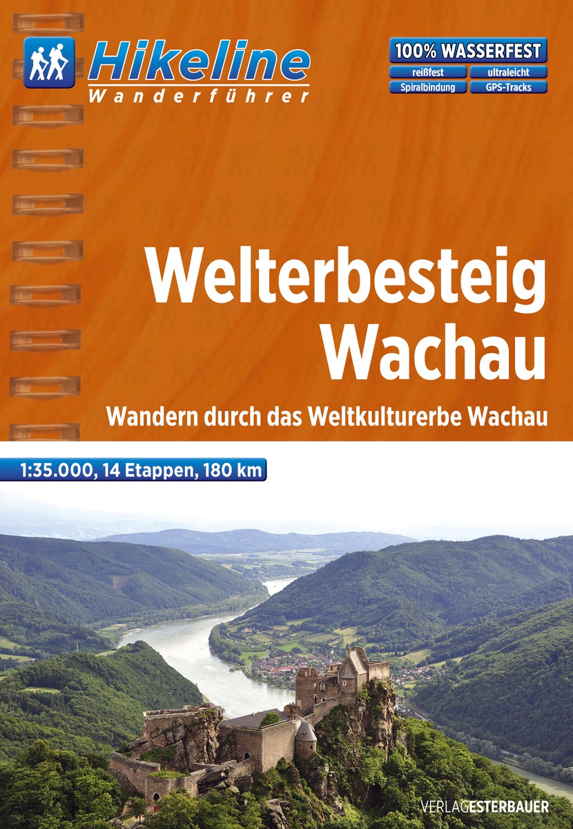
- Wandelgids Hikeline Wanderführer Welterbesteig Wachau | Esterbauer
- Goede handzame wandelgids met duidelijke kaarten en informatieve tekst. / Gedetailleerde wandelgidsen met ingetekende lange afstandsroute. Goede omschrijving van de route met tevens praktische informatie voor onderweg. Scheur- en watervast papier. An den steilen Hängen und Flussufern beidereits der Donau, auf einer Länge von rund 35 Kilometern,... Lire la suite
De Zwerver
Netherlands
2012
Netherlands
2012
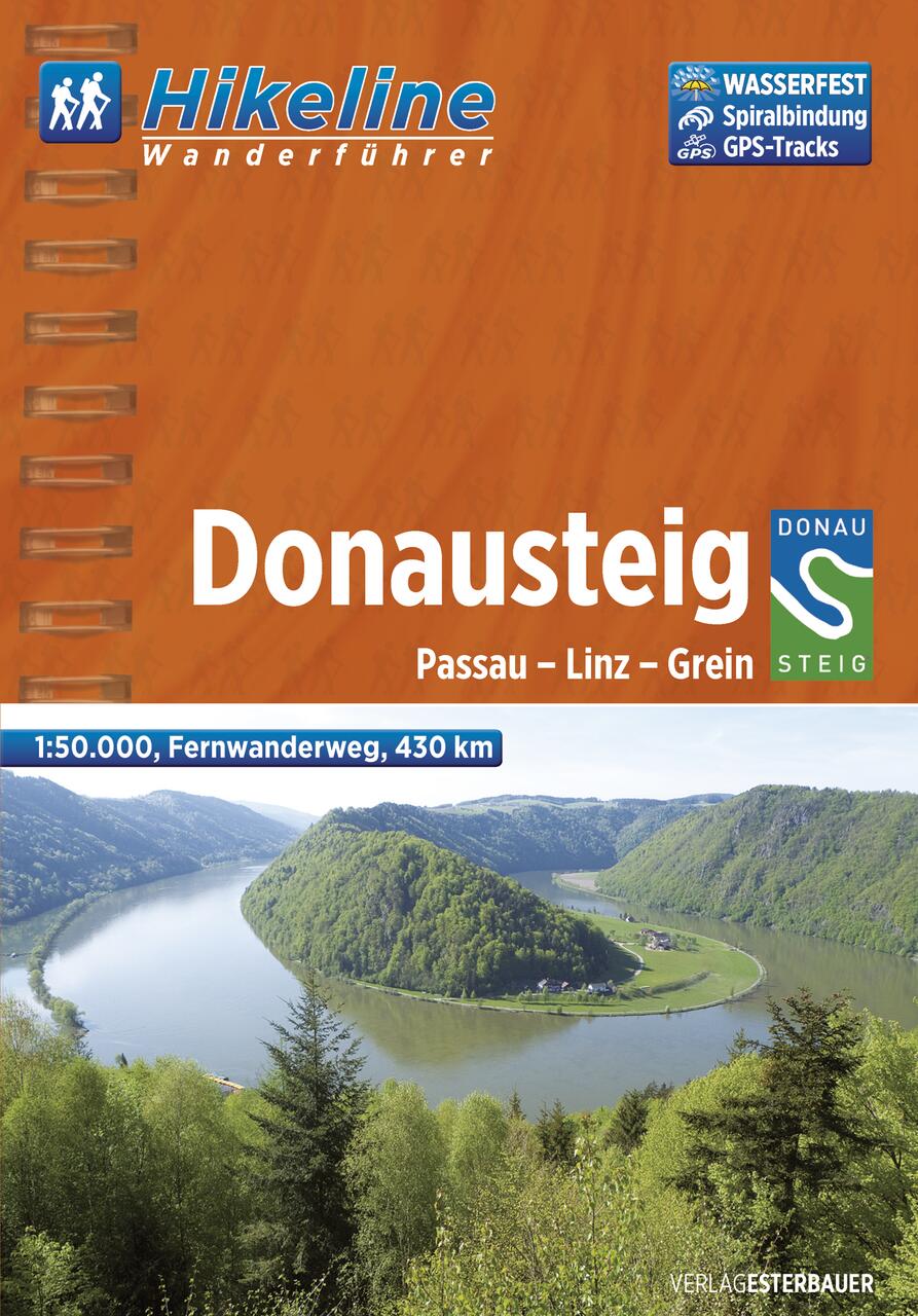
- Wandelgids Hikeline Donausteig | Esterbauer
- Handzame gids met een goede beschrijving van een meerdaagse tocht in dit gebied. De gids is in spiraalbinding en elke pagina is op scheur- en watervast papier gedrukt. Daar is echt over nagedacht! Der im Sommer 2010 neu eröffnete Donausteig startet im bayerisch-oberösterreichischen Grenzgebiet in der Drei-Flüsse-Stadt Passau und verläuft... Lire la suite
De Zwerver
Netherlands
2023
Netherlands
2023
De Zwerver
Netherlands
2015
Netherlands
2015
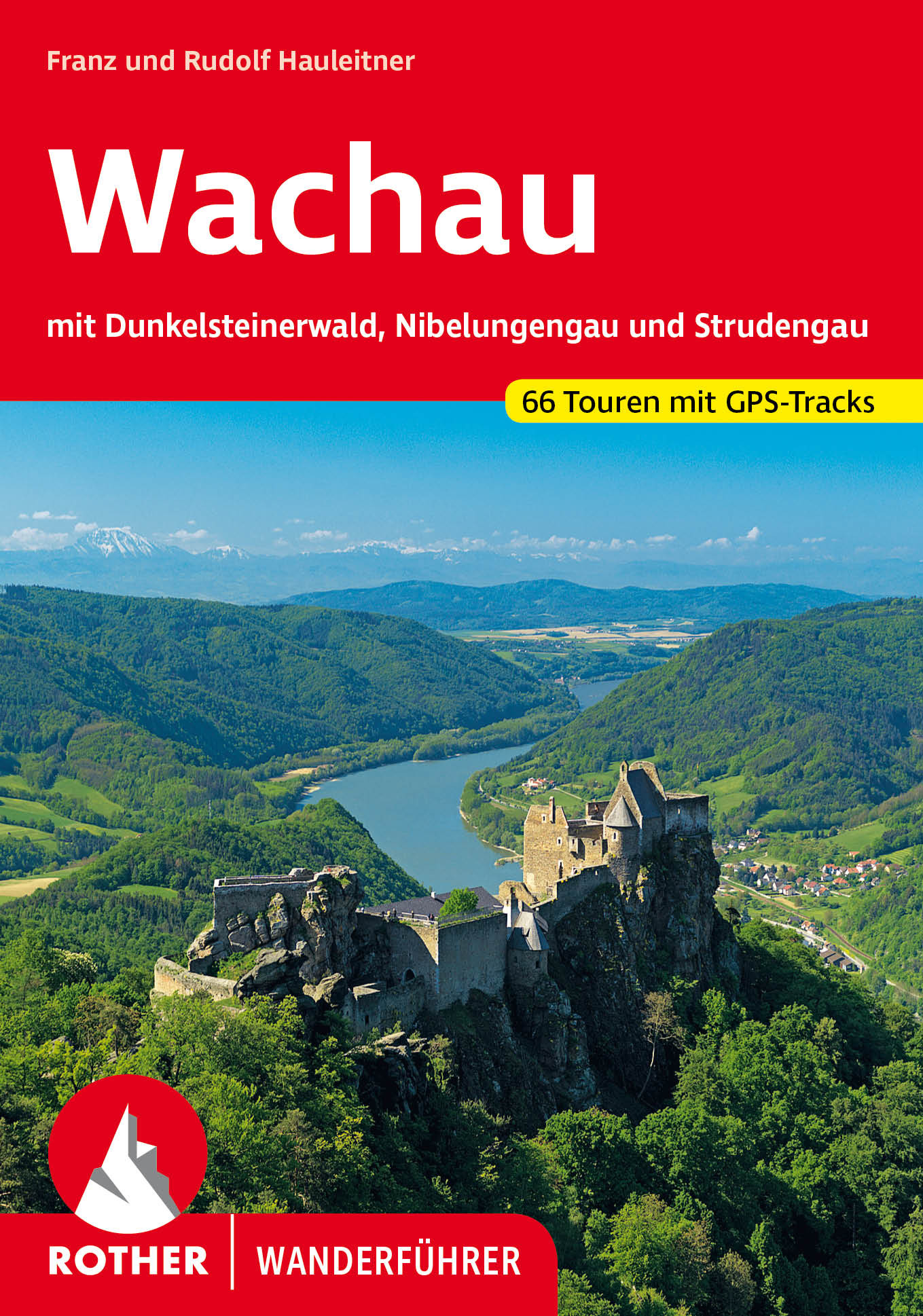
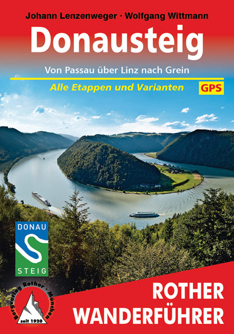
- Wandelgids Donausteig von Passau über Linz nach Grein | Rother Bergverlag
- Goede duidelijke beschrijving van deze meerdaagse wandeling van de Donausteig tussen Passau via Linz naar Grein. Voldoende info, zelfs kaartjes zijn behoorlijk goed en voldoende. Eine der schönsten Flusslandschaften Österreichs ist das Donautal, mit seinem Wechsel zwischen engen Durchbruchstälern und weiten Beckenlandschaften, mit... Lire la suite

Bol.com
Netherlands
Netherlands
- WF5640 Mariazeller Land und Mostviertel Kompass
- zahlr. Touren mit Top-Routenkarten und HöhenprofilenDe Kompass wandelgids + kaart geeft een overzicht van alle wandelroutes in het gebied met nauwkeurige routeaanwijzingen en hoogteaanduidingen, De extra grote kaart, schaal 1:35 000, is ideaal om van te voren uw route uit te stippelen en om onderweg te gebruiken • naast de bekende bestemmingen,... Lire la suite
- Also available from:
- Bol.com, Belgium
Bol.com
Belgium
Belgium
- WF5640 Mariazeller Land und Mostviertel Kompass
- zahlr. Touren mit Top-Routenkarten und HöhenprofilenDe Kompass wandelgids + kaart geeft een overzicht van alle wandelroutes in het gebied met nauwkeurige routeaanwijzingen en hoogteaanduidingen, De extra grote kaart, schaal 1:35 000, is ideaal om van te voren uw route uit te stippelen en om onderweg te gebruiken • naast de bekende bestemmingen,... Lire la suite
De Zwerver
Netherlands
2013
Netherlands
2013
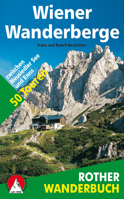
- Wandelgids Wiener Wanderberge | Rother Bergverlag
- De ‘Rother Wanderbücher’ behandelen telkens de 50 mooiste wandelingen, die variëren van eenvoudige kindvriendelijke wandelingen tot routes die aanzienlijk meer ervaring vereisen. Uitvoerige routebeschrijvingen, een aantrekkelijke lay-out met vele kleurenfoto’s, niets aan duidelijkheid te wensen gelaten hoogteprofielen, kaartjes met de... Lire la suite
Cartes

Stanfords
United Kingdom
United Kingdom
- Thayatal National Park - Kamptal - Znaim - Retz - Gars am Karp F&B WK073
- Thayatal NP - Znaim - Retz - Gars am Karp area of eastern Austria presented at 1:50,000 in a series of contoured and GPS compatible outdoor leisure map from Freytag & Berndt with hiking and cycling routes, mountain huts, campsites and youth hostels, local bus stops, plus other tourist information.To see the list of currently available titles in... Lire la suite

Stanfords
United Kingdom
United Kingdom
- Mostviertel - Strudengau - Donauland - Amstetten - Waidhofen a.d. Ybbs - Steyr F&B WK052
- Mostviertel - Strudengau - Donauland - Amstetten - Waidhofen a.d. Ybbs - Steyr area of eastern Austria presented at 1:50,000 in a series of contoured and GPS compatible outdoor leisure map from Freytag & Berndt with hiking and cycling routes, mountain huts, campsites and youth hostels, local bus stops, plus other tourist information.To see the... Lire la suite

Stanfords
United Kingdom
United Kingdom
- Zirbitzkogel-Grebenzen Nature Park – Murau – Sölkpass F&B WK211
- Zirbitzkogel NP - Grebenzen - Murau - Solkpass area of the Austrian Alps presented at 1:50,000 in a series of contoured and GPS compatible outdoor leisure map from Freytag & Berndt with hiking and cycling routes, mountain huts, campsites and youth hostels, local bus stops, plus other tourist information.To see the list of currently available... Lire la suite

Stanfords
United Kingdom
United Kingdom
- Wachau - Welterbesteig - Nibelungengau - Kremstal - Yspertal - Dunkelsteinerwald F&B WK071
- Wachau - Donautal - Yspertal - Jauerling - Dunkelsteiner Wald area of eastern Austria presented at 1:50,000 in a series of contoured and GPS compatible outdoor leisure map from Freytag & Berndt with hiking and cycling routes, mountain huts, campsites and youth hostels, local bus stops, plus other tourist information.To see the list of currently... Lire la suite

Stanfords
United Kingdom
United Kingdom
- Transrhodopi - Long distance hiking and biking trail From Trigrad to Ivaylovgrad
- Western Rhodope Mountains at 1:100,000 on a contoured GPS compatible map from Domino extending from just west of the Pirin National Park to Asenovgrad in the north-east. The map is double-sided with a good overlap between the sides. Topography is shown by contours at 50m intervals with relief shading and spot heights, plus colouring for... Lire la suite

Stanfords
United Kingdom
United Kingdom
- Rila Mountains Domino
- Rila Mountains at 1:50,000 on a large, double-sided, contoured map with GPS waypoints for shelters and chalets, peaks, etc. and highlighting hiking routes. Topography is shown by contours at 50m intervals with additional relief shading and graphics and colouring for scree, single rocks over 5m high, marshlands and pine scrub and forests. An... Lire la suite
- Also available from:
- De Zwerver, Netherlands

De Zwerver
Netherlands
Netherlands
- Wandelkaart 5 Rila gebergte | Domino
- Rila Mountains at 1:50,000 on a large, double-sided, contoured map with GPS waypoints for shelters and chalets, peaks, etc. and highlighting hiking routes. Topography is shown by contours at 50m intervals with additional relief shading and graphics and colouring for scree, single rocks over 5m high, marshlands and pine scrub and forests. An... Lire la suite

Stanfords
United Kingdom
United Kingdom
- Pirin Mountains Domino
- Pirin Mountains at 1:50,000 on a large, double-sided, contoured map with GPS waypoints for shelters and chalets, peaks, etc. and highlighting hiking routes. Topography is shown by contours at 40m intervals with additional relief shading and graphics and colouring for sandstone stacks, single rocks over 5m high, marshlands and different types of... Lire la suite
- Also available from:
- De Zwerver, Netherlands

De Zwerver
Netherlands
Netherlands
- Wandelkaart 6 Pirin gebergte | Domino
- Pirin Mountains at 1:50,000 on a large, double-sided, contoured map with GPS waypoints for shelters and chalets, peaks, etc. and highlighting hiking routes. Topography is shown by contours at 40m intervals with additional relief shading and graphics and colouring for sandstone stacks, single rocks over 5m high, marshlands and different types of... Lire la suite

Stanfords
United Kingdom
United Kingdom
- Western Rhodope Mountains Domino Map
- Western Rhodope Mountains at 1:100,000 on a contoured GPS compatible map from Domino extending from just west of the Pirin National Park to Asenovgrad in the north-east. The map is double-sided with a good overlap between the sides. Topography is shown by contours at 50m intervals with relief shading and spot heights, plus colouring for... Lire la suite
- Also available from:
- De Zwerver, Netherlands

De Zwerver
Netherlands
Netherlands
- Wandelkaart - Wegenkaart - landkaart 7 Westelijke Rhodopen - Western Rhodopes | Domino
- Western Rhodope Mountains at 1:100,000 on a contoured GPS compatible map from Domino extending from just west of the Pirin National Park to Asenovgrad in the north-east. The map is double-sided with a good overlap between the sides. Topography is shown by contours at 50m intervals with relief shading and spot heights, plus colouring for... Lire la suite

Stanfords
United Kingdom
United Kingdom
- Strandzha Mountains: Burgas to the Turkish Border Domino Map
- Strandzha Mountains in the south-eastern corner of Bulgaria between Burgas to the Turkish border on a contoured and GPS compatible map from Domino showing local hiking trails and highlighting various interesting sites, with three more detailed enlargements at 1:25,000. Most place names are in both Latin and Cyrillic alphabet; map legend... Lire la suite
- Also available from:
- De Zwerver, Netherlands

De Zwerver
Netherlands
Netherlands
- Wandelkaart Strandzha - Bulgarije | Domino
- Strandzha Mountains in the south-eastern corner of Bulgaria between Burgas to the Turkish border on a contoured and GPS compatible map from Domino showing local hiking trails and highlighting various interesting sites, with three more detailed enlargements at 1:25,000. Most place names are in both Latin and Cyrillic alphabet; map legend... Lire la suite

Stanfords
United Kingdom
United Kingdom
- Stara Planina Central: Zlatitsa to Kalofer Domino Map
- Stara Planina Central: Zlatitsa to Kalofer map at 1:50,000 from Bulgarian publishers Domino, contoured and GPS compatible, with hiking trails, accommodation options including a list of local mountain refuges, etc. The map is double-sided and covers the mountains from just west of Ribaritsa and Zlatitsa eastwards beyond Kalofer to the peak of... Lire la suite
- Also available from:
- De Zwerver, Netherlands

De Zwerver
Netherlands
Netherlands
- Wandelkaart 1 Stara Planina gebergte | Domino
- Stara Planina Central: Zlatitsa to Kalofer map at 1:50,000 from Bulgarian publishers Domino, contoured and GPS compatible, with hiking trails, accommodation options including a list of local mountain refuges, etc. The map is double-sided and covers the mountains from just west of Ribaritsa and Zlatitsa eastwards beyond Kalofer to the peak of... Lire la suite

De Zwerver
Netherlands
Netherlands
- Wandelkaart Sredna Gora - Bulgarije | Domino
- Pirin Mountains at 1:50,000 on a large, double-sided, contoured map with GPS waypoints for shelters and chalets, peaks, etc. and highlighting hiking routes. Topography is shown by contours at 40m intervals with additional relief shading and graphics and colouring for sandstone stacks, single rocks over 5m high, marshlands and different types of... Lire la suite

Stanfords
United Kingdom
United Kingdom
- Stara Planina Central: Uzana to Vratnik Domino Map
- Stara Planina Central: Uzana to Vratnik map at 1:50,000 from Bulgarian publishers Domino, contoured and GPS compatible, with hiking trails, accommodation options including a list of local mountain refuges, etc. The map is double-sided and covers the mountains from just west of the Uzana massif, the geographical centre of Bulgaria, eastwards to... Lire la suite
- Also available from:
- De Zwerver, Netherlands

De Zwerver
Netherlands
Netherlands
- Wandelkaart 2 Stara Planina gebergte | Domino
- Stara Planina Central: Uzana to Vratnik map at 1:50,000 from Bulgarian publishers Domino, contoured and GPS compatible, with hiking trails, accommodation options including a list of local mountain refuges, etc. The map is double-sided and covers the mountains from just west of the Uzana massif, the geographical centre of Bulgaria, eastwards to... Lire la suite
De Zwerver
Netherlands
Netherlands
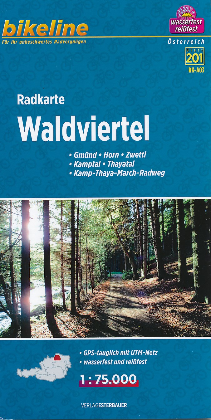
- Fietskaart A03 Bikeline Radkarte Waldviertel | Esterbauer
- Bikeline Radkarte Waldviertel 1 : 75 000 ab 6.9 EURO Gmünd - Horn - Zwettl - Kamptal - Thayatal - Kamp-Thaya-March-Radweg Österreich Bikeline Radkarte. 1. Auflage Lire la suite

Stanfords
United Kingdom
United Kingdom
- Stara Planina Western: Belogradchik to Berkovita Domino Map
- Stara Planina Western: Belogradchik to Berkovita map at 1:50,000 from Bulgarian publishers Domino, contoured and GPS compatible, with hiking trails, accommodation options including a list of local mountain refuges, etc. The map is double-sided and covers the mountains from the peak of Byala Voda near Belogradchik eastwards to just beyond... Lire la suite
- Also available from:
- De Zwerver, Netherlands

De Zwerver
Netherlands
Netherlands
- Wandelkaart 3 Stara Planina gebergte | Domino
- Stara Planina Western: Belogradchik to Berkovita map at 1:50,000 from Bulgarian publishers Domino, contoured and GPS compatible, with hiking trails, accommodation options including a list of local mountain refuges, etc. The map is double-sided and covers the mountains from the peak of Byala Voda near Belogradchik eastwards to just beyond... Lire la suite